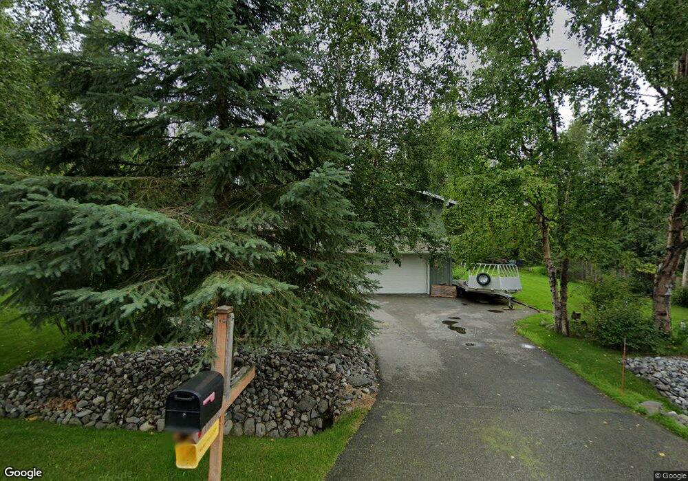
10210 Lone Tree Dr Anchorage, AK 99507
Mid-Hillside NeighborhoodEstimated Value: $564,000 - $626,000
3
Beds
3
Baths
1,726
Sq Ft
$343/Sq Ft
Est. Value
About This Home
This home is located at 10210 Lone Tree Dr, Anchorage, AK 99507 and is currently estimated at $592,532, approximately $343 per square foot. 10210 Lone Tree Dr is a home located in Anchorage Municipality with nearby schools including O'Malley Elementary School, Hanshew Middle School, and Service High School.
Ownership History
Date
Name
Owned For
Owner Type
Purchase Details
Closed on
Feb 21, 1996
Sold by
Mccarcie Patricia J and Neptune Andre G
Bought by
Neptune Andre G and Neptune Patricia J
Current Estimated Value
Home Financials for this Owner
Home Financials are based on the most recent Mortgage that was taken out on this home.
Original Mortgage
$135,000
Outstanding Balance
$3,576
Interest Rate
7.1%
Mortgage Type
New Conventional
Estimated Equity
$588,956
Purchase Details
Closed on
Feb 25, 1992
Sold by
Dickerman Richard Paul
Bought by
Neptune Andre G and Mccorcle Patricia J
Home Financials for this Owner
Home Financials are based on the most recent Mortgage that was taken out on this home.
Original Mortgage
$143,000
Interest Rate
8.47%
Mortgage Type
New Conventional
Purchase Details
Closed on
Nov 13, 1987
Sold by
Fruge Michael J and Fruge Catherine A
Bought by
Dickerman Richard Paul
Home Financials for this Owner
Home Financials are based on the most recent Mortgage that was taken out on this home.
Original Mortgage
$127,350
Interest Rate
11.26%
Mortgage Type
New Conventional
Create a Home Valuation Report for This Property
The Home Valuation Report is an in-depth analysis detailing your home's value as well as a comparison with similar homes in the area
Home Values in the Area
Average Home Value in this Area
Purchase History
| Date | Buyer | Sale Price | Title Company |
|---|---|---|---|
| Neptune Andre G | -- | -- | |
| Neptune Andre G | -- | -- | |
| Neptune Andre G | -- | -- | |
| Neptune Andre G | -- | -- | |
| Dickerman Richard Paul | -- | -- |
Source: Public Records
Mortgage History
| Date | Status | Borrower | Loan Amount |
|---|---|---|---|
| Open | Neptune Andre G | $135,000 | |
| Closed | Neptune Andre G | $135,000 | |
| Previous Owner | Neptune Andre G | $143,000 | |
| Previous Owner | Dickerman Richard Paul | $127,350 |
Source: Public Records
Tax History Compared to Growth
Tax History
| Year | Tax Paid | Tax Assessment Tax Assessment Total Assessment is a certain percentage of the fair market value that is determined by local assessors to be the total taxable value of land and additions on the property. | Land | Improvement |
|---|---|---|---|---|
| 2025 | $5,940 | $510,500 | $123,800 | $386,700 |
| 2024 | $5,940 | $471,400 | $117,900 | $353,500 |
| 2023 | $6,512 | $418,800 | $113,300 | $305,500 |
| 2022 | $5,732 | $415,100 | $113,300 | $301,800 |
| 2021 | $6,544 | $387,900 | $113,300 | $274,600 |
| 2020 | $4,802 | $373,300 | $113,300 | $260,000 |
| 2019 | $4,972 | $378,200 | $113,300 | $264,900 |
| 2018 | $4,890 | $373,000 | $128,600 | $244,400 |
| 2017 | $5,310 | $377,800 | $128,600 | $249,200 |
| 2016 | $4,358 | $382,900 | $128,600 | $254,300 |
| 2015 | $4,358 | $360,500 | $115,200 | $245,300 |
| 2014 | $4,358 | $340,800 | $100,800 | $240,000 |
Source: Public Records
Map
Nearby Homes
- 6411 Ridge Tree Cir
- 5900 Orth Cir
- 6815 Double Tree Ct
- 6460 Limestone Cir
- L3 Totem Rd
- 0 Rd
- 10960 Totem Rd
- 000 Valley View Dr
- 6550 Rockridge Dr
- 9203 Strutz Ave
- L7 Panorama Dr
- L13 Panorama Dr
- L3 Panorama Dr
- L6 Panorama Dr
- L11 Panorama Dr
- L2 Panorama Dr
- L10 Panorama Dr
- 11840 Coughlan Way
- 4715 E 112th Ave
- 11831 Moose Rd
- 10220 Lone Tree Dr
- 6321 Brown Tree Cir
- 6222 Green Tree Cir
- 6242 Green Tree Cir
- 10211 Lone Tree Dr
- 10300 Lone Tree Dr
- 6301 Brown Tree Cir
- 10201 Lone Tree Dr
- 10221 Lone Tree Dr
- 6202 Green Tree Cir
- 10121 Lone Tree Dr
- 10231 Lone Tree Dr
- 6300 Brown Tree Cir
- 6442 Lone Tree Cir
- 6203 Green Tree Cir
- 6243 Green Tree Cir
- 10111 Lone Tree Dr
- 6403 Lone Tree Cir
- 10301 Lone Tree Dr
- 6320 Brown Tree Cir