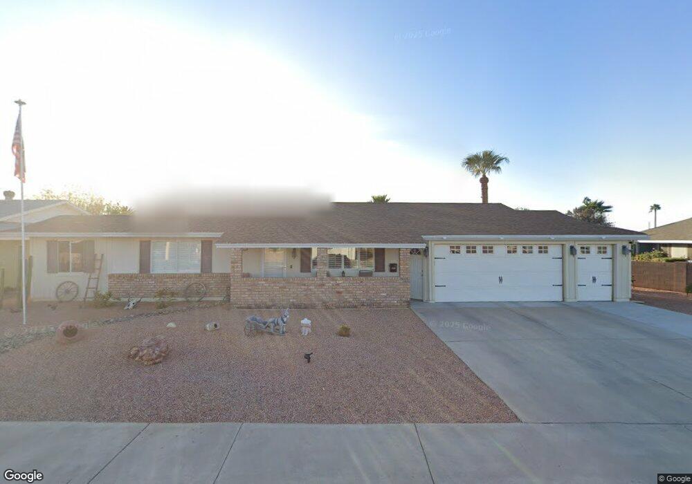
10211 W Denham Dr Unit 8 Sun City, AZ 85351
Estimated Value: $208,000 - $283,000
2
Beds
1
Bath
972
Sq Ft
$258/Sq Ft
Est. Value
About This Home
This home is located at 10211 W Denham Dr Unit 8, Sun City, AZ 85351 and is currently estimated at $250,570, approximately $257 per square foot. 10211 W Denham Dr Unit 8 is a home located in Maricopa County with nearby schools including Ombudsman - Northwest Charter and Peoria Accelerated High School.
Ownership History
Date
Name
Owned For
Owner Type
Purchase Details
Closed on
Apr 13, 2011
Sold by
Federal National Mortgage Association
Bought by
Darrow Richard and Darrow Shirley
Current Estimated Value
Purchase Details
Closed on
Jan 13, 2011
Sold by
Collins Edith S
Bought by
Bank Of America Na
Purchase Details
Closed on
Jan 10, 2011
Sold by
Bank Of America Na
Bought by
Federal National Mortgage Association
Purchase Details
Closed on
Dec 24, 2002
Sold by
Collins Edith S
Bought by
Collins Edith S
Home Financials for this Owner
Home Financials are based on the most recent Mortgage that was taken out on this home.
Original Mortgage
$39,000
Interest Rate
5.86%
Purchase Details
Closed on
May 1, 2000
Sold by
Collins Edith Smiley and Collins Edith S
Bought by
Collins Edith S and Edith S Collins Revocable Living Trust
Create a Home Valuation Report for This Property
The Home Valuation Report is an in-depth analysis detailing your home's value as well as a comparison with similar homes in the area
Home Values in the Area
Average Home Value in this Area
Purchase History
| Date | Buyer | Sale Price | Title Company |
|---|---|---|---|
| Darrow Richard | $53,050 | Great American Title Agency | |
| Bank Of America Na | -- | None Available | |
| Federal National Mortgage Association | -- | None Available | |
| Collins Edith S | -- | Metro Title Agency Inc | |
| Collins Edith S | -- | -- |
Source: Public Records
Mortgage History
| Date | Status | Borrower | Loan Amount |
|---|---|---|---|
| Previous Owner | Collins Edith S | $39,000 |
Source: Public Records
Tax History Compared to Growth
Tax History
| Year | Tax Paid | Tax Assessment Tax Assessment Total Assessment is a certain percentage of the fair market value that is determined by local assessors to be the total taxable value of land and additions on the property. | Land | Improvement |
|---|---|---|---|---|
| 2025 | $533 | $11,310 | -- | -- |
| 2024 | $560 | $11,310 | -- | -- |
| 2023 | $560 | $17,430 | $3,480 | $13,950 |
| 2022 | $562 | $17,430 | $3,480 | $13,950 |
| 2021 | $922 | $19,500 | $3,900 | $15,600 |
| 2020 | $896 | $17,630 | $3,520 | $14,110 |
| 2019 | $1,205 | $16,670 | $3,330 | $13,340 |
| 2018 | $630 | $8,450 | $1,690 | $6,760 |
| 2017 | $607 | $7,360 | $1,470 | $5,890 |
| 2016 | $570 | $6,800 | $1,360 | $5,440 |
| 2015 | $543 | $6,050 | $1,210 | $4,840 |
Source: Public Records
Map
Nearby Homes
- 10109 W Mountain View Rd
- 9815 N 103rd Ave
- 10014 W Mission Ln
- 10022 W Mountain View Rd
- 10326 W Caron Dr
- 10201 W Caron Dr
- 10316 W Salem Dr Unit 6D
- 10001 W Caron Dr Unit 8
- 9925 W Mountain View Rd Unit 27
- 9915 W Mountain View Rd
- 10221 W Puget Ave
- 10302 W Cheryl Dr Unit D
- 10166 W Cinnebar Ave
- 10131 W Cheryl Dr Unit 6D
- 9834 N Balboa Dr
- 10440 W Cheryl Dr
- 9939 W Ironwood Dr Unit 6D
- 10240 W Concord Ave
- 10405 W Andover Ave
- 9891 N Balboa Dr
- 10201 W Denham Dr
- 10218 W Mission Ln
- 10210 W Mission Ln
- 10208 W Denham Dr
- 10135 W Denham Dr
- 9201 N 102nd Dr
- 10214 W Denham Dr
- 10202 W Denham Dr
- 10220 W Denham Dr
- 10134 W Denham Dr Unit 8
- 10122 W Mission Ln
- 10127 W Denham Dr
- 9214 N 102nd Dr
- 9210 N 102nd Dr
- 10209 W Mountain View Rd
- 10215 W Mountain View Rd
- 10205 W Mountain View Rd
- 9202 N 102nd Dr
- 10128 W Denham Dr Unit 8
- 10217 W Mission Ln