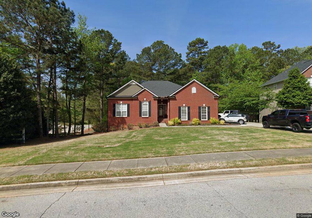
10214 N Links Dr Unit 1A Covington, GA 30014
Estimated Value: $342,374 - $407,000
--
Bed
2
Baths
2,196
Sq Ft
$174/Sq Ft
Est. Value
About This Home
This home is located at 10214 N Links Dr Unit 1A, Covington, GA 30014 and is currently estimated at $383,094, approximately $174 per square foot. 10214 N Links Dr Unit 1A is a home located in Newton County with nearby schools including East Newton Elementary School, Cousins Middle School, and Eastside High School.
Ownership History
Date
Name
Owned For
Owner Type
Purchase Details
Closed on
Mar 20, 2013
Sold by
Bryant Wanda Michelle
Bought by
Bryant Victor W
Current Estimated Value
Purchase Details
Closed on
Jan 31, 2002
Sold by
Ryland Group Inc
Bought by
Bryant Victor W and Bryant Wanda M
Home Financials for this Owner
Home Financials are based on the most recent Mortgage that was taken out on this home.
Original Mortgage
$213,350
Interest Rate
7.16%
Mortgage Type
VA
Create a Home Valuation Report for This Property
The Home Valuation Report is an in-depth analysis detailing your home's value as well as a comparison with similar homes in the area
Home Values in the Area
Average Home Value in this Area
Purchase History
| Date | Buyer | Sale Price | Title Company |
|---|---|---|---|
| Bryant Victor W | -- | -- | |
| Bryant Victor W | $207,700 | -- |
Source: Public Records
Mortgage History
| Date | Status | Borrower | Loan Amount |
|---|---|---|---|
| Previous Owner | Bryant Victor W | $213,350 |
Source: Public Records
Tax History Compared to Growth
Tax History
| Year | Tax Paid | Tax Assessment Tax Assessment Total Assessment is a certain percentage of the fair market value that is determined by local assessors to be the total taxable value of land and additions on the property. | Land | Improvement |
|---|---|---|---|---|
| 2024 | $4,009 | $137,920 | $22,400 | $115,520 |
| 2023 | $4,330 | $138,400 | $13,200 | $125,200 |
| 2022 | $3,489 | $110,600 | $13,200 | $97,400 |
| 2021 | $3,576 | $101,720 | $13,200 | $88,520 |
| 2020 | $3,667 | $95,200 | $13,200 | $82,000 |
| 2019 | $3,712 | $94,640 | $13,200 | $81,440 |
| 2018 | $3,517 | $88,840 | $13,200 | $75,640 |
| 2017 | $2,772 | $70,720 | $13,200 | $57,520 |
| 2016 | $2,350 | $60,440 | $10,000 | $50,440 |
| 2015 | $2,297 | $59,080 | $10,000 | $49,080 |
| 2014 | $2,096 | $54,160 | $0 | $0 |
Source: Public Records
Map
Nearby Homes
- 10155 Malcolm Dr
- 10184 Malcolm Dr
- 10110 Malcolm Ct
- 130 S Links Dr
- 8193 Monticello St
- 8 Jackson Rd
- 7703 Fawn Cir
- 7762 Fawn Cir
- 75 Woodfield Rd
- 13262 Tolstoy Dr
- 8239 High Lake Terrace SE
- 72 Woodfield Rd
- 9176 Carr Cir SW
- 0 Petty St Unit 10547316
- 0 Petty St Unit 7640177
- 7155 Petty St SW
- LOT 105 Puckett St SW
- 345 River Walk Farm Unit LOT 5
- 7120 Chaney Dr SW
- 10216 Azalea Dr
- 10204 N Links Dr
- 10196 N Links Dr Unit 1A
- 10215 N Links Dr Unit 72
- 10215 N Links Dr
- 10203 N Links Dr
- 10203 N Links Dr
- 10203 N Links Dr Unit 10203
- 10225 N Links Dr
- 10193 N Links Dr Unit 1A
- 10186 N Links Dr Unit 1A
- 10183 N Links Dr
- 10175 Malcolm Dr Unit 4
- 10175 Malcolm Dr
- 10169 Malcolm Dr
- 10179 Malcolm Dr
- 10176 N Links Dr Unit 1A
- 10163 Malcolm Dr
- 10185 Malcolm Dr
- 10159 Malcolm Dr
- 10187 Malcolm Dr