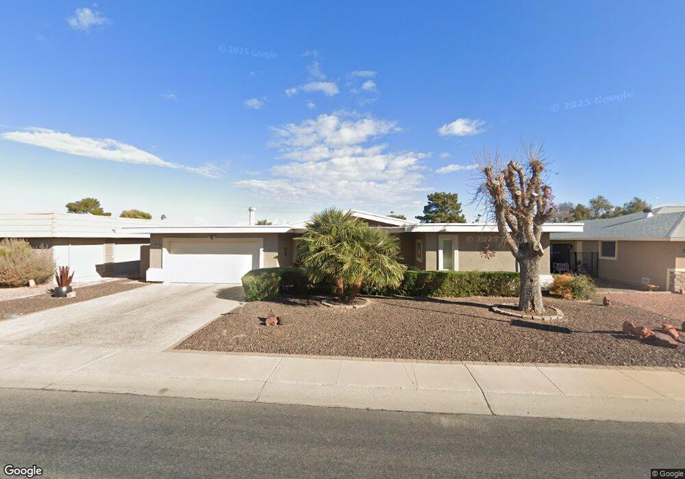
10214 W Brookside Dr Sun City, AZ 85351
Estimated Value: $288,073 - $368,000
--
Bed
2
Baths
1,597
Sq Ft
$215/Sq Ft
Est. Value
About This Home
This home is located at 10214 W Brookside Dr, Sun City, AZ 85351 and is currently estimated at $343,018, approximately $214 per square foot. 10214 W Brookside Dr is a home located in Maricopa County with nearby schools including Sonoran Science Academy-Peoria, Desert Mirage Elementary School, and Black Mountain Science Academy Montessori.
Ownership History
Date
Name
Owned For
Owner Type
Purchase Details
Closed on
Oct 6, 2020
Sold by
Millette Timothy T and Millette Janine M
Bought by
Millette Timothy T and Millette Janine M
Current Estimated Value
Purchase Details
Closed on
May 20, 2002
Sold by
Douglas Marcia R
Bought by
Millette Timothy T and Millette Janine M
Home Financials for this Owner
Home Financials are based on the most recent Mortgage that was taken out on this home.
Original Mortgage
$100,000
Outstanding Balance
$42,107
Interest Rate
6.89%
Estimated Equity
$300,911
Create a Home Valuation Report for This Property
The Home Valuation Report is an in-depth analysis detailing your home's value as well as a comparison with similar homes in the area
Home Values in the Area
Average Home Value in this Area
Purchase History
| Date | Buyer | Sale Price | Title Company |
|---|---|---|---|
| Millette Timothy T | -- | None Available | |
| Millette Timothy T | $124,000 | Security Title Agency |
Source: Public Records
Mortgage History
| Date | Status | Borrower | Loan Amount |
|---|---|---|---|
| Open | Millette Timothy T | $100,000 |
Source: Public Records
Tax History Compared to Growth
Tax History
| Year | Tax Paid | Tax Assessment Tax Assessment Total Assessment is a certain percentage of the fair market value that is determined by local assessors to be the total taxable value of land and additions on the property. | Land | Improvement |
|---|---|---|---|---|
| 2025 | $1,541 | $19,070 | -- | -- |
| 2024 | $1,391 | $18,162 | -- | -- |
| 2023 | $1,391 | $26,830 | $5,360 | $21,470 |
| 2022 | $1,301 | $22,820 | $4,560 | $18,260 |
| 2021 | $1,343 | $21,570 | $4,310 | $17,260 |
| 2020 | $1,308 | $19,360 | $3,870 | $15,490 |
| 2019 | $1,291 | $19,050 | $3,810 | $15,240 |
| 2018 | $1,242 | $11,150 | $2,230 | $8,920 |
| 2017 | $1,034 | $11,150 | $2,230 | $8,920 |
| 2016 | $575 | $11,150 | $2,230 | $8,920 |
| 2015 | $1,020 | $11,150 | $2,230 | $8,920 |
Source: Public Records
Map
Nearby Homes
- 10134 W Desert Rock Dr
- 10313 W Desert Rock Dr
- 10313 W Burns Dr
- 10214 W Hutton Dr Unit 36
- 9921 W Hutton Dr
- 16802 N Boswell Blvd
- 16822 N Boswell Blvd
- 10329 W Gulf Hills Dr
- 10018 W Burns Dr
- 16801 N 103rd Ave
- 16822 N 102nd Ave
- 16202 N 106th Ave
- 10202 W Edgewood Dr
- 10106 W Campana Dr
- 10511 W Edgewood Dr
- 10140 W Campana Dr
- 10228 W Twin Oaks Dr
- 10401 W Loma Blanca Dr
- 16869 N 103rd Ave
- 10608 W Edgewood Dr
- 10220 W Brookside Dr
- 10208 W Brookside Dr
- 10226 W Brookside Dr
- 10202 W Brookside Dr
- 10219 W Brookside Dr
- 10213 W Brookside Dr
- 10225 W Brookside Dr
- 10207 W Brookside Dr
- 10232 W Brookside Dr
- 10231 W Brookside Dr
- 10201 W Brookside Dr
- 10220 W Sutters Gold Ln
- 10214 W Sutters Gold Ln Unit 31
- 10237 W Brookside Dr
- 10226 W Sutters Gold Ln Unit 33
- 10302 W Brookside Dr
- 10208 W Sutters Gold Ln Unit 33
- 10232 W Sutters Gold Ln
- 10130 W Brookside Dr
- 10301 W Brookside Dr