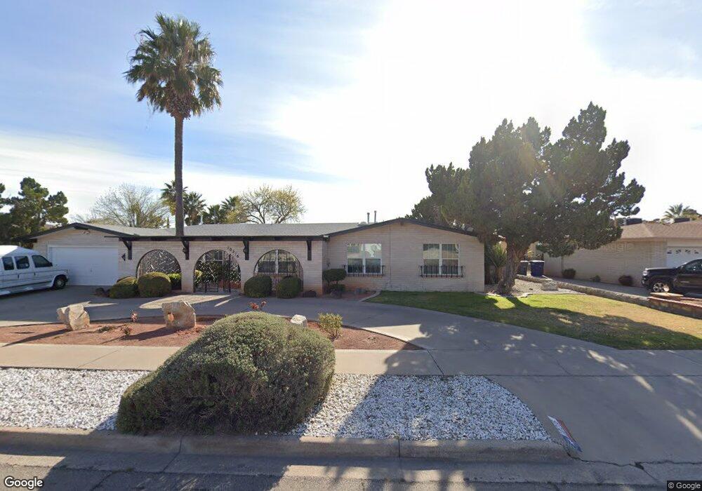
10216 Buckwood Ave El Paso, TX 79925
Travis White NeighborhoodEstimated Value: $482,000 - $564,000
--
Bed
4
Baths
4,239
Sq Ft
$120/Sq Ft
Est. Value
About This Home
This home is located at 10216 Buckwood Ave, El Paso, TX 79925 and is currently estimated at $510,211, approximately $120 per square foot. 10216 Buckwood Ave is a home located in El Paso County with nearby schools including Eastwood Heights Elementary School, Eastwood High School, and St. Raphael School.
Ownership History
Date
Name
Owned For
Owner Type
Purchase Details
Closed on
Jul 20, 2023
Sold by
Guzman Family Revocable Trust
Bought by
Guzman Ramiro and Guzman Anna M
Current Estimated Value
Home Financials for this Owner
Home Financials are based on the most recent Mortgage that was taken out on this home.
Original Mortgage
$648,000
Interest Rate
9%
Mortgage Type
FHA
Purchase Details
Closed on
Mar 24, 2021
Sold by
Guzman Ramiro and Guzman Anna Maria
Bought by
Guzman Ramiro and Guzman Family Revocable Trust
Create a Home Valuation Report for This Property
The Home Valuation Report is an in-depth analysis detailing your home's value as well as a comparison with similar homes in the area
Home Values in the Area
Average Home Value in this Area
Purchase History
| Date | Buyer | Sale Price | Title Company |
|---|---|---|---|
| Guzman Ramiro | -- | Fnc Title Services | |
| Guzman Ramiro | -- | None Available |
Source: Public Records
Mortgage History
| Date | Status | Borrower | Loan Amount |
|---|---|---|---|
| Closed | Guzman Ramiro | $648,000 | |
| Closed | Guzman Ramiro | $648,000 |
Source: Public Records
Tax History Compared to Growth
Tax History
| Year | Tax Paid | Tax Assessment Tax Assessment Total Assessment is a certain percentage of the fair market value that is determined by local assessors to be the total taxable value of land and additions on the property. | Land | Improvement |
|---|---|---|---|---|
| 2025 | -- | $417,476 | -- | -- |
| 2024 | -- | $379,524 | -- | -- |
| 2023 | $10,042 | $345,022 | $0 | $0 |
| 2022 | $9,740 | $313,656 | $0 | $0 |
| 2021 | $9,269 | $351,311 | $38,825 | $312,486 |
| 2020 | $8,187 | $259,220 | $35,539 | $223,681 |
| 2018 | $7,926 | $254,893 | $35,539 | $219,354 |
| 2017 | $7,477 | $244,617 | $35,539 | $209,078 |
| 2016 | $7,477 | $244,617 | $35,539 | $209,078 |
| 2015 | $5,338 | $244,617 | $35,539 | $209,078 |
| 2014 | $5,338 | $246,935 | $35,539 | $211,396 |
Source: Public Records
Map
Nearby Homes
- 10463 Davwood Ln
- 10401 Springwood Dr
- 10212 Garwood Ct
- 10233 Byway Dr
- 10412 Chinaberry Dr
- 9801 Eastridge Dr
- 10533 Springwood Dr
- 10313 Byway Dr
- 10145 Camwood Dr
- 10481 Deepwood Ct
- 10304 Woodruff Ct
- 10309 Woodruff Ct
- 9917 Honolulu Dr
- 7936 Dogwood St
- 7921 Candlewood Ave
- 1207 Bois d Arc Dr
- 1909 Crow Dr
- 9674 Stonehaven Dr
- 9525 Desert Ridge Dr
- 2425 Fir St
- 10208 Buckwood Ave
- 10217 Buckwood Dr
- 10220 Buckwood Ave
- 10217 Buckwood Ave
- 10204 Buckwood Ave
- 10213 Buckwood Ave
- 10221 Buckwood Ave
- 10209 Buckwood Ave
- 10225 Buckwood Ave
- 10200 Buckwood Ave
- 10232 Buckwood Ave
- 10229 Buckwood Ave
- 10228 Stoneway Dr
- 10205 Buckwood Ave
- 10224 Stoneway Dr
- 10236 Stoneway Dr
- 10220 Stoneway Dr
- 10240 Stoneway Dr
- 10216 Stoneway Dr
- 10201 Buckwood Ave