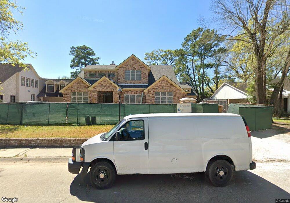
10219 Shady River Dr Houston, TX 77042
Briar Forest NeighborhoodEstimated Value: $1,196,000 - $1,787,982
4
Beds
3
Baths
3,438
Sq Ft
$452/Sq Ft
Est. Value
About This Home
This home is located at 10219 Shady River Dr, Houston, TX 77042 and is currently estimated at $1,554,746, approximately $452 per square foot. 10219 Shady River Dr is a home located in Harris County with nearby schools including Walnut Bend Elementary School, Paul Revere Middle School, and Westside High School.
Ownership History
Date
Name
Owned For
Owner Type
Purchase Details
Closed on
Jul 5, 2022
Sold by
Riverway Development Inc
Bought by
Plp Properties Llc
Current Estimated Value
Home Financials for this Owner
Home Financials are based on the most recent Mortgage that was taken out on this home.
Original Mortgage
$1,000,000
Outstanding Balance
$898,222
Interest Rate
5.1%
Mortgage Type
New Conventional
Estimated Equity
$656,524
Purchase Details
Closed on
Jun 14, 2021
Sold by
Davis Brian Ted and Davis Siri
Bought by
Riverway Development Inc
Home Financials for this Owner
Home Financials are based on the most recent Mortgage that was taken out on this home.
Original Mortgage
$1,080,000
Interest Rate
2.9%
Mortgage Type
Commercial
Purchase Details
Closed on
Jul 22, 2016
Sold by
Kitchel Bruce G and Kitchel Lydia R
Bought by
Davis Brian Ted and Davis Siri
Home Financials for this Owner
Home Financials are based on the most recent Mortgage that was taken out on this home.
Original Mortgage
$502,250
Interest Rate
2.87%
Mortgage Type
Adjustable Rate Mortgage/ARM
Purchase Details
Closed on
Jun 18, 2008
Sold by
Brown Robert D and Brown Linda K
Bought by
Kitchel Bruce G and Kitchel Lydia R
Home Financials for this Owner
Home Financials are based on the most recent Mortgage that was taken out on this home.
Original Mortgage
$355,000
Interest Rate
5.99%
Mortgage Type
Purchase Money Mortgage
Purchase Details
Closed on
Oct 23, 1998
Sold by
Rosch Robert M and Bosch Nikki Lyn
Bought by
Brown Robert D and Brown Linda K
Home Financials for this Owner
Home Financials are based on the most recent Mortgage that was taken out on this home.
Original Mortgage
$200,000
Interest Rate
6.57%
Purchase Details
Closed on
Sep 5, 1997
Sold by
Nelson Gregory V and Nelson Libbie L
Bought by
Bosch Robert M and Bosch Nikki Lyn
Home Financials for this Owner
Home Financials are based on the most recent Mortgage that was taken out on this home.
Original Mortgage
$279,000
Interest Rate
6.5%
Create a Home Valuation Report for This Property
The Home Valuation Report is an in-depth analysis detailing your home's value as well as a comparison with similar homes in the area
Home Values in the Area
Average Home Value in this Area
Purchase History
| Date | Buyer | Sale Price | Title Company |
|---|---|---|---|
| Plp Properties Llc | -- | Texas American Title Company | |
| Riverway Development Inc | -- | Texas American Title Company | |
| Davis Brian Ted | -- | None Available | |
| Kitchel Bruce G | -- | Alamo Title Company | |
| Brown Robert D | -- | First American Title | |
| Bosch Robert M | -- | Charter Title Company |
Source: Public Records
Mortgage History
| Date | Status | Borrower | Loan Amount |
|---|---|---|---|
| Open | Plp Properties Llc | $1,000,000 | |
| Previous Owner | Riverway Development Inc | $1,080,000 | |
| Previous Owner | Davis Brian Ted | $502,250 | |
| Previous Owner | Kitchel Bruce G | $355,000 | |
| Previous Owner | Brown Robert D | $200,000 | |
| Previous Owner | Bosch Robert M | $279,000 |
Source: Public Records
Tax History Compared to Growth
Tax History
| Year | Tax Paid | Tax Assessment Tax Assessment Total Assessment is a certain percentage of the fair market value that is determined by local assessors to be the total taxable value of land and additions on the property. | Land | Improvement |
|---|---|---|---|---|
| 2025 | $28,508 | $1,539,995 | $480,083 | $1,059,912 |
| 2024 | $28,508 | $1,362,494 | $480,083 | $882,411 |
| 2023 | $28,508 | $1,362,494 | $480,083 | $882,411 |
| 2022 | $17,925 | $814,091 | $480,083 | $334,008 |
| 2021 | $15,312 | $657,000 | $480,083 | $176,917 |
| 2020 | $16,696 | $689,460 | $480,083 | $209,377 |
| 2019 | $17,641 | $697,162 | $480,083 | $217,079 |
| 2018 | $13,064 | $657,000 | $256,044 | $400,956 |
| 2017 | $18,142 | $717,500 | $256,044 | $461,456 |
| 2016 | $18,964 | $750,000 | $256,044 | $493,956 |
| 2015 | $12,691 | $925,782 | $256,044 | $669,738 |
| 2014 | $12,691 | $684,664 | $256,044 | $428,620 |
Source: Public Records
Map
Nearby Homes
- 10323 Pine Forest Rd
- 238 Litchfield Ln
- 246 Litchfield Ln
- 168 Litchfield Ln
- 171 Litchfield Ln
- 201 Litchfield Ln
- 12625 Memorial Dr Unit 180
- 12625 Memorial Dr Unit 17
- 12625 Memorial Dr Unit 4
- 12625 Memorial Dr Unit 146
- 12625 Memorial Dr Unit 87
- 12625 Memorial Dr
- 12625 Memorial Dr Unit 11
- 161 Litchfield Ln
- 152 Litchfield Ln
- 10212 Longmont Dr Unit 44/7
- 241 Litchfield Ln
- 259 Litchfield Ln Unit 66
- 53 Litchfield Ln
- 10034 Bordley Dr
- 10223 Shady River Dr
- 10215 Shady River Dr
- 10230 Green Tree Rd
- 10302 Green Tree Rd
- 10226 Green Tree Rd
- 10303 Shady River Dr
- 10211 Shady River Dr
- 10211 Shady Ln
- 10218 Shady River Dr
- 10310 Green Tree Rd
- 10302 Shady River Dr
- 10214 Shady River Dr
- 10218 Green Tree Rd
- 10306 Shady River Dr
- 10314 Green Tree Rd
- 10307 Shady River Dr
- 10207 Shady River Dr
- 10210 Shady River Dr
- 10231 Green Tree Rd
- 10227 Green Tree Rd