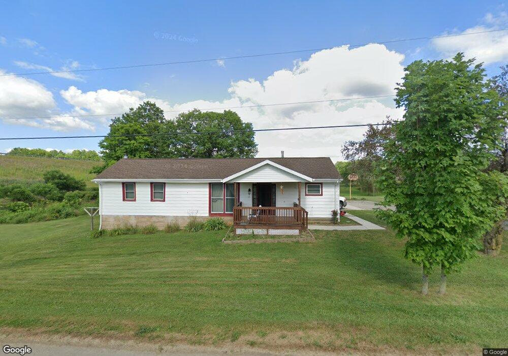
10219 Universal Dr Diamond, OH 44412
Estimated Value: $149,010 - $227,000
3
Beds
1
Bath
1,040
Sq Ft
$176/Sq Ft
Est. Value
About This Home
This home is located at 10219 Universal Dr, Diamond, OH 44412 and is currently estimated at $182,753, approximately $175 per square foot. 10219 Universal Dr is a home with nearby schools including Southeast High School.
Ownership History
Date
Name
Owned For
Owner Type
Purchase Details
Closed on
Jun 18, 2004
Sold by
Smith Arzetta
Bought by
Smith Arthur J and Smith Arthur J
Current Estimated Value
Home Financials for this Owner
Home Financials are based on the most recent Mortgage that was taken out on this home.
Original Mortgage
$88,609
Outstanding Balance
$44,386
Interest Rate
6.37%
Mortgage Type
FHA
Estimated Equity
$138,367
Purchase Details
Closed on
Jun 17, 2004
Sold by
Smith Arthur J and Smith Arthur J
Bought by
Meadows Danny R and Meadows Lorena E
Home Financials for this Owner
Home Financials are based on the most recent Mortgage that was taken out on this home.
Original Mortgage
$88,609
Outstanding Balance
$44,386
Interest Rate
6.37%
Mortgage Type
FHA
Estimated Equity
$138,367
Purchase Details
Closed on
Jan 1, 1990
Bought by
Smith Arthur
Create a Home Valuation Report for This Property
The Home Valuation Report is an in-depth analysis detailing your home's value as well as a comparison with similar homes in the area
Purchase History
| Date | Buyer | Sale Price | Title Company |
|---|---|---|---|
| Smith Arthur J | -- | Approved Statewide Title | |
| Meadows Danny R | $90,000 | Approved Statewide Title | |
| Smith Arthur | -- | -- |
Source: Public Records
Mortgage History
| Date | Status | Borrower | Loan Amount |
|---|---|---|---|
| Open | Meadows Danny R | $88,609 | |
| Closed | Meadows Danny R | $2,500 |
Source: Public Records
Tax History
| Year | Tax Paid | Tax Assessment Tax Assessment Total Assessment is a certain percentage of the fair market value that is determined by local assessors to be the total taxable value of land and additions on the property. | Land | Improvement |
|---|---|---|---|---|
| 2024 | $1,532 | $42,990 | $3,680 | $39,310 |
| 2023 | $1,269 | $32,170 | $3,680 | $28,490 |
| 2022 | $1,317 | $32,170 | $3,680 | $28,490 |
| 2021 | $1,328 | $32,170 | $3,680 | $28,490 |
| 2020 | $1,130 | $26,120 | $3,680 | $22,440 |
| 2019 | $1,133 | $26,120 | $3,680 | $22,440 |
| 2017 | $983 | $21,390 | $3,680 | $17,710 |
| 2016 | $980 | $21,390 | $3,680 | $17,710 |
Source: Public Records
Map
Nearby Homes
- 9865 Tallmadge Rd
- 3875 McClintocksburg Rd
- 1135 Mahoning Portage County Line Rd
- 9672 Whippoorwill Rd
- 0 Ohio 225 Unit 5174573
- 0 Maplewood Ave
- 0 Mahoning Ave Unit 16434374
- 0 Mahoning Ave Unit 5168095
- 0 Mahoning Ave Unit 5168074
- 0 Mahoning Ave Unit 11482663
- 0 Mahoning Ave Unit 5168085
- 0 Mahoning Ave Unit 5168089
- 0 Mahoning Ave Unit 5168093
- 0 Lawnview Ave
- 4133 State Route 225
- 17964 Glendale Ave
- 3609 State Route 225
- 0 Manchester St Unit 5172420
- 17911 Davis Rd
- 17544 Pine Ct
- 4036 Universal Dr
- 10191 Mason Ave
- 10227 Tallmadge Rd
- 10229 Tallmadge Rd
- 4035 Mason
- 10161 Mason Ave
- 10199 Tallmadge Rd
- 10187 Tallmadge Rd
- 10176 Mason Ave
- 4034 Depot St
- 10226 Tallmadge Rd
- 10166 Mason Ave
- 10214 Tallmadge Rd
- 0 Tallmadge Rd
- 10263 Tallmadge Rd
- 10248 Tallmadge Rd
- lot 31 Tallmadge Rd
- 10171 Tallmadge Rd
- 10260 Tallmadge Rd
- 10264 Tallmadge Rd
Your Personal Tour Guide
Ask me questions while you tour the home.