Estimated Value: $435,137 - $469,000
3
Beds
3
Baths
2,418
Sq Ft
$185/Sq Ft
Est. Value
About This Home
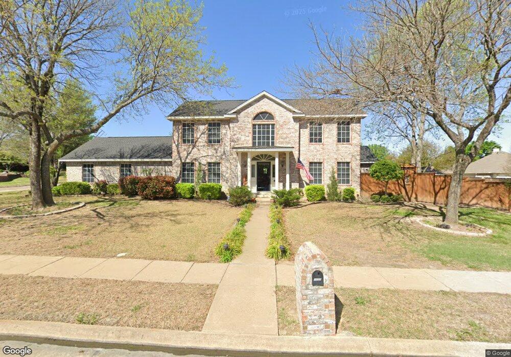
This home is located at 1022 Foxwood Ln, Wylie, TX 75098 and is currently estimated at $448,034, approximately $185 per square foot. 1022 Foxwood Ln is a home located in Collin County with nearby schools including P M Akin Elementary School, AB Harrison Intermediate School, and Grady Burnett J High School.
Ownership History
Date
Name
Owned For
Owner Type
Purchase Details
Closed on
Aug 15, 2000
Sold by
Bridges Ronnie A and Bridges Belinda Joyce
Bought by
Jackson John L and Jackson Joann K
Current Estimated Value
Home Financials for this Owner
Home Financials are based on the most recent Mortgage that was taken out on this home.
Original Mortgage
$152,900
Outstanding Balance
$55,166
Interest Rate
8.15%
Estimated Equity
$392,868
Create a Home Valuation Report for This Property
The Home Valuation Report is an in-depth analysis detailing your home's value as well as a comparison with similar homes in the area
Home Values in the Area
Average Home Value in this Area
Purchase History
| Date | Buyer | Sale Price | Title Company |
|---|---|---|---|
| Jackson John L | -- | -- |
Source: Public Records
Mortgage History
| Date | Status | Borrower | Loan Amount |
|---|---|---|---|
| Open | Jackson John L | $152,900 |
Source: Public Records
Tax History Compared to Growth
Tax History
| Year | Tax Paid | Tax Assessment Tax Assessment Total Assessment is a certain percentage of the fair market value that is determined by local assessors to be the total taxable value of land and additions on the property. | Land | Improvement |
|---|---|---|---|---|
| 2025 | $5,502 | $390,169 | $120,000 | $296,377 |
| 2024 | $5,502 | $354,699 | $120,000 | $282,283 |
| 2023 | $5,502 | $322,454 | $120,000 | $309,918 |
| 2022 | $6,431 | $293,140 | $120,000 | $275,748 |
| 2021 | $6,270 | $266,491 | $70,000 | $196,491 |
| 2020 | $6,555 | $263,976 | $70,000 | $193,976 |
| 2019 | $6,954 | $264,626 | $70,000 | $210,479 |
| 2018 | $6,479 | $240,569 | $70,000 | $195,789 |
| 2017 | $5,890 | $237,554 | $60,000 | $177,554 |
| 2016 | $5,524 | $215,604 | $42,000 | $173,604 |
| 2015 | $4,438 | $180,743 | $42,000 | $138,743 |
Source: Public Records
Map
Nearby Homes
- 1201 E Stone Rd
- 1320 Cedar Branch Dr
- 312 Maltese Cir
- 1318 Chestnut Hill Dr
- 306 Foxwood Ct
- 407 Sparrow Dr
- 1321 Iron Horse St
- 1210 Iron Horse St
- 1209 Surrey Cir
- 1115 Nighthawk Dr
- 1323 Canyon Creek Rd
- 1210 Troy Rd
- 1330 Canyon Creek Rd
- 409 Cedar Ridge Dr
- 825 Forest Edge Ln
- 1316 Taren Trail
- 1318 Taren Trail
- 825 Foxwood Ln
- 1503 E Collins Blvd
- 1056 Fairview Dr
- 1020 Foxwood Ln
- 504 Foxwood Ln
- 1018 Foxwood Ln
- 511 Foxwood Ln
- 1021 Foxwood Ln
- 509 Foxwood Ln
- 502 Foxwood Ln
- 1023 Foxwood Ln
- 1019 Foxwood Ln
- 513 Foxwood Ln
- 1016 Foxwood Ln
- 505 Foxwood Ln
- 1017 Foxwood Ln
- 414 Foxwood Ln
- 503 Foxwood Ln
- 1014 Foxwood Ln
- 501 Foxwood Ln
- 412 Foxwood Ln
- 503 Stonehedge Dr
- 1012 Foxwood Ln