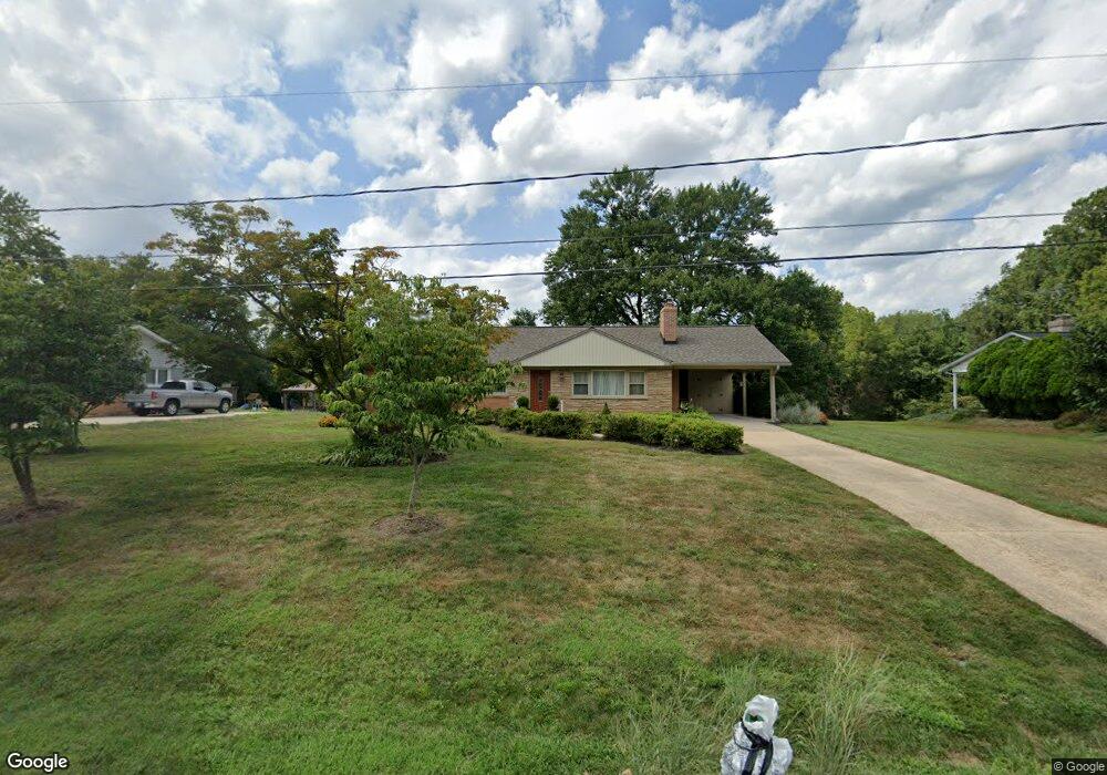
1022 Gadsden Ave Silver Spring, MD 20905
Ashton-Sandy Spring NeighborhoodEstimated Value: $538,000 - $565,000
3
Beds
2
Baths
1,256
Sq Ft
$440/Sq Ft
Est. Value
About This Home
This home is located at 1022 Gadsden Ave, Silver Spring, MD 20905 and is currently estimated at $552,131, approximately $439 per square foot. 1022 Gadsden Ave is a home located in Montgomery County with nearby schools including Cloverly Elementary School, William H. Farquhar Middle School, and James Hubert Blake High School.
Ownership History
Date
Name
Owned For
Owner Type
Purchase Details
Closed on
Aug 19, 2013
Sold by
Johnson Rena Marie and Johnson Rena M
Bought by
Johnson Rena Marie
Current Estimated Value
Home Financials for this Owner
Home Financials are based on the most recent Mortgage that was taken out on this home.
Original Mortgage
$379,765
Outstanding Balance
$286,426
Interest Rate
4.75%
Mortgage Type
FHA
Estimated Equity
$265,705
Purchase Details
Closed on
Mar 19, 2004
Sold by
Behrens Edgar F and Behrens M R
Bought by
Johnson Rena M
Create a Home Valuation Report for This Property
The Home Valuation Report is an in-depth analysis detailing your home's value as well as a comparison with similar homes in the area
Home Values in the Area
Average Home Value in this Area
Purchase History
| Date | Buyer | Sale Price | Title Company |
|---|---|---|---|
| Johnson Rena Marie | -- | None Available | |
| Johnson Rena M | $377,900 | -- | |
| Johnson Rena M | $377,900 | -- |
Source: Public Records
Mortgage History
| Date | Status | Borrower | Loan Amount |
|---|---|---|---|
| Open | Johnson Rena Marie | $379,765 |
Source: Public Records
Tax History
| Year | Tax Paid | Tax Assessment Tax Assessment Total Assessment is a certain percentage of the fair market value that is determined by local assessors to be the total taxable value of land and additions on the property. | Land | Improvement |
|---|---|---|---|---|
| 2025 | $5,522 | $460,600 | -- | -- |
| 2024 | $5,522 | $440,800 | $0 | $0 |
| 2023 | $4,578 | $421,000 | $236,400 | $184,600 |
| 2022 | $4,133 | $400,300 | $0 | $0 |
| 2021 | $3,598 | $379,600 | $0 | $0 |
| 2020 | $3,598 | $358,900 | $236,400 | $122,500 |
| 2019 | $3,560 | $356,833 | $0 | $0 |
| 2018 | $3,536 | $354,767 | $0 | $0 |
| 2017 | $3,585 | $352,700 | $0 | $0 |
| 2016 | $3,882 | $343,567 | $0 | $0 |
| 2015 | $3,882 | $334,433 | $0 | $0 |
| 2014 | $3,882 | $325,300 | $0 | $0 |
Source: Public Records
Map
Nearby Homes
- 1325 Patuxent Dr
- 1401 Tucker Ln
- 1625 Ashton Rd
- 16612 Medinah Ct
- 17812 Hidden Garden Ln
- 1216 Ashton Rd
- 1225 Spencerville Rd
- 1400 Spencerville Rd
- 550 Bryants Nursery Rd
- 15801 New Hampshire Ave
- 401 Bryants Nursery Rd
- 12762 Lime Kiln Rd
- 1320 Rainbow Dr
- 1600 Rainbow Dr
- 7033 Mink Hollow Rd
- 2307 Spencerville Rd
- 15408 Valencia St
- 15533 Thompson Rd
- 410 Norwood Rd
- 12425 Hill Crest
- 1020 Gadsden Ave
- 1024 Gadsden Ave
- 1018 Gadsden Ave
- 17211 Emerson Dr
- 17209 Emerson Dr
- 1100 Gadsden Ave
- 17207 Emerson Dr
- 1021 Gadsden Ave
- 1019 Gadsden Ave
- 1101 Gadsden Ave
- 17213 Emerson Dr
- 1016 Gadsden Ave
- 17205 Emerson Dr
- 1017 Gadsden Ave
- 17215 Emerson Dr
- 17203 Emerson Dr
- 1137 Hornell Dr
- 1014 Gadsden Ave
- 1015 Gadsden Ave
- 1201 Hornell Dr
Your Personal Tour Guide
Ask me questions while you tour the home.