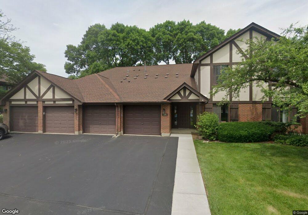
1022 Harbour Dr Unit 1BL Wheeling, IL 60090
Estimated Value: $255,541 - $350,000
3
Beds
--
Bath
9,960
Sq Ft
$29/Sq Ft
Est. Value
About This Home
This home is located at 1022 Harbour Dr Unit 1BL, Wheeling, IL 60090 and is currently estimated at $291,635, approximately $29 per square foot. 1022 Harbour Dr Unit 1BL is a home located in Cook County with nearby schools including Dwight D Eisenhower Elementary School, Anne Sullivan Elementary School, and Betsy Ross Elementary School.
Ownership History
Date
Name
Owned For
Owner Type
Purchase Details
Closed on
Sep 2, 2015
Sold by
Million Alisa and Nosovitsky Anatoly
Bought by
Million Alisa and Nosovitsky Anatoly
Current Estimated Value
Purchase Details
Closed on
Oct 14, 2013
Sold by
Fisher Daniel
Bought by
Million Alisa and Nosovitsky Anatoly
Purchase Details
Closed on
Dec 20, 2012
Sold by
Fisher Daniel
Bought by
Fisher Daniel and Daniel Fisher Living Trust
Purchase Details
Closed on
Nov 23, 2012
Sold by
Greenberg Marlene Sutel and Greenberg Barry
Bought by
Fisher Daniel
Purchase Details
Closed on
Oct 12, 2012
Sold by
Fisher Baker Sheila
Bought by
Fisher Daniel
Create a Home Valuation Report for This Property
The Home Valuation Report is an in-depth analysis detailing your home's value as well as a comparison with similar homes in the area
Home Values in the Area
Average Home Value in this Area
Purchase History
| Date | Buyer | Sale Price | Title Company |
|---|---|---|---|
| Million Alisa | -- | Carrington Title Partners Ll | |
| Million Alisa | $140,000 | None Available | |
| Fisher Daniel | -- | None Available | |
| Fisher Daniel | -- | None Available | |
| Fisher Daniel | -- | None Available |
Source: Public Records
Tax History
| Year | Tax Paid | Tax Assessment Tax Assessment Total Assessment is a certain percentage of the fair market value that is determined by local assessors to be the total taxable value of land and additions on the property. | Land | Improvement |
|---|---|---|---|---|
| 2025 | $1,195 | $24,337 | $5,062 | $19,275 |
| 2024 | $1,195 | $16,838 | $4,640 | $12,198 |
| 2023 | $1,180 | $16,838 | $4,640 | $12,198 |
| 2022 | $1,180 | $16,838 | $4,640 | $12,198 |
| 2021 | $1,338 | $15,460 | $527 | $14,933 |
| 2020 | $1,212 | $15,460 | $527 | $14,933 |
| 2019 | $1,202 | $17,234 | $527 | $16,707 |
| 2018 | $1,596 | $11,913 | $421 | $11,492 |
| 2017 | $1,278 | $11,913 | $421 | $11,492 |
| 2016 | $1,877 | $11,913 | $421 | $11,492 |
| 2015 | $2,148 | $11,292 | $2,003 | $9,289 |
| 2014 | $3,480 | $11,292 | $2,003 | $9,289 |
| 2013 | $2,582 | $11,292 | $2,003 | $9,289 |
Source: Public Records
Map
Nearby Homes
- 1030 Cottonwood Ct Unit 2A
- 1025 Cottonwood Ct Unit 2AR
- 1025 Cottonwood Ct Unit 1B
- 1014 Lakeland Ct Unit 2A
- 1810 E Waverly Dr
- 2643 N Prindle Ave
- 791 Lakeside Circle Dr Unit 1
- 1507 Clearwater Ln Unit 1
- 700 Lakeside Circle Dr
- 691 Lakeside Circle Dr
- 2812 Jackson Dr
- 671 Cedarwood Ct Unit 2
- 2010 N Oak Wood Dr
- 2632 N Windsor Dr Unit 104
- 528 Surf Ct
- 2612 N Windsor Dr Unit 201
- 3026 Jackson Dr
- 2522 N Brighton Place
- 1637 Tahoe Circle Dr Unit 209
- 413 Buffalo Trail Unit 10601
- 1022 Harbour Dr Unit 1B
- 1022 Harbour Dr Unit 2AL
- 1022 Harbour Dr Unit 2BL
- 1022 Harbour Dr Unit 1AL
- 1022 Harbour Dr Unit 2-A
- 1022 Harbour Dr Unit 1A
- 1022 Harbour Ct Unit 2AL
- 1022 Harbour Ct Unit 1BL
- 1022 Harbour Ct Unit 2BL
- 1022 Harbour Ct Unit 1AL
- 1022 Harbour Ct Unit 1-A
- 1012 Harbour Dr Unit 1BR
- 1012 Harbour Dr Unit 2BR
- 1012 Harbour Dr Unit 1AR
- 1012 Harbour Dr Unit 2AR
- 1012 Harbour Dr Unit 1A
- 1033 Harbour Ct Unit 1BR
- 1033 Harbour Ct Unit 2AR
- 1033 Harbour Ct Unit 2BR
- 1033 Harbour Ct Unit 1AR
