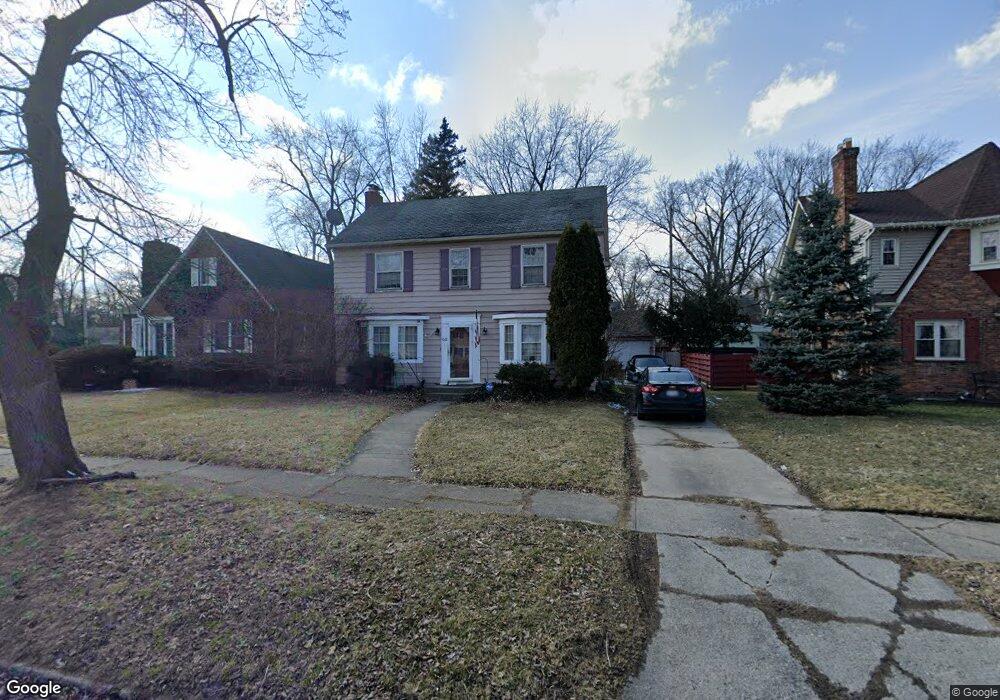
1022 Kensington Ave Flint, MI 48503
College Cultural Neighborhood NeighborhoodEstimated Value: $144,853 - $193,000
3
Beds
2
Baths
1,614
Sq Ft
$107/Sq Ft
Est. Value
About This Home
This home is located at 1022 Kensington Ave, Flint, MI 48503 and is currently estimated at $173,463, approximately $107 per square foot. 1022 Kensington Ave is a home located in Genesee County with nearby schools including Pierce Elementary School, Flint Southwestern Classical Academy, and Flint Cultural Center Academy.
Ownership History
Date
Name
Owned For
Owner Type
Purchase Details
Closed on
Apr 2, 2008
Sold by
Mortgage Electronic Registration Systems
Bought by
Wells Fargo Bank Na and Impac Secured Assets Corp Mortgage Pass
Current Estimated Value
Purchase Details
Closed on
Mar 28, 2008
Sold by
Murphy Carolyn S
Bought by
Mortgage Electronic Registration Systems
Create a Home Valuation Report for This Property
The Home Valuation Report is an in-depth analysis detailing your home's value as well as a comparison with similar homes in the area
Home Values in the Area
Average Home Value in this Area
Purchase History
| Date | Buyer | Sale Price | Title Company |
|---|---|---|---|
| Wells Fargo Bank Na | -- | None Available | |
| Mortgage Electronic Registration Systems | $128,694 | None Available |
Source: Public Records
Tax History Compared to Growth
Tax History
| Year | Tax Paid | Tax Assessment Tax Assessment Total Assessment is a certain percentage of the fair market value that is determined by local assessors to be the total taxable value of land and additions on the property. | Land | Improvement |
|---|---|---|---|---|
| 2025 | $1,660 | $62,200 | $0 | $0 |
| 2024 | $1,481 | $59,400 | $0 | $0 |
| 2023 | $1,441 | $48,700 | $0 | $0 |
| 2022 | $0 | $40,900 | $0 | $0 |
| 2021 | $1,513 | $38,400 | $0 | $0 |
| 2020 | $1,341 | $36,200 | $0 | $0 |
| 2019 | $2,092 | $34,100 | $0 | $0 |
| 2018 | $1,343 | $26,500 | $0 | $0 |
| 2017 | $1,403 | $0 | $0 | $0 |
| 2016 | $1,290 | $0 | $0 | $0 |
| 2015 | -- | $0 | $0 | $0 |
| 2014 | -- | $0 | $0 | $0 |
| 2012 | -- | $28,500 | $0 | $0 |
Source: Public Records
Map
Nearby Homes
- 1018 Lafayette St
- 1510 S Franklin Ave
- 2013 E Court St
- 2122 Pierce St
- 1623 Montclair Ave
- 930 Belmont Ave
- 2313 Brookside Dr
- 2319 Calumet St
- 2202 Windemere Ave
- 2131 Windemere Ave
- 2208 Windemere Ave
- 911 E 7th St
- 841 E 8th St
- 524 S Lynch St
- 605 S Lynch St
- 915 E Court St Unit 104
- 915 E Court St
- 903 E Court St
- 622 Chalmers St
- 406 S Lynch St
- 1018 Kensington Ave
- 1026 Kensington Ave
- 1021 Blanchard Ave
- 1017 Blanchard Ave Unit Bldg-Unit
- 1017 Blanchard Ave
- 1025 Blanchard Ave
- 1010 Kensington Ave
- 1013 Blanchard Ave
- 1102 Kensington Ave
- 1009 Blanchard Ave
- 1021 Kensington Ave
- 1006 Kensington Ave
- 1101 Blanchard Ave
- 1025 Kensington Ave
- 1013 Kensington Ave
- 1106 Kensington Ave
- 1009 Kensington Ave
- 1105 Blanchard Ave
- 1002 Kensington Ave
- 1101 Kensington Ave