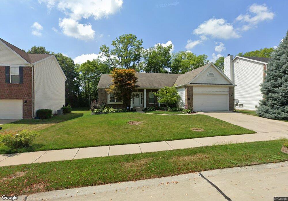
1022 Landing Place Dr Lake Saint Louis, MO 63367
Estimated Value: $451,000 - $522,000
3
Beds
2
Baths
2,234
Sq Ft
$220/Sq Ft
Est. Value
About This Home
This home is located at 1022 Landing Place Dr, Lake Saint Louis, MO 63367 and is currently estimated at $491,020, approximately $219 per square foot. 1022 Landing Place Dr is a home located in St. Charles County with nearby schools including Prairie View Elementary School, Frontier Middle School, and Liberty High School.
Ownership History
Date
Name
Owned For
Owner Type
Purchase Details
Closed on
Sep 19, 2024
Sold by
Hild Norman K and Hild Sharon K
Bought by
Hild Sharon K
Current Estimated Value
Purchase Details
Closed on
Aug 29, 2002
Sold by
The Jones Company Custom Homes Inc
Bought by
Hild Norman K and Hild Sharon K
Home Financials for this Owner
Home Financials are based on the most recent Mortgage that was taken out on this home.
Original Mortgage
$59,000
Interest Rate
6.33%
Create a Home Valuation Report for This Property
The Home Valuation Report is an in-depth analysis detailing your home's value as well as a comparison with similar homes in the area
Home Values in the Area
Average Home Value in this Area
Purchase History
| Date | Buyer | Sale Price | Title Company |
|---|---|---|---|
| Hild Sharon K | -- | None Listed On Document | |
| Hild Norman K | $199,879 | -- |
Source: Public Records
Mortgage History
| Date | Status | Borrower | Loan Amount |
|---|---|---|---|
| Previous Owner | Hild Norman K | $59,000 |
Source: Public Records
Tax History Compared to Growth
Tax History
| Year | Tax Paid | Tax Assessment Tax Assessment Total Assessment is a certain percentage of the fair market value that is determined by local assessors to be the total taxable value of land and additions on the property. | Land | Improvement |
|---|---|---|---|---|
| 2025 | $5,718 | $91,339 | -- | -- |
| 2023 | $5,718 | $84,331 | $0 | $0 |
| 2022 | $3,986 | $58,678 | $0 | $0 |
| 2021 | $3,990 | $58,678 | $0 | $0 |
| 2020 | $3,781 | $53,343 | $0 | $0 |
| 2019 | $3,509 | $53,343 | $0 | $0 |
| 2018 | $2,951 | $42,735 | $0 | $0 |
| 2017 | $3,414 | $42,735 | $0 | $0 |
| 2016 | $2,890 | $40,113 | $0 | $0 |
| 2015 | $2,851 | $40,113 | $0 | $0 |
| 2014 | $2,737 | $41,312 | $0 | $0 |
Source: Public Records
Map
Nearby Homes
- 355 Countryshire Dr
- 506 Country Landing Dr
- 618 Country Heights Dr
- 191 Noahs Mill Dr
- 109 Sommers Creek Ct
- 1009 Carpathian Dr
- 223 Countryshire Dr
- 2340 Oak Dr
- 823 Waler Dr
- 650 Country Village Dr
- 320 Briarchase Cir
- 0 Lancaster @ Montage at Hawk Ridge Unit MIS25059636
- 0 Chesapeake @ Montage at Hawk Ridge Unit MIS25059472
- Pierce Plan at Montage at Hawk Ridge - Montage At Hawk Ridge
- Sierra Plan at Montage at Hawk Ridge - Montage At Hawk Ridge
- Braxton Plan at Montage at Hawk Ridge - Montage At Hawk Ridge
- Davenport Plan at Montage at Hawk Ridge - Montage At Hawk Ridge
- Lancaster Plan at Montage at Hawk Ridge - Montage At Hawk Ridge
- Portsmouth Plan at Montage at Hawk Ridge - Montage At Hawk Ridge
- Rosemont Plan at Montage at Hawk Ridge - Montage At Hawk Ridge
- 1024 Landing Place Dr
- 1020 Landing Place Dr
- 1026 Landing Place Dr
- 1018 Landing Place Dr
- 703 Stonewood Bend Dr
- 702 Stonewood Bend Dr
- 1028 Landing Place Dr
- 1016 Landing Place Dr
- 21 Canfield Ct
- 705 Stonewood Bend Dr
- 1027 Landing Place Dr
- 23 Canfield Ct
- 1014 Landing Place Dr
- 1030 Landing Place Dr
- 708 Stonewood Bend Dr
- 1029 Landing Place Dr
- 707 Stonewood Bend Dr
- 25 Canfield Ct
- 1032 Landing Place Dr
- 1012 Landing Place Dr