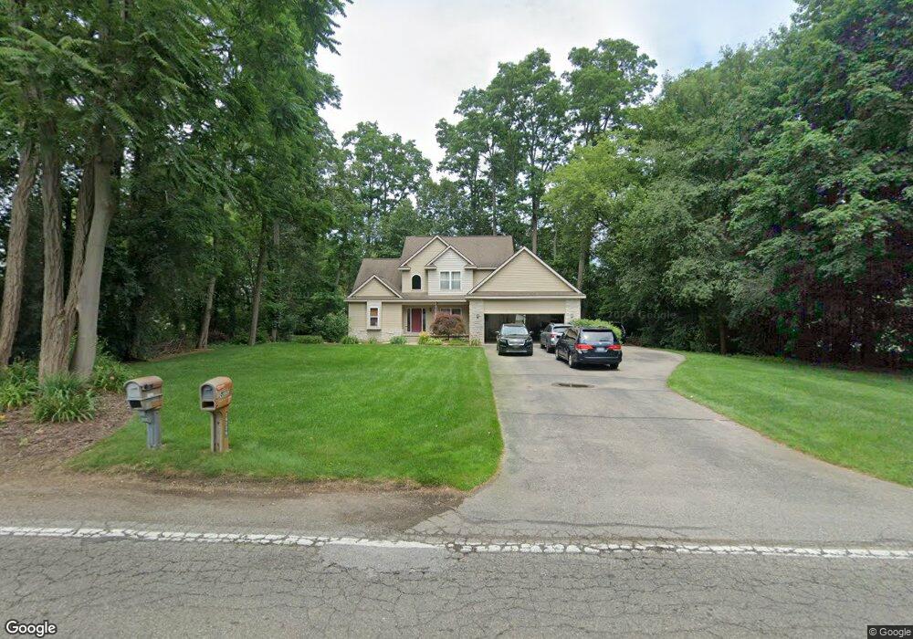
10220 Cedar Island Rd White Lake, MI 48386
Estimated Value: $468,404 - $595,000
3
Beds
3
Baths
2,017
Sq Ft
$264/Sq Ft
Est. Value
About This Home
This home is located at 10220 Cedar Island Rd, White Lake, MI 48386 and is currently estimated at $532,351, approximately $263 per square foot. 10220 Cedar Island Rd is a home located in Oakland County with nearby schools including St. Patrick School.
Ownership History
Date
Name
Owned For
Owner Type
Purchase Details
Closed on
Nov 12, 2010
Sold by
Stephenson Lisa A and Jones Lisa A
Bought by
Deel Donald M and Deel Yvette M
Current Estimated Value
Purchase Details
Closed on
Jan 4, 2006
Sold by
White Margaret G and White Douglas W
Bought by
Stephenson Lisa A
Home Financials for this Owner
Home Financials are based on the most recent Mortgage that was taken out on this home.
Original Mortgage
$233,200
Interest Rate
6.4%
Create a Home Valuation Report for This Property
The Home Valuation Report is an in-depth analysis detailing your home's value as well as a comparison with similar homes in the area
Home Values in the Area
Average Home Value in this Area
Purchase History
| Date | Buyer | Sale Price | Title Company |
|---|---|---|---|
| Deel Donald M | $188,000 | Sterling Title Agency | |
| Stephenson Lisa A | $291,500 | Philip R Seaver Title Co Inc |
Source: Public Records
Mortgage History
| Date | Status | Borrower | Loan Amount |
|---|---|---|---|
| Previous Owner | Stephenson Lisa A | $233,200 |
Source: Public Records
Tax History Compared to Growth
Tax History
| Year | Tax Paid | Tax Assessment Tax Assessment Total Assessment is a certain percentage of the fair market value that is determined by local assessors to be the total taxable value of land and additions on the property. | Land | Improvement |
|---|---|---|---|---|
| 2024 | $2,623 | $214,430 | $0 | $0 |
| 2023 | $2,502 | $196,390 | $0 | $0 |
| 2022 | $3,859 | $185,730 | $0 | $0 |
| 2021 | $3,609 | $175,010 | $0 | $0 |
| 2020 | $2,291 | $167,720 | $0 | $0 |
| 2019 | $3,510 | $156,200 | $0 | $0 |
| 2018 | $3,432 | $145,470 | $0 | $0 |
| 2017 | $3,309 | $145,470 | $0 | $0 |
| 2016 | $3,304 | $142,260 | $0 | $0 |
| 2015 | -- | $131,720 | $0 | $0 |
| 2014 | -- | $113,830 | $0 | $0 |
| 2011 | -- | $92,710 | $0 | $0 |
Source: Public Records
Map
Nearby Homes
- 9885 Cedar Island Rd
- 10023 Cedar Shores
- 00 Coledale Dr
- 9924 Burgess Ct
- 1225 Grove Point Dr
- 9526 Cedar Island Rd
- 9495 Garforth Dr
- 000 Lakeview Dr
- 0000 Lakeview Dr
- 1272 Bayview
- 9333 Beechcrest St
- 9439 Garforth St
- 227 Bramble Brae St
- 10332 Northridge Ct
- 10379 Northridge Ct
- 508 Woodstone Ct
- 9548 Roundlake Blvd
- 9145 Mandon Rd
- 0000 Holmes Road Holmes St
- 315 Tower Rd
- 10230 Cedar Island Rd
- 814 Rachelle St
- 840 Rachelle St
- 800 Rachelle St
- 10174 Cedar Island Rd
- 10227 Cedar Island Rd
- 10211 Cedar Island Rd
- 10259 Cedar Island Rd
- 784 Rachelle St
- 10179 Cedar Island Rd
- 10195 Cedar Island Rd
- 10250 Cedar Island Rd
- 10243 Cedar Island Rd
- 772 Rachelle St
- 811 Rachelle St
- 876 Rachelle St
- 821 Rachelle St
- 10163 Cedar Island Rd
- 0000000 Cedar Island Rd
- 000d Cedar Island Rd