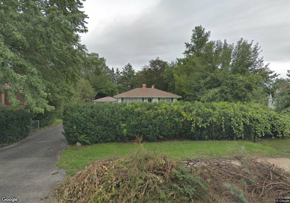
10220 Dickens Ave Melrose Park, IL 60164
Estimated Value: $285,887 - $319,000
3
Beds
1
Bath
1,278
Sq Ft
$234/Sq Ft
Est. Value
About This Home
This home is located at 10220 Dickens Ave, Melrose Park, IL 60164 and is currently estimated at $298,722, approximately $233 per square foot. 10220 Dickens Ave is a home located in Cook County with nearby schools including Scott Elementary School, Mannheim Middle School, and West Leyden High School.
Ownership History
Date
Name
Owned For
Owner Type
Purchase Details
Closed on
Jan 21, 1999
Sold by
Firstar Bank Illinois
Bought by
Toal Frank J
Current Estimated Value
Home Financials for this Owner
Home Financials are based on the most recent Mortgage that was taken out on this home.
Original Mortgage
$112,000
Outstanding Balance
$26,336
Interest Rate
6.92%
Mortgage Type
Stand Alone First
Estimated Equity
$272,386
Create a Home Valuation Report for This Property
The Home Valuation Report is an in-depth analysis detailing your home's value as well as a comparison with similar homes in the area
Home Values in the Area
Average Home Value in this Area
Purchase History
| Date | Buyer | Sale Price | Title Company |
|---|---|---|---|
| Toal Frank J | $140,000 | -- |
Source: Public Records
Mortgage History
| Date | Status | Borrower | Loan Amount |
|---|---|---|---|
| Open | Toal Frank J | $112,000 |
Source: Public Records
Tax History Compared to Growth
Tax History
| Year | Tax Paid | Tax Assessment Tax Assessment Total Assessment is a certain percentage of the fair market value that is determined by local assessors to be the total taxable value of land and additions on the property. | Land | Improvement |
|---|---|---|---|---|
| 2024 | $6,320 | $21,216 | $5,049 | $16,167 |
| 2023 | $6,197 | $24,000 | $5,049 | $18,951 |
| 2022 | $6,197 | $24,000 | $5,049 | $18,951 |
| 2021 | $4,014 | $14,572 | $3,927 | $10,645 |
| 2020 | $4,031 | $14,572 | $3,927 | $10,645 |
| 2019 | $4,221 | $16,448 | $3,927 | $12,521 |
| 2018 | $3,852 | $14,131 | $3,366 | $10,765 |
| 2017 | $3,850 | $14,131 | $3,366 | $10,765 |
| 2016 | $5,647 | $19,255 | $3,366 | $15,889 |
| 2015 | $4,564 | $15,395 | $3,085 | $12,310 |
| 2014 | $4,508 | $15,395 | $3,085 | $12,310 |
| 2013 | $4,863 | $17,128 | $3,085 | $14,043 |
Source: Public Records
Map
Nearby Homes
- 2118 Fairfield Ave
- 10213 W Lyndale Ave
- 10302 W Palmer Ave
- 10417 W Palmer Ave
- 10115 Belden Ave
- 3201 Armitage Ave
- 2520 Dora St
- 10510 W Fullerton Ave
- 10131 Nevada Ave
- 2003 Emerson Ave
- 9907 W Fullerton Ave
- 2038 Ruby St
- 3723 N Ruby St Unit 206N
- 330 Major Dr
- 2632 Westbrook Dr
- 10501 Schubert Ave
- 1818 N 39th Ave
- 250 Village Dr
- 248 E Lyndale Ave
- 1745 N 40th Ave
- 10208 Dickens Ave
- 10208 Dickens Ave
- 10224 Dickens Ave
- 10204 Dickens Ave
- 2120 Dora St
- 10228 Dickens Ave
- 2122 Dora St
- 10232 Dickens Ave
- 10217 Dickens Ave
- 10217 Dickens Ave
- 10227 W Palmer Ave
- 10146 Dickens Ave
- 2124 Dora St
- 10221 Dickens Ave
- 10231 W Palmer Ave
- 10240 Dickens Ave
- 10201 Dickens Ave
- 2119 Dora St
- 10227 Dickens Ave