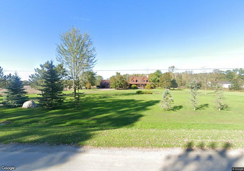
10222 Big Hand Rd Columbus, MI 48063
Estimated Value: $452,000 - $510,000
3
Beds
2
Baths
1,710
Sq Ft
$283/Sq Ft
Est. Value
About This Home
This home is located at 10222 Big Hand Rd, Columbus, MI 48063 and is currently estimated at $484,493, approximately $283 per square foot. 10222 Big Hand Rd is a home located in St. Clair County with nearby schools including Will L. Lee School, Richmond Middle School, and Richmond Community High School.
Ownership History
Date
Name
Owned For
Owner Type
Purchase Details
Closed on
Jun 7, 2021
Sold by
Ketelhut William C E and Ketelhut Susan M
Bought by
Ketelhut William C E and Ketelhut Susan M
Current Estimated Value
Purchase Details
Closed on
Nov 5, 2012
Sold by
Ketelhut William C E
Bought by
Ketelhut Susan M
Purchase Details
Closed on
Jul 21, 2006
Sold by
Fuller Richard P and Fuller Sandra A
Bought by
Ketelhut William C and Ketelhut Susan M
Home Financials for this Owner
Home Financials are based on the most recent Mortgage that was taken out on this home.
Original Mortgage
$256,000
Outstanding Balance
$153,069
Interest Rate
6.78%
Mortgage Type
New Conventional
Estimated Equity
$331,424
Create a Home Valuation Report for This Property
The Home Valuation Report is an in-depth analysis detailing your home's value as well as a comparison with similar homes in the area
Home Values in the Area
Average Home Value in this Area
Purchase History
| Date | Buyer | Sale Price | Title Company |
|---|---|---|---|
| Ketelhut William C E | -- | None Available | |
| Ketelhut Susan M | -- | None Available | |
| Ketelhut William C | $320,000 | Devon Title Agency |
Source: Public Records
Mortgage History
| Date | Status | Borrower | Loan Amount |
|---|---|---|---|
| Open | Ketelhut William C | $256,000 |
Source: Public Records
Tax History Compared to Growth
Tax History
| Year | Tax Paid | Tax Assessment Tax Assessment Total Assessment is a certain percentage of the fair market value that is determined by local assessors to be the total taxable value of land and additions on the property. | Land | Improvement |
|---|---|---|---|---|
| 2025 | $3,700 | $235,700 | $0 | $0 |
| 2024 | $2,318 | $214,400 | $0 | $0 |
| 2023 | $2,238 | $200,100 | $0 | $0 |
| 2022 | $3,385 | $177,000 | $0 | $0 |
| 2021 | $3,109 | $160,200 | $0 | $0 |
| 2020 | $3,109 | $153,000 | $153,000 | $0 |
| 2019 | $2,689 | $142,700 | $0 | $0 |
| 2018 | $2,648 | $124,300 | $0 | $0 |
| 2017 | $2,764 | $120,100 | $0 | $0 |
| 2016 | $2,048 | $120,100 | $0 | $0 |
| 2015 | -- | $103,300 | $103,300 | $0 |
| 2014 | -- | $100,700 | $100,700 | $0 |
| 2013 | -- | $100,200 | $0 | $0 |
Source: Public Records
Map
Nearby Homes
- 2043 Kronner Rd
- Lot C Stoddard Rd
- 36870 Hebel Rd
- 1675 Bauman Rd
- 0 Hebel Rd
- 1828 Withey Rd
- 0 00 Meskill Rd 4001 - 070 Parcel 8 & 1001-000 Rd Unit 50159561
- 0 00 Kroner Rd 4001 - 060 Parcel 7 Rd Unit 50159560
- 70550 N Main St
- 0000 Gratiot Ave
- 70372 N Main St
- 70276 N Main St
- 34950 Mourning Dove
- 0 00 Kroner Rd 4001 - 040 Parcel 5 Rd Unit 50159557
- 35930 Washington St
- 0 00 Kroner 4001 - 020 Parcel 3 Rd Unit 50159555
- 70794 Sunny Brook Ln Unit 7
- 69446 N Forest Ave
- 9202 Crawford Rd
- 0 00 Weber Rd 4001-100 Parcel 11 Rd
- 10334 Big Hand Rd
- 10234 Big Hand Rd
- 10175 Big Hand Rd
- 10201 Big Hand Rd
- 10350 Big Hand Rd
- 10350 Big Hand Rd
- 1920 Kronner Rd
- 1900 Kronner Rd
- 10420 Big Hand Rd
- 1880 Kronner Rd
- 10081 Big Hand Rd
- 2055 Kronner Rd Unit 2099
- 10442 Big Hand Rd
- 2125 Kronner Rd
- 10069 Big Hand Rd
- 10456 Big Hand Rd
- 10465 Big Hand Rd
- 10480 Big Hand Rd
- 2005 Stoddard Rd
- 7.8 acres Kronner Rd