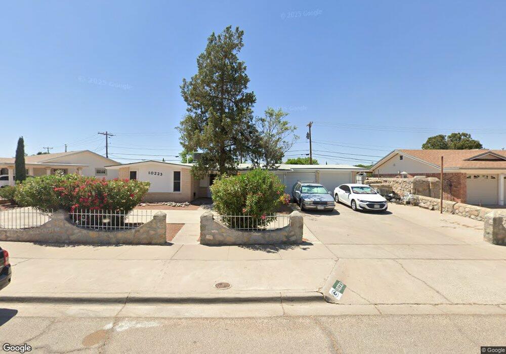
10223 Suez Dr El Paso, TX 79925
Eastwood NeighborhoodEstimated Value: $246,000 - $274,000
3
Beds
2
Baths
1,676
Sq Ft
$153/Sq Ft
Est. Value
About This Home
This home is located at 10223 Suez Dr, El Paso, TX 79925 and is currently estimated at $256,439, approximately $153 per square foot. 10223 Suez Dr is a home located in El Paso County with nearby schools including East Point Elementary School, Eastwood Middle School, and Eastwood High School.
Ownership History
Date
Name
Owned For
Owner Type
Purchase Details
Closed on
Mar 29, 2024
Sold by
Mcenroe Ann Marie
Bought by
Saldana Maria De La Luz Vi
Current Estimated Value
Purchase Details
Closed on
Oct 25, 2023
Sold by
Mcenroe Robert F
Bought by
Mcenroe Ann M
Purchase Details
Closed on
Jun 21, 2023
Sold by
Mcenroe Robert F
Bought by
Mcenroe Ann M
Purchase Details
Closed on
Jun 30, 2016
Sold by
Mcenroe Robert F
Bought by
Mcenroe Robert F and Mcenroe Dorothy A
Create a Home Valuation Report for This Property
The Home Valuation Report is an in-depth analysis detailing your home's value as well as a comparison with similar homes in the area
Home Values in the Area
Average Home Value in this Area
Purchase History
| Date | Buyer | Sale Price | Title Company |
|---|---|---|---|
| Saldana Maria De La Luz Vi | -- | None Listed On Document | |
| Mcenroe Ann M | -- | None Listed On Document | |
| Mcenroe Ann M | -- | None Listed On Document | |
| Mcenroe Robert F | -- | None Available |
Source: Public Records
Tax History Compared to Growth
Tax History
| Year | Tax Paid | Tax Assessment Tax Assessment Total Assessment is a certain percentage of the fair market value that is determined by local assessors to be the total taxable value of land and additions on the property. | Land | Improvement |
|---|---|---|---|---|
| 2025 | $6,005 | $237,290 | $53,496 | $183,794 |
| 2024 | $6,005 | $218,637 | $27,270 | $191,367 |
| 2023 | $6,015 | $206,669 | $27,270 | $179,399 |
| 2022 | $6,038 | $194,437 | $27,270 | $167,167 |
| 2021 | $5,072 | $156,032 | $27,270 | $128,762 |
| 2020 | $4,735 | $149,905 | $20,977 | $128,928 |
| 2018 | $4,671 | $150,207 | $20,977 | $129,230 |
| 2017 | $4,220 | $138,068 | $20,977 | $117,091 |
| 2016 | $4,220 | $138,068 | $20,977 | $117,091 |
| 2015 | $2,098 | $138,068 | $20,977 | $117,091 |
| 2014 | $2,098 | $137,475 | $20,977 | $116,498 |
Source: Public Records
Map
Nearby Homes
- 10140 Suez Dr
- 10145 Singapore Ave
- 3000 Woodall St
- 10232 Bayo Ave
- 3018 Wedgewood Dr
- 2412 Penwood Dr
- 10304 Blackwood Ave
- 10145 Camwood Dr
- 10301 Bayo Ave
- 9941 Debbie Dr
- 3020 Cork Dr
- 3028 Wedgewood Dr
- 9917 Honolulu Dr
- 3211 Drumond Rd
- 2912 Chaswood St
- 3202 Wedgewood Dr
- 3200 Cork Dr
- 10309 Woodruff Ct
- 2801 Brady Place
- 2701 Brady Place
- 10227 Suez Dr
- 10215 Suez Dr
- 10231 Suez Dr
- 10209 Suez Dr
- 10224 Suez Dr
- 10220 Suez Dr
- 10228 Suez Dr
- 10216 Suez Dr
- 10232 Suez Dr
- 10212 Suez Dr
- 10205 Suez Dr
- 10208 Suez Dr
- 10235 Sumatra St
- 10231 Sumatra St Unit ABE
- 10231 Sumatra St Unit 1
- 10239 Sumatra St
- 10225 Sumatra St
- 10201 Suez Dr
- 10243 Sumatra St
- 10204 Suez Dr