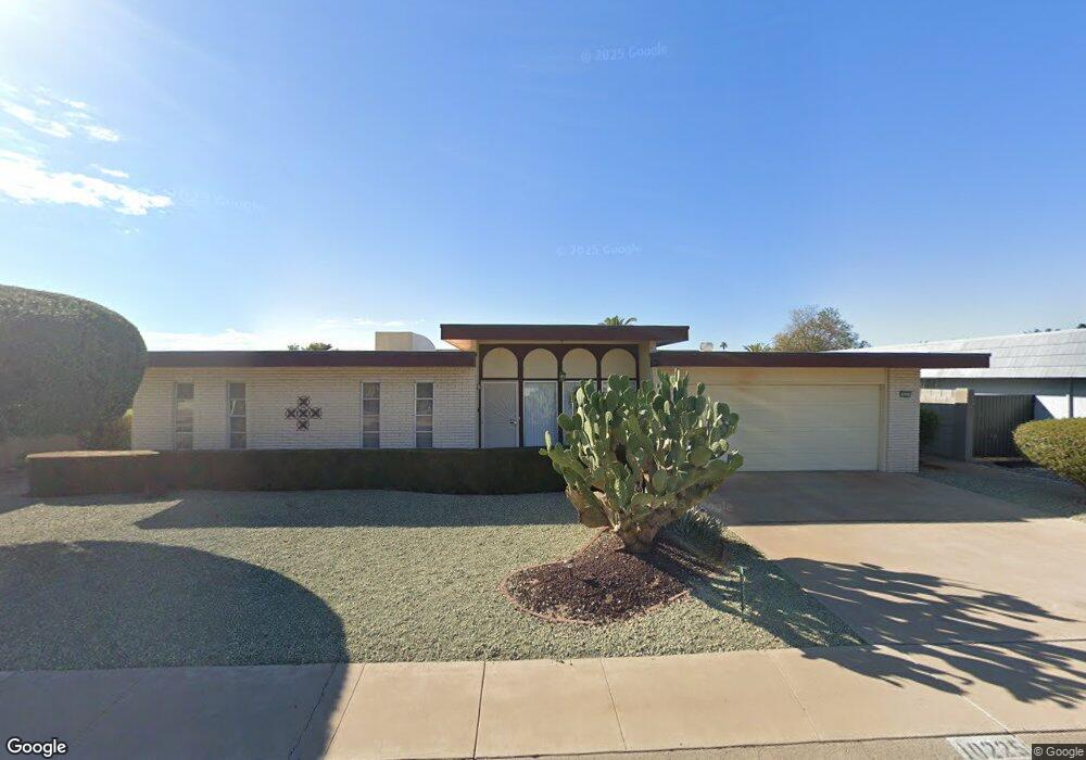
10225 W Brookside Dr Sun City, AZ 85351
Estimated Value: $291,527 - $368,000
--
Bed
2
Baths
1,955
Sq Ft
$174/Sq Ft
Est. Value
About This Home
This home is located at 10225 W Brookside Dr, Sun City, AZ 85351 and is currently estimated at $340,132, approximately $173 per square foot. 10225 W Brookside Dr is a home located in Maricopa County with nearby schools including Sonoran Science Academy-Peoria, Desert Mirage Elementary School, and Black Mountain Science Academy Montessori.
Ownership History
Date
Name
Owned For
Owner Type
Purchase Details
Closed on
Jun 14, 1999
Sold by
Kearney John P and Estate Of Janet F Kearney
Bought by
Gabrielson Charles T
Current Estimated Value
Home Financials for this Owner
Home Financials are based on the most recent Mortgage that was taken out on this home.
Original Mortgage
$75,200
Interest Rate
7.64%
Mortgage Type
New Conventional
Create a Home Valuation Report for This Property
The Home Valuation Report is an in-depth analysis detailing your home's value as well as a comparison with similar homes in the area
Home Values in the Area
Average Home Value in this Area
Purchase History
| Date | Buyer | Sale Price | Title Company |
|---|---|---|---|
| Gabrielson Charles T | $94,000 | Capital Title Agency |
Source: Public Records
Mortgage History
| Date | Status | Borrower | Loan Amount |
|---|---|---|---|
| Previous Owner | Gabrielson Charles T | $75,200 |
Source: Public Records
Tax History Compared to Growth
Tax History
| Year | Tax Paid | Tax Assessment Tax Assessment Total Assessment is a certain percentage of the fair market value that is determined by local assessors to be the total taxable value of land and additions on the property. | Land | Improvement |
|---|---|---|---|---|
| 2025 | $1,342 | $16,642 | -- | -- |
| 2024 | $1,339 | $15,849 | -- | -- |
| 2023 | $1,339 | $25,970 | $5,190 | $20,780 |
| 2022 | $1,258 | $20,470 | $4,090 | $16,380 |
| 2021 | $1,286 | $19,280 | $3,850 | $15,430 |
| 2020 | $1,254 | $17,150 | $3,430 | $13,720 |
| 2019 | $1,238 | $16,110 | $3,220 | $12,890 |
| 2018 | $1,194 | $14,750 | $2,950 | $11,800 |
| 2017 | $1,044 | $13,250 | $2,650 | $10,600 |
| 2016 | $553 | $12,560 | $2,510 | $10,050 |
| 2015 | $935 | $11,620 | $2,320 | $9,300 |
Source: Public Records
Map
Nearby Homes
- 10134 W Desert Rock Dr
- 10313 W Desert Rock Dr
- 10313 W Burns Dr
- 10329 W Gulf Hills Dr
- 10018 W Burns Dr
- 10202 W Edgewood Dr
- 9921 W Hutton Dr
- 10214 W Hutton Dr Unit 36
- 16202 N 106th Ave
- 10228 W Twin Oaks Dr
- 16802 N Boswell Blvd
- 16822 N Boswell Blvd
- 10511 W Edgewood Dr
- 10251 W Twin Oaks Dr
- 16801 N 103rd Ave
- 10319 W Twin Oaks Dr
- 16822 N 102nd Ave
- 10009 W Pleasant Valley Rd
- 10608 W Edgewood Dr
- 10210 W Charter Oak Dr
- 10219 W Brookside Dr
- 10231 W Brookside Dr
- 10226 W Sutters Gold Ln Unit 33
- 10232 W Sutters Gold Ln
- 10213 W Brookside Dr
- 10220 W Sutters Gold Ln
- 10237 W Brookside Dr
- 10220 W Brookside Dr
- 10238 W Sutters Gold Ln
- 10226 W Brookside Dr
- 10214 W Brookside Dr
- 10214 W Sutters Gold Ln Unit 31
- 10232 W Brookside Dr
- 10301 W Brookside Dr
- 10207 W Brookside Dr
- 10302 W Sutters Gold Ln
- 10208 W Brookside Dr
- 10208 W Sutters Gold Ln Unit 33
- 10302 W Brookside Dr
- 10231 W Sutters Gold Ln