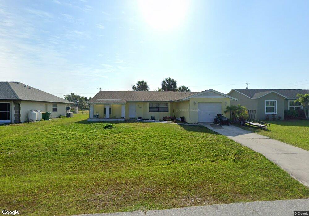
10229 Euston Ave Englewood, FL 34224
Englewood East NeighborhoodEstimated Value: $207,000 - $338,000
3
Beds
2
Baths
1,542
Sq Ft
$172/Sq Ft
Est. Value
About This Home
This home is located at 10229 Euston Ave, Englewood, FL 34224 and is currently estimated at $264,683, approximately $171 per square foot. 10229 Euston Ave is a home located in Charlotte County with nearby schools including Myakka River Elementary School, L.A. Ainger Middle School, and Lemon Bay High School.
Ownership History
Date
Name
Owned For
Owner Type
Purchase Details
Closed on
Jul 17, 2025
Sold by
Zammit Rosemarie
Bought by
Zammit Rosemarie and Hages Andrea Marie
Current Estimated Value
Purchase Details
Closed on
Mar 19, 2003
Sold by
Baggett James and Baggett Susan
Bought by
Zammit Rosemarie
Home Financials for this Owner
Home Financials are based on the most recent Mortgage that was taken out on this home.
Original Mortgage
$67,050
Interest Rate
5.62%
Mortgage Type
Purchase Money Mortgage
Create a Home Valuation Report for This Property
The Home Valuation Report is an in-depth analysis detailing your home's value as well as a comparison with similar homes in the area
Home Values in the Area
Average Home Value in this Area
Purchase History
| Date | Buyer | Sale Price | Title Company |
|---|---|---|---|
| Zammit Rosemarie | $100 | None Listed On Document | |
| Zammit Rosemarie | $77,100 | -- |
Source: Public Records
Mortgage History
| Date | Status | Borrower | Loan Amount |
|---|---|---|---|
| Previous Owner | Zammit Rosemarie | $67,050 |
Source: Public Records
Tax History
| Year | Tax Paid | Tax Assessment Tax Assessment Total Assessment is a certain percentage of the fair market value that is determined by local assessors to be the total taxable value of land and additions on the property. | Land | Improvement |
|---|---|---|---|---|
| 2025 | $3,976 | $219,714 | $15,300 | $204,414 |
| 2024 | $4,039 | $239,018 | $15,300 | $223,718 |
| 2023 | $4,039 | $169,222 | $0 | $0 |
| 2022 | $3,410 | $187,771 | $12,750 | $175,021 |
| 2021 | $3,156 | $158,322 | $5,100 | $153,222 |
| 2020 | $2,799 | $137,112 | $4,505 | $132,607 |
| 2019 | $2,636 | $136,794 | $4,505 | $132,289 |
| 2018 | $2,171 | $113,051 | $4,250 | $108,801 |
| 2017 | $2,008 | $99,204 | $4,250 | $94,954 |
| 2016 | $1,904 | $86,220 | $0 | $0 |
| 2015 | $1,827 | $78,382 | $0 | $0 |
| 2014 | $1,599 | $71,256 | $0 | $0 |
Source: Public Records
Map
Nearby Homes
- 10212 Willmington Blvd
- 10299 Willmington Blvd
- 10148 Alexandria Ave
- 10245 Euston Ave
- 6230 Berkeley St
- 10316 Grail Ave
- 10493 Grail Ave
- 6175 Cromwell St
- 10455 Huntington Ave
- 6191 Cavan St
- 10088 Willmington Blvd
- 10437 Grail Ave
- 6150 Alloway St
- 10430 Valerie Ave
- 10063 Willmington Blvd
- 6231 Rowe St
- 6377 Roberta Dr
- 10415 Woodland Ave
- 10245 Deerwood Ave
- 10487 Woodland Ave
- 10237 Euston Ave
- 10221 Euston Ave
- 6063 Almanac St
- 6071 Almanac St
- 10213 Euston Ave
- 6047 Almanac St
- 6079 Almanac St
- 6039 Almanac St
- 9503 Willmington Blvd
- 10290 Willmington Blvd
- 10290 Wilmington Blvd
- 10290 Grail Ave
- 10228 Willmington Blvd
- 10121 Willmington Blvd Unit 7
- 10121 Willmington Blvd
- 9321 Willmington Blvd
- 9545 Willmington Blvd
- 11279 Willmington Blvd
- 9203 Willmington Blvd
- 10316 Willmington Blvd
Your Personal Tour Guide
Ask me questions while you tour the home.