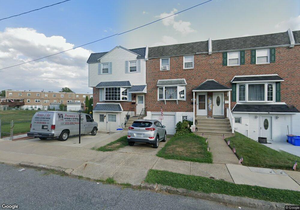
10229 Kilburn Rd Philadelphia, PA 19114
Northeast Philadelphia NeighborhoodEstimated Value: $307,969 - $339,000
3
Beds
1
Bath
1,518
Sq Ft
$212/Sq Ft
Est. Value
About This Home
This home is located at 10229 Kilburn Rd, Philadelphia, PA 19114 and is currently estimated at $322,242, approximately $212 per square foot. 10229 Kilburn Rd is a home located in Philadelphia County with nearby schools including A. L. Fitzpatrick School, George Washington High School, and Christ The King Elementary School.
Ownership History
Date
Name
Owned For
Owner Type
Purchase Details
Closed on
May 29, 2003
Sold by
Ault Judith A
Bought by
Foy Patrick and Regulski Christy
Current Estimated Value
Home Financials for this Owner
Home Financials are based on the most recent Mortgage that was taken out on this home.
Original Mortgage
$121,500
Outstanding Balance
$51,947
Interest Rate
5.45%
Mortgage Type
Purchase Money Mortgage
Estimated Equity
$270,295
Create a Home Valuation Report for This Property
The Home Valuation Report is an in-depth analysis detailing your home's value as well as a comparison with similar homes in the area
Home Values in the Area
Average Home Value in this Area
Purchase History
| Date | Buyer | Sale Price | Title Company |
|---|---|---|---|
| Foy Patrick | $135,000 | First American Title Ins Co |
Source: Public Records
Mortgage History
| Date | Status | Borrower | Loan Amount |
|---|---|---|---|
| Open | Foy Patrick | $121,500 |
Source: Public Records
Tax History Compared to Growth
Tax History
| Year | Tax Paid | Tax Assessment Tax Assessment Total Assessment is a certain percentage of the fair market value that is determined by local assessors to be the total taxable value of land and additions on the property. | Land | Improvement |
|---|---|---|---|---|
| 2025 | $3,624 | $323,700 | $64,740 | $258,960 |
| 2024 | $3,624 | $323,700 | $64,740 | $258,960 |
| 2023 | $3,624 | $258,900 | $51,780 | $207,120 |
| 2022 | $2,170 | $213,900 | $51,780 | $162,120 |
| 2021 | $2,800 | $0 | $0 | $0 |
| 2020 | $2,800 | $0 | $0 | $0 |
| 2019 | $2,636 | $0 | $0 | $0 |
| 2018 | $2,098 | $0 | $0 | $0 |
| 2017 | $2,518 | $0 | $0 | $0 |
| 2016 | $2,098 | $0 | $0 | $0 |
| 2015 | $2,009 | $0 | $0 | $0 |
| 2014 | -- | $179,900 | $62,471 | $117,429 |
| 2012 | -- | $21,952 | $4,623 | $17,329 |
Source: Public Records
Map
Nearby Homes
- 10210 W Keswick Rd
- 3225 Kilburn Rd
- 3326 Elliston Cir
- 3319 Morrell Ave
- 10012 Warfield Place
- 3300 Ashfield Ln
- 3239 Red Lion Rd
- 3237 Red Lion Rd
- 3212 Saxon Place
- 10730 Philcrest Rd
- 3202 Thornbrook Place
- 3411 Morrell Ave
- 9838 Legion St Unit 5
- 9838 Legion St Unit 7
- 9838 Legion St Unit 1
- 9838 Legion St Unit 4
- 3701 President St
- 10852 Rayland Rd
- 9817 Academy Rd Unit A
- 3559 Churchill Ln
- 10227 Kilburn Rd
- 10225 Kilburn Rd
- 10223 Kilburn Rd
- 10221 Kilburn Rd
- 10219 Kilburn Rd
- 10217 Kilburn Rd
- 10215 Kilburn Rd
- 10224 Kilburn Rd
- 10226 Kilburn Rd
- 10222 Kilburn Rd
- 10220 Kilburn Rd
- 10218 Kilburn Rd
- 10216 Kilburn Rd
- 10213 Kilburn Rd
- 3290 Cromwell Rd
- 10214 Kilburn Rd
- 10202 W Keswick Rd
- 10204 W Keswick Rd
- 10212 Kilburn Rd
- 3288 Cromwell Rd