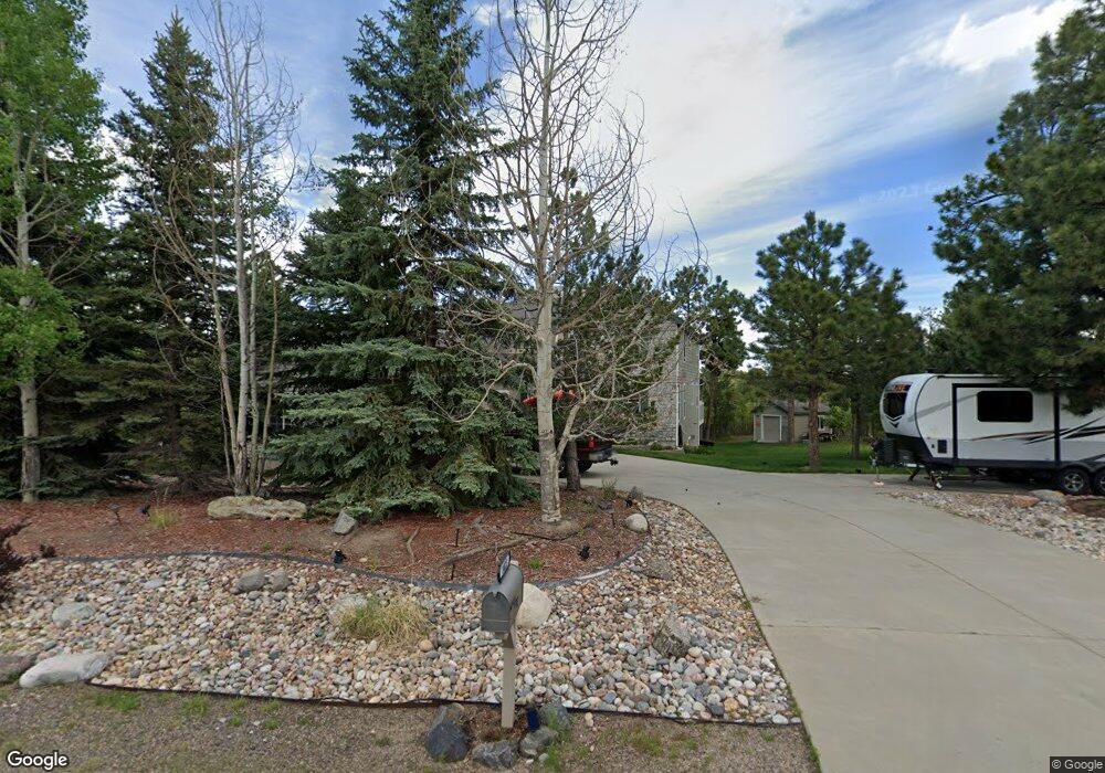
1023 Cottonwood Ln Larkspur, CO 80118
Estimated Value: $909,000 - $1,024,000
3
Beds
3
Baths
2,676
Sq Ft
$362/Sq Ft
Est. Value
About This Home
This home is located at 1023 Cottonwood Ln, Larkspur, CO 80118 and is currently estimated at $968,519, approximately $361 per square foot. 1023 Cottonwood Ln is a home located in Douglas County with nearby schools including Larkspur Elementary School, Castle Rock Middle School, and Castle View High School.
Ownership History
Date
Name
Owned For
Owner Type
Purchase Details
Closed on
Aug 15, 2002
Sold by
Stremick Construction Inc
Bought by
Stremick Paul and Stremick Julie
Current Estimated Value
Home Financials for this Owner
Home Financials are based on the most recent Mortgage that was taken out on this home.
Original Mortgage
$220,000
Outstanding Balance
$86,076
Interest Rate
5.5%
Mortgage Type
Unknown
Estimated Equity
$882,443
Purchase Details
Closed on
Jan 5, 2001
Sold by
Beatty Ruth R
Bought by
Stremick Construction Inc
Home Financials for this Owner
Home Financials are based on the most recent Mortgage that was taken out on this home.
Original Mortgage
$290,000
Interest Rate
7.63%
Purchase Details
Closed on
Jan 29, 1999
Sold by
Wade Daylon A and Wade Claris J
Bought by
Beatty Ruth R
Purchase Details
Closed on
Dec 12, 1979
Sold by
Unavailable
Bought by
Unavailable
Create a Home Valuation Report for This Property
The Home Valuation Report is an in-depth analysis detailing your home's value as well as a comparison with similar homes in the area
Home Values in the Area
Average Home Value in this Area
Purchase History
| Date | Buyer | Sale Price | Title Company |
|---|---|---|---|
| Stremick Paul | -- | North American Title | |
| Stremick Construction Inc | $77,500 | Land Title | |
| Beatty Ruth R | $35,500 | -- | |
| Unavailable | $6,600 | -- | |
| Wade Daylon A Wade Claris J | -- | -- |
Source: Public Records
Mortgage History
| Date | Status | Borrower | Loan Amount |
|---|---|---|---|
| Open | Stremick Paul | $220,000 | |
| Previous Owner | Stremick Construction Inc | $290,000 |
Source: Public Records
Tax History Compared to Growth
Tax History
| Year | Tax Paid | Tax Assessment Tax Assessment Total Assessment is a certain percentage of the fair market value that is determined by local assessors to be the total taxable value of land and additions on the property. | Land | Improvement |
|---|---|---|---|---|
| 2024 | $6,123 | $66,510 | $12,570 | $53,940 |
| 2023 | $6,184 | $66,510 | $12,570 | $53,940 |
| 2022 | $4,448 | $46,960 | $8,590 | $38,370 |
| 2021 | $4,605 | $46,960 | $8,590 | $38,370 |
| 2020 | $4,145 | $43,150 | $7,430 | $35,720 |
| 2019 | $4,159 | $43,150 | $7,430 | $35,720 |
| 2018 | $3,707 | $37,790 | $6,800 | $30,990 |
| 2017 | $3,484 | $37,790 | $6,800 | $30,990 |
| 2016 | $3,533 | $37,690 | $6,530 | $31,160 |
| 2015 | $3,455 | $37,690 | $6,530 | $31,160 |
| 2014 | $3,037 | $31,060 | $4,700 | $26,360 |
Source: Public Records
Map
Nearby Homes
- 0 E Cherry Creek Rd Unit 2541327
- 0 E Cherry Creek Rd Unit REC1786246
- 929 Tenderfoot Dr
- 7596 Rollins Dr
- 1065 Independence Dr
- 950 Tenderfoot Dr
- 1038 Tenderfoot Dr
- 1600 Independence Dr
- 1600 Independence Dr Unit 50
- 691 Cumberland Rd
- 670 Independence Dr
- 7737 Taylor Cir
- 7317 Fremont Place
- 7994 Monarch Rd
- 1025 Tenderfoot Dr
- 773 Copper Fox Place
- 682 Copper Fox Place
- 720 Copper Fox Place
- 1275 Fremont Dr
- 1210 Kenosha Dr
- 1055 Cottonwood Ln
- 991 Cottonwood Ln
- 1020 Cottonwood Ln
- 1010 Independence Dr
- 988 Independence Dr
- 7643 Vail Cir
- 994 Cottonwood Ln
- 1044 Cottonwood Ln
- 1085 Cottonwood Ln
- 1064 Cottonwood Ln
- 969 Cottonwood Ln
- 960 Independence Dr
- 976 Cottonwood Ln
- 7644 Vail Cir
- 7450 Shrine Rd
- 1001 Independence Dr
- 928 Independence Dr
- 7674 Vail Cir
- 995 Tenderfoot Dr
- 960 Cottonwood Ln