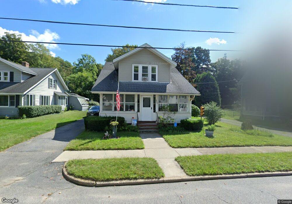
1023 Maple St Palmer, MA 01069
Estimated Value: $237,000 - $309,000
About This Home
This home is located at 1023 Maple St, Palmer, MA 01069 and is currently estimated at $272,700, approximately $270 per square foot. 1023 Maple St is a home located in Hampden County with nearby schools including Old Mill Pond Elementary School, Converse Middle School, and Palmer High School.
Ownership History
We collect this data history from publicly available records. To have your information removed, we recommend requesting removal directly through your county’s website.
Purchase Details
Purchase Details
Home Financials for this Owner
Home Financials are based on the most recent Mortgage that was taken out on this home.Home Values in the Area
Average Home Value in this Area
Purchase History
We collect this data history from publicly available records. To have your information removed, we recommend requesting removal directly through your county’s website.
| Date | Buyer | Sale Price | Title Company |
|---|---|---|---|
| -- | -- | ||
| -- | -- | ||
| $105,000 | -- | ||
| $105,000 | -- |
Mortgage History
We collect this data history from publicly available records. To have your information removed, we recommend requesting removal directly through your county’s website.
| Date | Status | Borrower | Loan Amount |
|---|---|---|---|
| Previous Owner | $84,000 | ||
| Previous Owner | $39,500 |
Tax History
We collect this data history from publicly available records. To have your information removed, we recommend requesting removal directly through your county’s website.
| Year | Tax Paid | Tax Assessment Tax Assessment Total Assessment is a certain percentage of the fair market value that is determined by local assessors to be the total taxable value of land and additions on the property. | Land | Improvement |
|---|---|---|---|---|
| 2025 | $3,390 | $186,800 | $52,700 | $134,100 |
| 2024 | $2,963 | $158,700 | $47,900 | $110,800 |
| 2023 | $2,897 | $149,000 | $47,900 | $101,100 |
| 2022 | $2,868 | $134,000 | $42,000 | $92,000 |
| 2021 | $2,826 | $124,900 | $46,600 | $78,300 |
| 2020 | $2,752 | $120,700 | $46,600 | $74,100 |
| 2019 | $2,672 | $120,700 | $46,600 | $74,100 |
| 2018 | $2,590 | $117,300 | $45,200 | $72,100 |
| 2017 | $2,530 | $117,300 | $45,200 | $72,100 |
| 2016 | $2,427 | $114,100 | $43,900 | $70,200 |
| 2015 | $2,354 | $114,100 | $43,900 | $70,200 |
Map
- 1030 School St
- 1061-1063 Pleasant St
- 1030 Pine St
- 1016 Chestnut St
- 48 Longview St
- 14 Brown St
- 2B Forest Hill Dr
- 0 St Unit 73414881
- 7,37,38 Thorndike and Lawrence St
- 3 Salem St
- 7 Caroline Cir
- Lot 8 Breckenridge St
- 44-50 Lawrence St
- 99 Longview St
- 1537 N Main St
- 5 Packard St
- 58 Randall St
- 1644-1646 N Main St
- 13 Orchard St
- 268 Palmer Rd Unit 7
- 1083 Central St Unit 1085
- 1079 Central St
- 7 Grove St
- 6 Grove St
- 2 Grove St
- 1080 Central St
- 1075 Central St
- 1072 Central St
- 1084 Central St
- 15 Grove St
- 1070 Central St
- 16 Grove St
- 1071 Central St Unit 1073
- 53 Walnut St
- 1018 Maple St Unit 1020
- 29 Grove St
- 1093 Central St Unit 1095
- 51 Walnut St
- 1064 Central St
- 18 Grove St
Ask me questions while you tour the home.