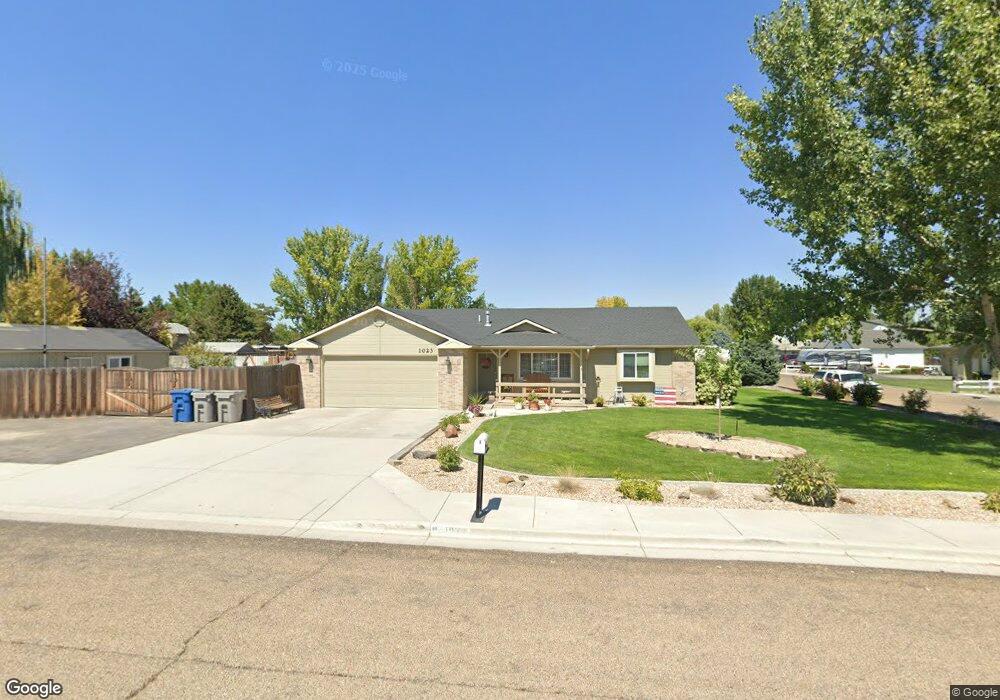
1023 Palrang Dr Caldwell, ID 83607
Caldwell AreaEstimated Value: $393,000 - $434,000
About This Home
This home is located at 1023 Palrang Dr, Caldwell, ID 83607 and is currently estimated at $415,931, approximately $240 per square foot. 1023 Palrang Dr is a home located in Canyon County with nearby schools including Lewis And Clark Elementary School, Syringa Middle School, and Caldwell Senior High School.
Ownership History
We collect this data history from publicly available records. To have your information removed, we recommend requesting removal directly through your county’s website.
Purchase Details
Home Financials for this Owner
Home Financials are based on the most recent Mortgage that was taken out on this home.Purchase Details
Home Financials for this Owner
Home Financials are based on the most recent Mortgage that was taken out on this home.Purchase Details
Purchase Details
Home Financials for this Owner
Home Financials are based on the most recent Mortgage that was taken out on this home.Purchase Details
Home Financials for this Owner
Home Financials are based on the most recent Mortgage that was taken out on this home.Purchase Details
Home Financials for this Owner
Home Financials are based on the most recent Mortgage that was taken out on this home.Home Values in the Area
Average Home Value in this Area
Purchase History
We collect this data history from publicly available records. To have your information removed, we recommend requesting removal directly through your county’s website.
| Date | Buyer | Sale Price | Title Company |
|---|---|---|---|
| -- | Amrock Llc | ||
| -- | None Listed On Document | ||
| -- | None Listed On Document | ||
| -- | Amrock Llc | ||
| -- | Amrock Inc | ||
| -- | Amrock | ||
| -- | None Available | ||
| -- | Pioneer Title Company Of Can | ||
| -- | Pioneer Title Company Of Can |
Mortgage History
We collect this data history from publicly available records. To have your information removed, we recommend requesting removal directly through your county’s website.
| Date | Status | Borrower | Loan Amount |
|---|---|---|---|
| Open | $126,000 | ||
| Previous Owner | $200,000 | ||
| Previous Owner | $113,950 | ||
| Previous Owner | $112,056 | ||
| Previous Owner | $116,500 | ||
| Previous Owner | $119,000 | ||
| Previous Owner | $99,120 |
Tax History
We collect this data history from publicly available records. To have your information removed, we recommend requesting removal directly through your county’s website.
| Year | Tax Paid | Tax Assessment Tax Assessment Total Assessment is a certain percentage of the fair market value that is determined by local assessors to be the total taxable value of land and additions on the property. | Land | Improvement |
|---|---|---|---|---|
| 2026 | $1,665 | $408,700 | $128,000 | $280,700 |
| 2025 | $1,514 | $417,500 | $128,000 | $289,500 |
| 2024 | $1,514 | $413,200 | $128,000 | $285,200 |
| 2023 | $1,547 | $405,700 | $128,000 | $277,700 |
| 2022 | $2,245 | $422,400 | $128,000 | $294,400 |
| 2021 | $2,253 | $307,300 | $75,000 | $232,300 |
| 2020 | $1,204 | $261,400 | $60,000 | $201,400 |
| 2019 | $2,231 | $237,200 | $52,000 | $185,200 |
| 2018 | $1,916 | $0 | $0 | $0 |
| 2017 | $1,669 | $0 | $0 | $0 |
| 2016 | $1,604 | $0 | $0 | $0 |
| 2015 | $1,439 | $0 | $0 | $0 |
| 2014 | $1,426 | $133,200 | $25,500 | $107,700 |
Map
- 719 Trailside Dr
- 1108 E Ustick Rd
- 4718 Great Falls Ave
- 4613 Great Falls Ave
- 3819 S Montana Ave
- 4416 Belethor Ave
- 1810 Windhelm St
- 4322 Belethor Ave
- 13546 Nisene Dr
- 15006 Snow Mountain Dr
- 13570 Nisene Dr
- 403 Appalachian St
- 4403 Belethor Ave
- 1822 Windhelm St
- 1902 Windhelm St
- 4322 Solitude Way
- 4318 Solitude Way
- 1916 Windhelm St
- 1924 Windhelm St
- 4412 Solitude Way
- 1024 Palrang Dr
- 1102 Palrang Dr
- 1020 Palrang Dr
- 1107 Empire Dr
- 1023 Empire Ct
- 1103 Empire Dr
- 1017 Empire Ct
- 1016 Palrang Dr
- 1108 Palrang Dr
- 1010 Palrang Dr
- 1116 Palrang Dr
- 4421 Washington Ave
- 1020 Empire Ct
- 1106 Empire Dr
- 1013 Empire Dr
- 1112 Empire Dr
- 1106 Empire Dr
- 1112 Empire Dr
- 4418 Washington Ave
- 1102 Empire Dr
Ask me questions while you tour the home.