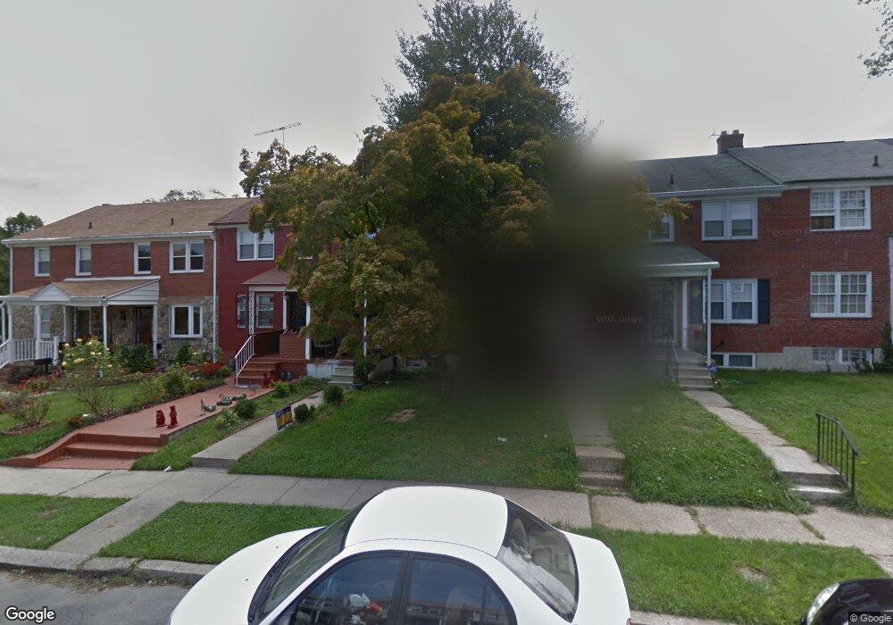
1023 Saint Dunstans Rd Baltimore, MD 21212
Cameron Village NeighborhoodEstimated Value: $156,000 - $170,375
Studio
2
Baths
1,008
Sq Ft
$162/Sq Ft
Est. Value
About This Home
This home is located at 1023 Saint Dunstans Rd, Baltimore, MD 21212 and is currently estimated at $163,188, approximately $161 per square foot. 1023 Saint Dunstans Rd is a home located in Baltimore City with nearby schools including Booker T. Washington Middle School, Reginald F. Lewis High School, and Paul Laurence Dunbar High School.
Ownership History
Date
Name
Owned For
Owner Type
Purchase Details
Closed on
May 21, 2007
Sold by
N.B.S. Inc.
Bought by
Jenkins Latoya S
Current Estimated Value
Home Financials for this Owner
Home Financials are based on the most recent Mortgage that was taken out on this home.
Original Mortgage
$5,000
Outstanding Balance
$3,048
Interest Rate
6.21%
Mortgage Type
Stand Alone Second
Estimated Equity
$160,140
Purchase Details
Closed on
Apr 26, 2007
Sold by
N.B.S. Inc.
Bought by
Jenkins Latoya S
Home Financials for this Owner
Home Financials are based on the most recent Mortgage that was taken out on this home.
Original Mortgage
$5,000
Outstanding Balance
$3,048
Interest Rate
6.21%
Mortgage Type
Stand Alone Second
Estimated Equity
$160,140
Purchase Details
Closed on
Jul 12, 1990
Sold by
Plakosh George E
Bought by
Nbsinc
Create a Home Valuation Report for This Property
The Home Valuation Report is an in-depth analysis detailing your home's value as well as a comparison with similar homes in the area
Home Values in the Area
Average Home Value in this Area
Purchase History
| Date | Buyer | Sale Price | Title Company |
|---|---|---|---|
| Jenkins Latoya S | $125,000 | -- | |
| Jenkins Latoya S | $125,000 | -- | |
| Nbsinc | $3,400 | -- |
Source: Public Records
Mortgage History
| Date | Status | Borrower | Loan Amount |
|---|---|---|---|
| Open | Jenkins Latoya S | $5,000 | |
| Open | Jenkins Latoya S | $120,750 | |
| Closed | Jenkins Latoya S | $5,000 | |
| Closed | Jenkins Latoya S | $120,750 |
Source: Public Records
Tax History
| Year | Tax Paid | Tax Assessment Tax Assessment Total Assessment is a certain percentage of the fair market value that is determined by local assessors to be the total taxable value of land and additions on the property. | Land | Improvement |
|---|---|---|---|---|
| 2025 | $2,059 | $116,133 | -- | -- |
| 2024 | $2,059 | $104,200 | $20,000 | $84,200 |
| 2023 | $1,967 | $101,633 | $0 | $0 |
| 2022 | $1,885 | $99,067 | $0 | $0 |
| 2021 | $2,277 | $96,500 | $20,000 | $76,500 |
| 2020 | $1,748 | $96,500 | $20,000 | $76,500 |
| 2019 | $1,667 | $96,500 | $20,000 | $76,500 |
| 2018 | $1,628 | $99,800 | $20,000 | $79,800 |
| 2017 | $1,580 | $93,267 | $0 | $0 |
| 2016 | $1,391 | $86,733 | $0 | $0 |
| 2015 | $1,391 | $80,200 | $0 | $0 |
| 2014 | $1,391 | $80,200 | $0 | $0 |
Source: Public Records
Map
Nearby Homes
- 1025 Witherspoon Rd
- 5638 Midwood Ave
- 1014 Upnor Rd
- 1027 Evesham Ave
- 1018 Cameron Rd
- 830 Saint Dunstans Rd
- 5516 Midwood Ave
- 912 Evesham Ave
- 1200 Woodbourne Ave
- 1101 Woodbourne Ave
- 1033 Marlau Dr
- 5320 The Alameda
- 608 Harwood Ave
- 5701 The Alameda
- 5315 Midwood Ave
- 810 E Belvedere Ave
- 837 Reverdy Rd
- 5914 Northwood Dr
- 1241 E Belvedere Ave
- 5302 Saint Georges Ave
- 1021 Saint Dunstans Rd
- 1025 Saint Dunstans Rd
- 1019 Saint Dunstans Rd
- 1027 Saint Dunstans Rd
- 1029 Saint Dunstans Rd
- 1017 Saint Dunstans Rd
- 1031 Saint Dunstans Rd
- 1015 Saint Dunstans Rd
- 1013 Saint Dunstans Rd
- 1020 Witherspoon Rd
- 1022 Witherspoon Rd
- 1016 Witherspoon Rd
- 1011 Saint Dunstans Rd
- 1018 Witherspoon Rd
- 1024 Witherspoon Rd
- 1026 Witherspoon Rd
- 1014 Witherspoon Rd
- 1028 Witherspoon Rd
- 1012 Witherspoon Rd
- 1009 Saint Dunstans Rd
Your Personal Tour Guide
Ask me questions while you tour the home.