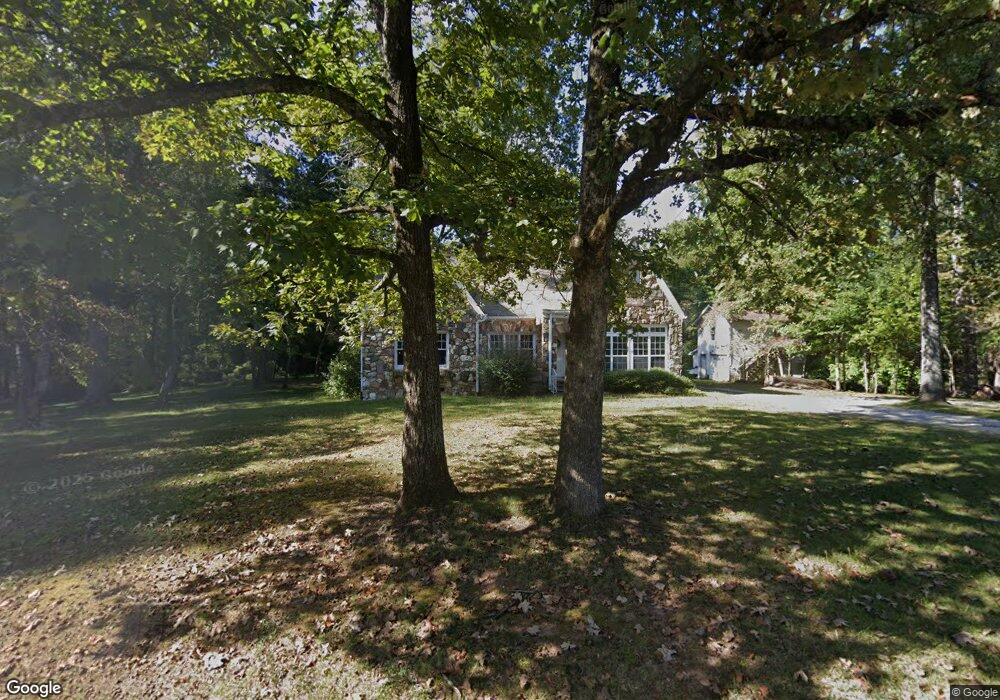
1023 Tallapoosa St W Bremen, GA 30110
Estimated Value: $265,403 - $347,000
3
Beds
2
Baths
2,223
Sq Ft
$135/Sq Ft
Est. Value
About This Home
This home is located at 1023 Tallapoosa St W, Bremen, GA 30110 and is currently estimated at $300,101, approximately $134 per square foot. 1023 Tallapoosa St W is a home located in Haralson County with nearby schools including Haralson County High School.
Ownership History
Date
Name
Owned For
Owner Type
Purchase Details
Closed on
Apr 2, 2018
Sold by
Alexander Martha C
Bought by
Luckey Erik A and Luckey Jennifer S
Current Estimated Value
Home Financials for this Owner
Home Financials are based on the most recent Mortgage that was taken out on this home.
Original Mortgage
$105,400
Outstanding Balance
$90,642
Interest Rate
4.44%
Mortgage Type
New Conventional
Estimated Equity
$209,459
Purchase Details
Closed on
Jun 30, 2005
Sold by
Luckey Angela S
Bought by
Alexander Martha C
Purchase Details
Closed on
Aug 25, 2004
Sold by
Luckey Angela S
Bought by
Alexander Martha C
Purchase Details
Closed on
Jul 23, 2004
Sold by
Mortgage Electronic Registration Systems
Bought by
Alexander Martha C
Create a Home Valuation Report for This Property
The Home Valuation Report is an in-depth analysis detailing your home's value as well as a comparison with similar homes in the area
Home Values in the Area
Average Home Value in this Area
Purchase History
| Date | Buyer | Sale Price | Title Company |
|---|---|---|---|
| Luckey Erik A | -- | -- | |
| Alexander Martha C | -- | -- | |
| Alexander Martha C | $149,400 | -- | |
| Alexander Martha C | -- | -- |
Source: Public Records
Mortgage History
| Date | Status | Borrower | Loan Amount |
|---|---|---|---|
| Open | Luckey Erik A | $105,400 |
Source: Public Records
Tax History Compared to Growth
Tax History
| Year | Tax Paid | Tax Assessment Tax Assessment Total Assessment is a certain percentage of the fair market value that is determined by local assessors to be the total taxable value of land and additions on the property. | Land | Improvement |
|---|---|---|---|---|
| 2024 | $1,880 | $60,406 | $5,088 | $55,318 |
| 2023 | $2,170 | $67,164 | $5,088 | $62,076 |
| 2022 | $1,577 | $53,819 | $5,088 | $48,731 |
| 2021 | $1,556 | $50,670 | $5,088 | $45,582 |
| 2020 | $1,613 | $52,476 | $5,088 | $47,388 |
| 2019 | $1,629 | $51,415 | $5,088 | $46,327 |
| 2018 | $756 | $25,477 | $5,088 | $20,389 |
| 2017 | $738 | $22,876 | $5,088 | $17,788 |
| 2016 | $1,136 | $39,064 | $5,088 | $33,976 |
| 2015 | $1,110 | $38,196 | $5,088 | $33,108 |
| 2014 | $1,156 | $40,308 | $7,200 | $33,108 |
Source: Public Records
Map
Nearby Homes
- 735 Tallapoosa St W
- 145 Wall St
- 67 Depot St
- 0 Mt Zion St Unit 7399245
- 0 Stonebridge Blvd Unit 143588
- 707 Mill Stone Way
- 6315 Highway 78
- 522 Atlantic Ave
- 273 Sewell Rd
- 0 Sewell Rd Unit 10624236
- 0 Sewell Rd Unit 7665305
- 101 Bush Creek Way
- 201 Stonebridge Blvd
- 319 Stonebridge Blvd
- 321 Stonebridge Blvd
- 327 Crest Pointe S
- 225 Edwards St
- 330 Kensington Cir
- 1021 Tallapoosa St W
- 991 Tallapoosa St W
- 1019 Tallapoosa St W
- 6061 U S Highway 78
- 6097 U S 78
- 6221 U S Highway 78
- 6033 U S Highway 78
- 6027 U S Highway 78
- 0 Atlantic Ave
- 0 Atlantic Ave Unit 8592791
- 0 Atlantic Ave Unit 7384040
- 0 Atlantic Ave Unit 7309069
- 0 Atlantic Ave Unit 3260727
- 0 Atlantic Ave Unit 9043768
- 0 Atlantic Ave Unit 9058108
- 0 Atlantic Ave Unit 6902607
- 0 Atlantic Ave Unit 9000702
- 0 Atlantic Ave Unit 8345703
- 0 Atlantic Ave Unit 8465929
- 0 Atlantic Ave Unit 8586938