Estimated Value: $284,000 - $324,000
4
Beds
3
Baths
2,216
Sq Ft
$135/Sq Ft
Est. Value
About This Home
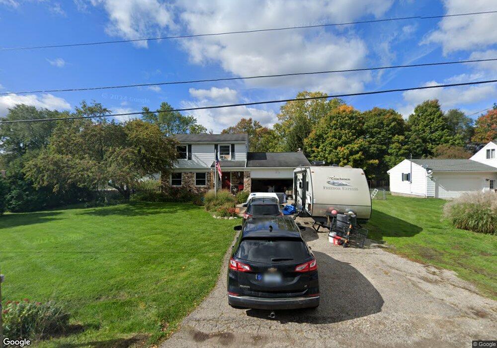
This home is located at 1023 Wentland Dr, Mason, MI 48854 and is currently estimated at $299,985, approximately $135 per square foot. 1023 Wentland Dr is a home located in Ingham County with nearby schools including Mason High School.
Ownership History
Date
Name
Owned For
Owner Type
Purchase Details
Closed on
Apr 16, 2004
Sold by
Armstrong William R and Armstrong Jeanne M
Bought by
Bryan Jeffrey M and Bryan Kimberly A
Current Estimated Value
Home Financials for this Owner
Home Financials are based on the most recent Mortgage that was taken out on this home.
Original Mortgage
$121,600
Interest Rate
6%
Mortgage Type
Purchase Money Mortgage
Purchase Details
Closed on
Jan 8, 1996
Sold by
Harbitz Linda A
Bought by
Armstrong William R and Armstrong Jeanne M
Create a Home Valuation Report for This Property
The Home Valuation Report is an in-depth analysis detailing your home's value as well as a comparison with similar homes in the area
Home Values in the Area
Average Home Value in this Area
Purchase History
| Date | Buyer | Sale Price | Title Company |
|---|---|---|---|
| Bryan Jeffrey M | $152,000 | Chicago | |
| Armstrong William R | $105,000 | -- |
Source: Public Records
Mortgage History
| Date | Status | Borrower | Loan Amount |
|---|---|---|---|
| Previous Owner | Bryan Jeffrey M | $121,600 |
Source: Public Records
Tax History Compared to Growth
Tax History
| Year | Tax Paid | Tax Assessment Tax Assessment Total Assessment is a certain percentage of the fair market value that is determined by local assessors to be the total taxable value of land and additions on the property. | Land | Improvement |
|---|---|---|---|---|
| 2025 | $5,440 | $130,900 | $22,700 | $108,200 |
| 2024 | $5,115 | $127,400 | $22,700 | $104,700 |
| 2023 | $5,115 | $113,500 | $18,100 | $95,400 |
| 2022 | $4,896 | $102,200 | $10,700 | $91,500 |
| 2021 | $4,380 | $98,500 | $10,000 | $88,500 |
| 2020 | $4,732 | $94,000 | $10,000 | $84,000 |
| 2019 | $3,786 | $88,900 | $10,000 | $78,900 |
| 2018 | $3,565 | $68,700 | $9,500 | $59,200 |
| 2017 | $2,946 | $68,700 | $9,500 | $59,200 |
| 2016 | $2,674 | $65,000 | $9,500 | $55,500 |
| 2015 | $2,712 | $60,200 | $19,000 | $41,200 |
| 2014 | $2,712 | $56,500 | $23,029 | $33,471 |
Source: Public Records
Map
Nearby Homes
- 968 N College Rd
- 1095 N College Rd
- 3630 Fernwood Ln Unit 20
- 3532 Fernwood Ln
- 3590 Beal Ln Unit 80
- 951 N Edgar Rd
- 3684 W Howell Rd
- 3564 Josephine Ln
- 671 Dart Rd
- 331 N College Rd
- 1028 Hagadorn Rd
- 1368 Yarrow Dr Unit 96
- 1566 Berkley Dr
- 1596 Berkley Dr
- 1554 Huntshire Dr
- 305 Oak Ridge St
- 4535 Harper Rd
- 0 Holt Rd
- 4344 Willesdon Ave
- 4526 Bison Dr
- 1035 Wentland Dr
- 3538 Harper Rd
- 3564 Harper Rd
- 1024 Wentland Dr
- 1047 Wentland Dr
- 1036 Wentland Dr
- 3534 Harper Rd
- 3580 Harper Rd
- 1046 Wentland Dr
- 1054 Wentland Dr
- 1063 Wentland Dr
- 3559 Harper Rd
- 3547 Harper Rd
- 3596 Harper Rd
- 1019 N College Rd
- 3575 Harper Rd
- 3535 Harper Rd
- 1064 Wentland Dr
- 1045 N College Rd