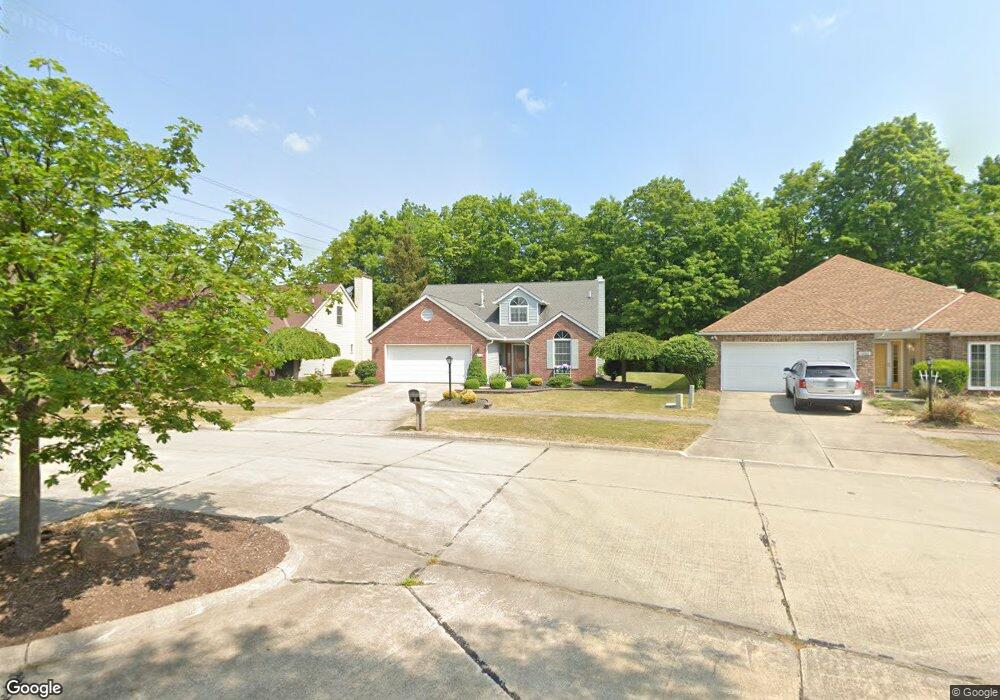
10233 Council Bluff Strongsville, OH 44136
Estimated Value: $344,000 - $363,000
3
Beds
3
Baths
1,971
Sq Ft
$180/Sq Ft
Est. Value
About This Home
This home is located at 10233 Council Bluff, Strongsville, OH 44136 and is currently estimated at $354,565, approximately $179 per square foot. 10233 Council Bluff is a home located in Cuyahoga County with nearby schools including Strongsville High School, Sts Joseph & John Interparochial School, and Royal Redeemer Lutheran School.
Ownership History
Date
Name
Owned For
Owner Type
Purchase Details
Closed on
Jan 27, 2025
Sold by
Thomas Daniel S
Bought by
Daniel S Thomas Trust and Thomas
Current Estimated Value
Purchase Details
Closed on
Nov 1, 1994
Sold by
Elbert Patrick J
Bought by
Thomas Daniel S and Thomas Carolee
Home Financials for this Owner
Home Financials are based on the most recent Mortgage that was taken out on this home.
Original Mortgage
$130,600
Interest Rate
5.2%
Mortgage Type
New Conventional
Purchase Details
Closed on
Jan 13, 1993
Bought by
Elbert Patrick J
Purchase Details
Closed on
Jan 1, 1991
Bought by
Bruscino Homes Corp
Create a Home Valuation Report for This Property
The Home Valuation Report is an in-depth analysis detailing your home's value as well as a comparison with similar homes in the area
Home Values in the Area
Average Home Value in this Area
Purchase History
| Date | Buyer | Sale Price | Title Company |
|---|---|---|---|
| Daniel S Thomas Trust | -- | None Listed On Document | |
| Thomas Daniel S | $154,000 | -- | |
| Elbert Patrick J | $137,800 | -- | |
| Bruscino Homes Corp | -- | -- |
Source: Public Records
Mortgage History
| Date | Status | Borrower | Loan Amount |
|---|---|---|---|
| Previous Owner | Thomas Daniel S | $130,600 |
Source: Public Records
Tax History Compared to Growth
Tax History
| Year | Tax Paid | Tax Assessment Tax Assessment Total Assessment is a certain percentage of the fair market value that is determined by local assessors to be the total taxable value of land and additions on the property. | Land | Improvement |
|---|---|---|---|---|
| 2024 | $4,661 | $109,060 | $21,945 | $87,115 |
| 2023 | $4,607 | $82,740 | $19,250 | $63,490 |
| 2022 | $4,599 | $82,740 | $19,250 | $63,490 |
| 2021 | $4,563 | $82,740 | $19,250 | $63,490 |
| 2020 | $4,362 | $71,330 | $16,590 | $54,740 |
| 2019 | $4,234 | $203,800 | $47,400 | $156,400 |
| 2018 | $3,843 | $71,330 | $16,590 | $54,740 |
| 2017 | $3,646 | $63,710 | $12,570 | $51,140 |
| 2016 | $3,616 | $63,710 | $12,570 | $51,140 |
| 2015 | $3,543 | $63,710 | $12,570 | $51,140 |
| 2014 | $3,543 | $61,850 | $12,220 | $49,630 |
Source: Public Records
Map
Nearby Homes
- 10369 Council Bluff
- 9945 Twelve Oaks Cir
- 16519 Albion Rd
- 9890 Webster Rd
- 10010 Chevy Chase
- 9129 Tahoe Cir
- 0 Webster Rd
- 11650 River Moss Rd
- 12101 The Bluffs
- 18433 Whitney Rd
- 18203 Broxton Dr
- 9531 Nicole Cir
- 14069 Basswood Cir
- 17945 Cliffside Dr
- 17809 Cliffside Dr Unit 4926
- 18336 Falling Water Rd
- 14298 Calderdale Ln
- 14584 Baywood Ln
- 14557 Baywood Ln
- 14644 Baywood Ln
- 10267 Council Bluff
- 10199 Council Bluff
- 10303 Council Bluff
- 10335 Council Bluff
- 10335 Council Bluff Unit 3
- 10274 Council Bluff
- 10220 Council Bluff
- 10220 Council Bluff Unit 8
- 10352 Council Bluff
- 10352 Council Bluff Unit 10
- 16336 N Laguardia Pkwy
- 10401 Council Bluff
- 10204 S Bexley Cir
- 16368 N Laguardia Pkwy
- 16278 N Laguardia Pkwy
- 16374 Logan Ct
- 10189 S Bexley Cir
- 16386 Logan Ct
- 16386 Logan Ct Unit 14
- 10172 S Bexley Cir