Estimated Value: $177,000 - $211,000
--
Bed
1
Bath
1,248
Sq Ft
$160/Sq Ft
Est. Value
About This Home
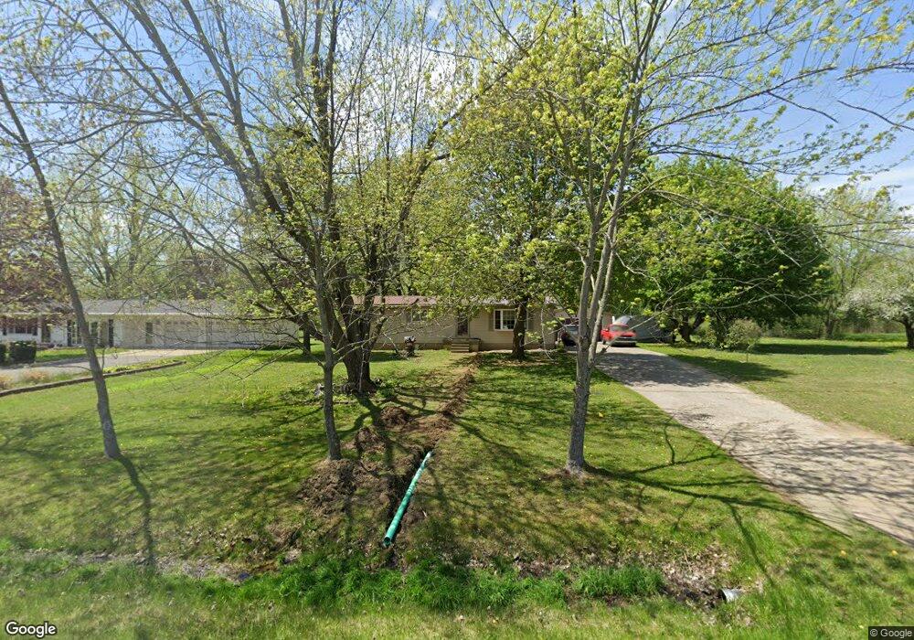
This home is located at 10233 N Jennings Rd, Clio, MI 48420 and is currently estimated at $199,408, approximately $159 per square foot. 10233 N Jennings Rd is a home located in Genesee County with nearby schools including George R. Carter Middle School and Clio Area High School.
Ownership History
Date
Name
Owned For
Owner Type
Purchase Details
Closed on
Aug 30, 2024
Sold by
Vanalst Dana R
Bought by
Vanalst Scott and Vanalst Dana
Current Estimated Value
Home Financials for this Owner
Home Financials are based on the most recent Mortgage that was taken out on this home.
Original Mortgage
$90,000
Outstanding Balance
$87,614
Interest Rate
6.78%
Mortgage Type
New Conventional
Estimated Equity
$111,794
Purchase Details
Closed on
Nov 18, 2004
Sold by
Bailey Robert D and Bailey Kathryn
Bought by
Bailey Wayne M
Home Financials for this Owner
Home Financials are based on the most recent Mortgage that was taken out on this home.
Original Mortgage
$52,000
Interest Rate
5.71%
Mortgage Type
New Conventional
Purchase Details
Closed on
Sep 26, 2003
Sold by
Bailey Alfus L
Bought by
Bailey Wayne M
Create a Home Valuation Report for This Property
The Home Valuation Report is an in-depth analysis detailing your home's value as well as a comparison with similar homes in the area
Home Values in the Area
Average Home Value in this Area
Purchase History
| Date | Buyer | Sale Price | Title Company |
|---|---|---|---|
| Vanalst Scott | -- | None Listed On Document | |
| Bailey Wayne M | -- | Guaranty Title Company | |
| Bailey Wayne M | -- | -- |
Source: Public Records
Mortgage History
| Date | Status | Borrower | Loan Amount |
|---|---|---|---|
| Open | Vanalst Scott | $90,000 | |
| Previous Owner | Bailey Wayne M | $52,000 |
Source: Public Records
Tax History Compared to Growth
Tax History
| Year | Tax Paid | Tax Assessment Tax Assessment Total Assessment is a certain percentage of the fair market value that is determined by local assessors to be the total taxable value of land and additions on the property. | Land | Improvement |
|---|---|---|---|---|
| 2025 | $2,942 | $95,900 | $0 | $0 |
| 2024 | $2,010 | $92,400 | $0 | $0 |
| 2023 | $1,917 | $77,900 | $0 | $0 |
| 2022 | $1,609 | $66,300 | $0 | $0 |
| 2021 | $1,589 | $59,600 | $0 | $0 |
| 2020 | $654 | $56,400 | $0 | $0 |
| 2019 | $585 | $50,800 | $0 | $0 |
| 2018 | $1,355 | $47,500 | $0 | $0 |
| 2017 | $1,294 | $47,500 | $0 | $0 |
| 2016 | $1,283 | $44,000 | $0 | $0 |
| 2015 | $1,272 | $41,700 | $0 | $0 |
| 2012 | -- | $38,600 | $38,600 | $0 |
Source: Public Records
Map
Nearby Homes
- 10414 Ataberry Dr
- 0 W Wilson Rd Unit 50180050
- 11102 Pheasant Run Dr
- 11209 Phyllis Dr
- Elements 2070 Plan at Pheasant Run
- 11159 Pheasant Run Dr
- Integrity 1610 Plan at Pheasant Run - Integrity
- Elements 1800 Plan at Pheasant Run
- Integrity 2061 V8.1a Plan at Pheasant Run - Integrity
- Integrity 1830 Plan at Pheasant Run - Integrity
- Elements 2700 Plan at Pheasant Run
- Elements 2090 Plan at Pheasant Run
- Elements 2200 Plan at Pheasant Run
- Integrity 2085 Plan at Pheasant Run - Integrity
- Integrity 1605 Plan at Pheasant Run - Integrity
- Integrity 1880 Plan at Pheasant Run - Integrity
- Integrity 2080 Plan at Pheasant Run - Integrity
- Integrity 2000 Plan at Pheasant Run - Integrity
- Integrity 2190 Plan at Pheasant Run - Integrity
- Integrity 1800 Plan at Pheasant Run - Integrity
- 10249 N Jennings Rd
- 10211 N Jennings Rd
- 10259 N Jennings Rd
- 10258 N Jennings Rd
- 10191 N Jennings Rd
- 10238 N Jennings Rd
- 10181 N Jennings Rd
- 10171 N Jennings Rd
- 10159 N Jennings Rd
- 10149 N Jennings Rd
- 10291 N Jennings Rd
- 10150 N Jennings Rd
- 10141 N Jennings Rd
- 10192 N Jennings Rd
- 10218 N Jennings Rd
- 10270 N Jennings Rd
- 10131 N Jennings Rd
- 10290 N Jennings Rd
- 10172 N Jennings Rd
- 10121 N Jennings Rd