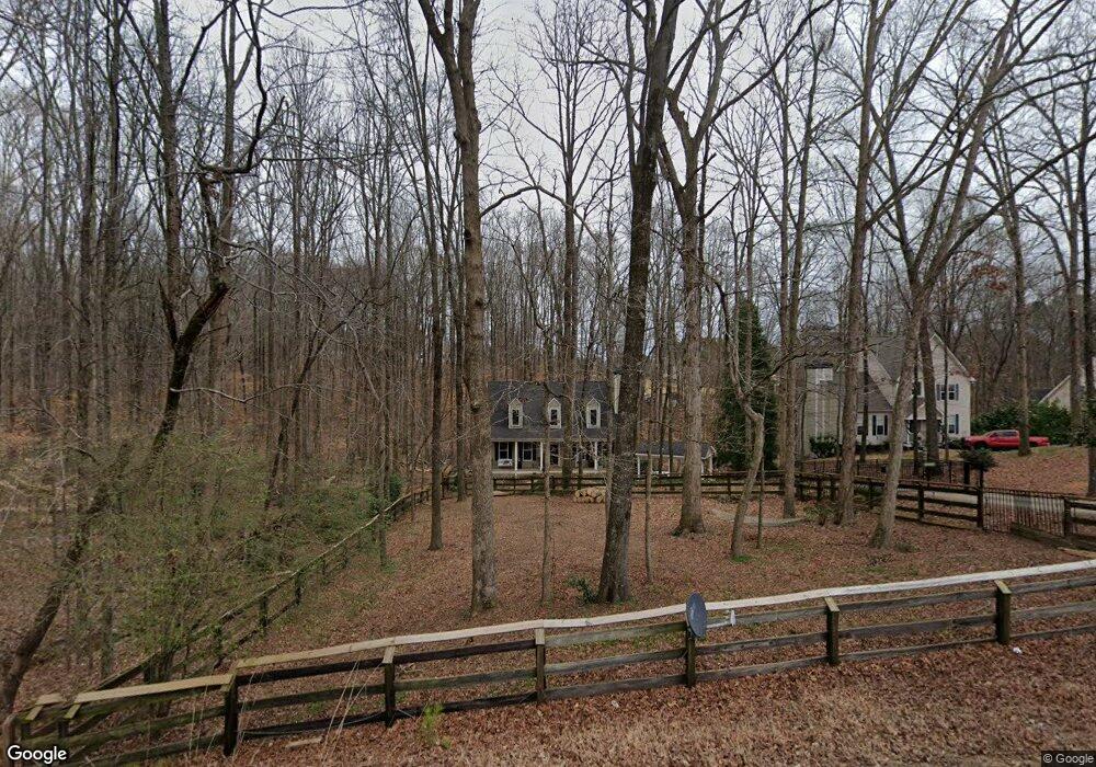
10235 Freehome Hwy Canton, GA 30115
Union Hill NeighborhoodEstimated Value: $411,000 - $448,893
3
Beds
4
Baths
2,244
Sq Ft
$192/Sq Ft
Est. Value
About This Home
This home is located at 10235 Freehome Hwy, Canton, GA 30115 and is currently estimated at $429,947, approximately $191 per square foot. 10235 Freehome Hwy is a home located in Cherokee County with nearby schools including Macedonia Elementary School, Creekland Middle School, and Creekview High School.
Ownership History
Date
Name
Owned For
Owner Type
Purchase Details
Closed on
Aug 14, 2015
Sold by
Freeborn Jason F
Bought by
Macksey Dennis W and Macksey Diana L
Current Estimated Value
Home Financials for this Owner
Home Financials are based on the most recent Mortgage that was taken out on this home.
Original Mortgage
$136,125
Outstanding Balance
$54,225
Interest Rate
4.16%
Mortgage Type
Commercial
Estimated Equity
$375,722
Purchase Details
Closed on
Feb 15, 2002
Sold by
Windwood Prop Inc
Bought by
Shirley Melanie M
Home Financials for this Owner
Home Financials are based on the most recent Mortgage that was taken out on this home.
Original Mortgage
$144,000
Interest Rate
6.81%
Mortgage Type
Stand Alone Second
Create a Home Valuation Report for This Property
The Home Valuation Report is an in-depth analysis detailing your home's value as well as a comparison with similar homes in the area
Home Values in the Area
Average Home Value in this Area
Purchase History
| Date | Buyer | Sale Price | Title Company |
|---|---|---|---|
| Macksey Dennis W | -- | -- | |
| Macksey Dennis W | $181,500 | -- | |
| Shirley Melanie M | $180,000 | -- |
Source: Public Records
Mortgage History
| Date | Status | Borrower | Loan Amount |
|---|---|---|---|
| Open | Macksey Dennis W | $136,125 | |
| Closed | Macksey Dennis W | $136,125 | |
| Previous Owner | Shirley Melanie M | $144,000 |
Source: Public Records
Tax History Compared to Growth
Tax History
| Year | Tax Paid | Tax Assessment Tax Assessment Total Assessment is a certain percentage of the fair market value that is determined by local assessors to be the total taxable value of land and additions on the property. | Land | Improvement |
|---|---|---|---|---|
| 2024 | $735 | $140,960 | $19,200 | $121,760 |
| 2023 | $815 | $153,620 | $19,200 | $134,420 |
| 2022 | $604 | $90,316 | $12,800 | $77,516 |
| 2021 | $619 | $81,376 | $12,800 | $68,576 |
| 2020 | $621 | $81,356 | $12,800 | $68,556 |
| 2019 | $593 | $73,880 | $10,880 | $63,000 |
| 2018 | $600 | $72,920 | $10,880 | $62,040 |
| 2017 | $1,973 | $179,900 | $10,880 | $61,080 |
| 2016 | $1,914 | $171,700 | $9,600 | $59,080 |
| 2015 | $1,696 | $150,000 | $9,600 | $50,400 |
| 2014 | $1,512 | $134,100 | $8,960 | $44,680 |
Source: Public Records
Map
Nearby Homes
- 10004 Freehome Hwy
- 2691 Trinity Church Rd
- 889 Freehome Rd
- 949 Freehome Rd
- 146 Henderson Farm Dr
- 995 Freehome Rd
- 122 Birmingham Walk
- 200 Red Gate Terrace
- 205 Brighten Ct
- 529 Claude Scott Rd
- 150 Trinity Farm Dr
- 17040 Birmingham Rd
- 12184 Cumming Hwy
- 65-A Pruitt Rd
- 65-B Pruitt Rd
- 351 Allendale Dr
- 152 Sherwood Ln
- 146 Sherwood Ln
- 146/148 Sherwood Ln
- 10265 Freehome Hwy
- 10006 Georgia 372
- 10281 Freehome Hwy
- 0 Freehome Hwy Unit 10265084
- 0 Freehome Hwy Unit 7350921
- 0 Freehome Hwy Unit 7445783
- 0 Freehome Hwy Unit 7309490
- 0 Freehome Hwy Unit 7124816
- 0 Freehome Hwy Unit 3289301
- 0 Freehome Hwy Unit 3180855
- 0 Freehome Hwy Unit 7319889
- 0 Freehome Hwy Unit 7217476
- 0 Freehome Hwy Unit 8692827
- 0 Freehome Hwy Unit 8455163
- 0 Freehome Hwy Unit 8122676
- 0 Freehome Hwy Unit 8228142
- 0 Freehome Hwy Unit 3241723
- 0 Freehome Hwy Unit 3217488
- 0 Freehome Hwy Unit 8027725
- 0 Freehome Hwy Unit 8000531