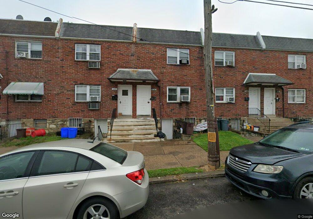
1024 E Sanger St Philadelphia, PA 19124
Frankford NeighborhoodEstimated Value: $230,000 - $267,224
2
Beds
2
Baths
1,536
Sq Ft
$158/Sq Ft
Est. Value
About This Home
This home is located at 1024 E Sanger St, Philadelphia, PA 19124 and is currently estimated at $242,741, approximately $158 per square foot. 1024 E Sanger St is a home located in Philadelphia County with nearby schools including Frankford High School, The Philadelphia Charter School for the Arts & Sciences, and Northwood Academy Charter School.
Ownership History
Date
Name
Owned For
Owner Type
Purchase Details
Closed on
Feb 15, 2008
Sold by
Dhan Philip Mita and Dhan Philip
Bought by
Guerrero Salvador E and Guerrero Maria C
Current Estimated Value
Purchase Details
Closed on
Jul 11, 2005
Sold by
Mccullough Dolores
Bought by
Dhan Philip Mita and Dhan Philip
Home Financials for this Owner
Home Financials are based on the most recent Mortgage that was taken out on this home.
Original Mortgage
$65,500
Interest Rate
5.59%
Mortgage Type
Commercial
Create a Home Valuation Report for This Property
The Home Valuation Report is an in-depth analysis detailing your home's value as well as a comparison with similar homes in the area
Home Values in the Area
Average Home Value in this Area
Purchase History
| Date | Buyer | Sale Price | Title Company |
|---|---|---|---|
| Guerrero Salvador E | $124,000 | None Available | |
| Dhan Philip Mita | $82,000 | -- |
Source: Public Records
Mortgage History
| Date | Status | Borrower | Loan Amount |
|---|---|---|---|
| Previous Owner | Dhan Philip Mita | $65,500 |
Source: Public Records
Tax History Compared to Growth
Tax History
| Year | Tax Paid | Tax Assessment Tax Assessment Total Assessment is a certain percentage of the fair market value that is determined by local assessors to be the total taxable value of land and additions on the property. | Land | Improvement |
|---|---|---|---|---|
| 2026 | $2,935 | $260,700 | $52,140 | $208,560 |
| 2025 | $2,935 | $260,700 | $52,140 | $208,560 |
| 2024 | $2,935 | $260,700 | $52,140 | $208,560 |
| 2023 | $2,935 | $209,700 | $41,940 | $167,760 |
| 2022 | $2,935 | $209,700 | $41,940 | $167,760 |
| 2021 | $1,674 | $0 | $0 | $0 |
| 2020 | $1,674 | $0 | $0 | $0 |
| 2019 | $1,607 | $0 | $0 | $0 |
| 2018 | $1,512 | $0 | $0 | $0 |
| 2017 | $1,512 | $0 | $0 | $0 |
| 2016 | $1,512 | $0 | $0 | $0 |
| 2015 | $1,447 | $0 | $0 | $0 |
| 2014 | -- | $108,000 | $21,190 | $86,810 |
| 2012 | -- | $18,752 | $1,839 | $16,913 |
Source: Public Records
Map
Nearby Homes
- 1431 Rosalie St
- 1137 Bridge St
- 1209 E Sanger St
- 1048 Bridge St
- 5902 E Roosevelt Blvd
- 5661 Miriam Rd
- 5659 Miriam Rd
- 5347 Sylvester St
- 1244 E Sanger St
- 7753 E Roosevelt Blvd
- 996 Anchor St
- 7600 E Roosevelt Blvd Unit 206
- 7600 E Roosevelt Blvd Unit 212
- 7600 E Roosevelt Blvd Unit 909
- 7600 E Roosevelt Blvd Unit 705
- 7600 E Roosevelt Blvd Unit 701
- 7600 E Roosevelt Blvd Unit 806
- 7600 E Roosevelt Blvd Unit 904
- 7600 E Roosevelt Blvd Unit 604
- 6632 E Roosevelt Blvd
- 1026 E Sanger St
- 1022 E Sanger St
- 1028 E Sanger St
- 1020 E Sanger St
- 1030 E Sanger St
- 1032 E Sanger St
- 1034 E Sanger St
- 5355 Oxford Ave Unit B
- 5355 Oxford Ave Unit A
- 5355 Oxford Ave
- 5353 Oxford Ave
- 5359 Oxford Ave
- 5401 Rutland St
- 5349 Oxford Ave
- 5350 Large St
- 5356 Large St
- 5354 Large St
- 5352 Large St
- 5358 Large St
- 5360 Large St