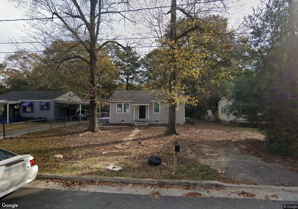
1024 Harbison Dr Columbus, GA 31903
South Columbus NeighborhoodEstimated Value: $49,000 - $75,000
2
Beds
2
Baths
858
Sq Ft
$70/Sq Ft
Est. Value
About This Home
This home is located at 1024 Harbison Dr, Columbus, GA 31903 and is currently estimated at $59,667, approximately $69 per square foot. 1024 Harbison Dr is a home located in Muscogee County with nearby schools including Dorothy Height Elementary School, Baker Middle School, and Spencer High School.
Ownership History
Date
Name
Owned For
Owner Type
Purchase Details
Closed on
Aug 15, 2025
Sold by
Plex Cvr Llc
Bought by
Plex Col De 03 Llc
Current Estimated Value
Home Financials for this Owner
Home Financials are based on the most recent Mortgage that was taken out on this home.
Original Mortgage
$731,500
Outstanding Balance
$721,195
Interest Rate
6.67%
Mortgage Type
New Conventional
Estimated Equity
-$661,528
Purchase Details
Closed on
Jan 8, 2025
Sold by
Plex Capital Investors Llc
Bought by
Plex Cvr Llc
Home Financials for this Owner
Home Financials are based on the most recent Mortgage that was taken out on this home.
Original Mortgage
$5,000,000
Interest Rate
6.6%
Mortgage Type
Construction
Purchase Details
Closed on
Sep 12, 2024
Sold by
Lotz George W
Bought by
Plex Capital Investors Llc
Purchase Details
Closed on
Jul 18, 2019
Sold by
Lotz Streetman Nancy
Bought by
Lotz George W
Create a Home Valuation Report for This Property
The Home Valuation Report is an in-depth analysis detailing your home's value as well as a comparison with similar homes in the area
Home Values in the Area
Average Home Value in this Area
Purchase History
| Date | Buyer | Sale Price | Title Company |
|---|---|---|---|
| Plex Col De 03 Llc | -- | None Listed On Document | |
| Plex Cvr Llc | -- | None Listed On Document | |
| Plex Capital Investors Llc | $75,000 | None Listed On Document | |
| Lotz George W | -- | -- |
Source: Public Records
Mortgage History
| Date | Status | Borrower | Loan Amount |
|---|---|---|---|
| Open | Plex Col De 03 Llc | $731,500 | |
| Previous Owner | Plex Cvr Llc | $5,000,000 |
Source: Public Records
Tax History
| Year | Tax Paid | Tax Assessment Tax Assessment Total Assessment is a certain percentage of the fair market value that is determined by local assessors to be the total taxable value of land and additions on the property. | Land | Improvement |
|---|---|---|---|---|
| 2025 | $822 | $21,000 | $3,956 | $17,044 |
| 2024 | $330 | $8,424 | $3,368 | $5,056 |
| 2023 | $332 | $8,424 | $3,368 | $5,056 |
| 2022 | $292 | $7,160 | $3,368 | $3,792 |
| 2021 | $277 | $6,788 | $3,368 | $3,420 |
| 2020 | $277 | $6,788 | $3,368 | $3,420 |
| 2019 | $278 | $6,788 | $3,368 | $3,420 |
| 2018 | $333 | $9,556 | $3,368 | $6,188 |
| 2017 | $393 | $9,556 | $3,368 | $6,188 |
| 2016 | $386 | $9,369 | $1,800 | $7,569 |
| 2015 | $387 | $9,369 | $1,800 | $7,569 |
| 2014 | $387 | $9,369 | $1,800 | $7,569 |
| 2013 | -- | $9,369 | $1,800 | $7,569 |
Source: Public Records
Map
Nearby Homes
- 1013 Harbison Dr
- 920 Brooks Rd
- 1103 Calvin Ave
- 1049 Winston Rd
- 1120 Calvin Ave
- 824 Winston Rd
- 1055 Benning Dr
- 917 Fletcher Ave
- 1025 Fletcher Ave
- 716 Benning Dr
- 3711 Youmans St
- 270 32nd Ave
- 307 32nd Ave
- 3110 Victory Dr
- 3110 Victory Dr Unit 2036
- 2916 Lee St
- 338 31st Ave
- 3016 Dawson St
- 2731 Lumpkin Ct
- 3935 Evergreen St
- 1018 Harbison Dr
- 1030 Harbison Dr
- 1014 Harbison Dr
- 1034 Harbison Dr
- 1025 Brooks Rd
- 1019 Brooks Rd
- 1031 Brooks Rd
- 1010 Harbison Dr
- 1040 Harbison Dr
- 1013 Brooks Rd
- 1035 Brooks Rd
- 1023 Harbison Dr
- 1017 Harbison Dr
- 1029 Harbison Dr
- 1031 Harbison Dr
- 1039 Brooks Rd
- 1009 Brooks Rd
- 1044 Harbison Dr
- 3110 Clay St
- 1004 Harbison Dr
Your Personal Tour Guide
Ask me questions while you tour the home.