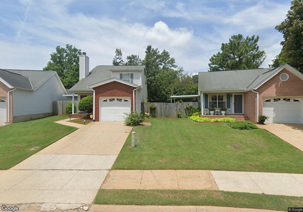
1024 Mockingbird Ln Northport, AL 35476
Estimated Value: $222,325 - $254,000
2
Beds
1
Bath
1,314
Sq Ft
$180/Sq Ft
Est. Value
About This Home
This home is located at 1024 Mockingbird Ln, Northport, AL 35476 and is currently estimated at $236,081, approximately $179 per square foot. 1024 Mockingbird Ln is a home located in Tuscaloosa County with nearby schools including Englewood Elementary School, Hillcrest Middle School, and Hillcrest High School.
Ownership History
Date
Name
Owned For
Owner Type
Purchase Details
Closed on
Jan 30, 2015
Sold by
Pruitt Sherry J
Bought by
Latopolski Keely
Current Estimated Value
Home Financials for this Owner
Home Financials are based on the most recent Mortgage that was taken out on this home.
Original Mortgage
$115,000
Outstanding Balance
$88,470
Interest Rate
3.88%
Mortgage Type
New Conventional
Estimated Equity
$147,611
Purchase Details
Closed on
May 5, 2010
Sold by
Gw Enterprises Llc
Bought by
Pruitt Sherry J
Home Financials for this Owner
Home Financials are based on the most recent Mortgage that was taken out on this home.
Original Mortgage
$116,800
Interest Rate
4.34%
Purchase Details
Closed on
Dec 10, 2009
Sold by
Gibbs Johnie Elizabeth Eta
Bought by
Gw Enterprises Llc
Create a Home Valuation Report for This Property
The Home Valuation Report is an in-depth analysis detailing your home's value as well as a comparison with similar homes in the area
Home Values in the Area
Average Home Value in this Area
Purchase History
| Date | Buyer | Sale Price | Title Company |
|---|---|---|---|
| Latopolski Keely | $154,000 | -- | |
| Pruitt Sherry J | $146,300 | -- | |
| Gw Enterprises Llc | $85,000 | -- |
Source: Public Records
Mortgage History
| Date | Status | Borrower | Loan Amount |
|---|---|---|---|
| Open | Latopolski Keely | $115,000 | |
| Previous Owner | Gw Enterprises Llc | $116,800 |
Source: Public Records
Tax History Compared to Growth
Tax History
| Year | Tax Paid | Tax Assessment Tax Assessment Total Assessment is a certain percentage of the fair market value that is determined by local assessors to be the total taxable value of land and additions on the property. | Land | Improvement |
|---|---|---|---|---|
| 2024 | $470 | $26,860 | $3,780 | $23,080 |
| 2023 | $470 | $26,860 | $3,780 | $23,080 |
| 2022 | $471 | $26,880 | $3,780 | $23,100 |
| 2021 | $487 | $27,700 | $3,780 | $23,920 |
| 2020 | $433 | $12,480 | $1,890 | $10,590 |
| 2019 | $433 | $12,480 | $1,890 | $10,590 |
| 2018 | $433 | $12,480 | $1,890 | $10,590 |
| 2017 | $507 | $0 | $0 | $0 |
| 2016 | $506 | $0 | $0 | $0 |
| 2015 | $1,105 | $0 | $0 | $0 |
| 2014 | -- | $28,700 | $3,780 | $24,920 |
Source: Public Records
Map
Nearby Homes
- 1023 Mockingbird Ln
- 2161 Fox Ridge Rd
- 2205 18th Ave
- 2103 18th Ave
- 115 Brookside Dr
- 3801 Blackberry Ln
- 3809 Blackberry Ln
- 2421 21st Ave
- 1711 17th St
- 1332 Independence Dr
- 2301 22nd Ave
- 2203 22nd Ave
- 1514 17th Ave
- 2105 22nd Ave
- 1738 Hollow Ln
- 600 Innsbruck Ct
- 2805 Mayfield Way
- 3904 Blackberry Ln
- 555 Dollar Rd
- 1711 St Andrews Dr
- 1028 Mockingbird Ln
- 1020 Mockingbird Ln
- 1016 Mockingbird Ln
- 1033 Windsong Dr
- 1029 Windsong Dr
- 2713 Swallow Ln
- 1032 Mockingbird Ln
- 2709 Swallow Ln
- 2717 Swallow Ln
- 2705 Swallow Ln
- 1025 Windsong Dr
- 1012 Mockingbird Ln
- 2721 Swallow Ln
- 1021 Windsong Dr
- 2627 Swallow Ln
- 2601 Swallow Ln
- 1017 Windsong Dr
- 1015 Mockingbird Ln
- 1008 Mockingbird Ln
- 2623 Swallow Ln