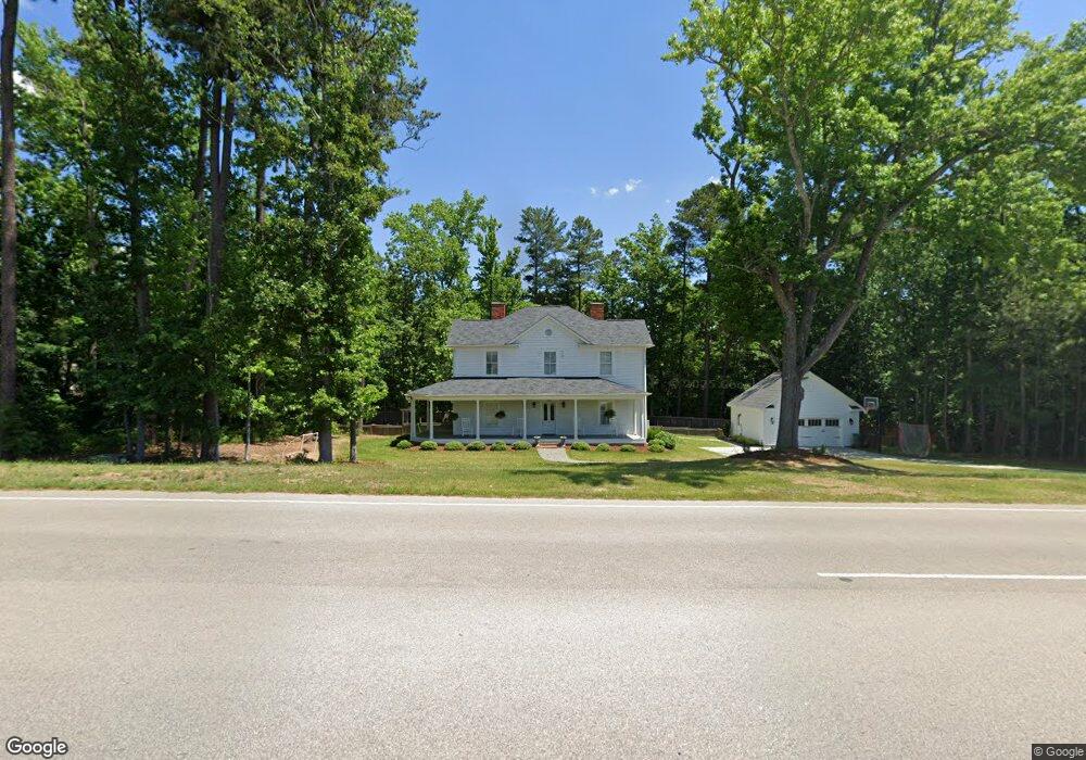
1024 Waldo Rood Blvd Cary, NC 27519
West Cary NeighborhoodEstimated Value: $557,000 - $834,000
3
Beds
1
Bath
2,702
Sq Ft
$267/Sq Ft
Est. Value
About This Home
This home is located at 1024 Waldo Rood Blvd, Cary, NC 27519 and is currently estimated at $721,391, approximately $266 per square foot. 1024 Waldo Rood Blvd is a home located in Wake County with nearby schools including Davis Drive Elementary, Davis Drive Middle, and Green Hope High.
Ownership History
Date
Name
Owned For
Owner Type
Purchase Details
Closed on
Jul 20, 2015
Sold by
Capital Area Preservation Inc
Bought by
Mcleod Terrence Kent and Mcleod Whitney Dunlap
Current Estimated Value
Home Financials for this Owner
Home Financials are based on the most recent Mortgage that was taken out on this home.
Original Mortgage
$486,400
Outstanding Balance
$381,374
Interest Rate
4.02%
Mortgage Type
Construction
Estimated Equity
$340,017
Purchase Details
Closed on
Feb 28, 2013
Sold by
Standard Pacific Of The Carolinas Llc
Bought by
Capital Area Preesercation Inc
Create a Home Valuation Report for This Property
The Home Valuation Report is an in-depth analysis detailing your home's value as well as a comparison with similar homes in the area
Home Values in the Area
Average Home Value in this Area
Purchase History
| Date | Buyer | Sale Price | Title Company |
|---|---|---|---|
| Mcleod Terrence Kent | $175,000 | Attorney | |
| Capital Area Preesercation Inc | -- | None Available | |
| Standard Pacific Of The Carolinas Llc | $190,000 | None Available |
Source: Public Records
Mortgage History
| Date | Status | Borrower | Loan Amount |
|---|---|---|---|
| Open | Mcleod Terrence Kent | $486,400 |
Source: Public Records
Tax History Compared to Growth
Tax History
| Year | Tax Paid | Tax Assessment Tax Assessment Total Assessment is a certain percentage of the fair market value that is determined by local assessors to be the total taxable value of land and additions on the property. | Land | Improvement |
|---|---|---|---|---|
| 2025 | $4,697 | $545,644 | $205,920 | $339,724 |
| 2024 | $4,595 | $545,644 | $205,920 | $339,724 |
| 2023 | $3,837 | $380,923 | $148,080 | $232,843 |
| 2022 | $3,694 | $380,923 | $148,080 | $232,843 |
| 2021 | $3,620 | $380,923 | $148,080 | $232,843 |
| 2020 | $3,639 | $380,923 | $148,080 | $232,843 |
| 2019 | $3,285 | $304,938 | $127,160 | $177,778 |
| 2018 | $3,011 | $289,056 | $127,160 | $161,896 |
| 2017 | $2,809 | $289,056 | $127,160 | $161,896 |
| 2016 | $1,258 | $178,812 | $127,160 | $51,652 |
| 2015 | -- | $206,932 | $135,360 | $71,572 |
| 2014 | -- | $135,360 | $135,360 | $0 |
Source: Public Records
Map
Nearby Homes
- 324 Farrow Glen Loop
- 722 Mcrae Rd
- 467 Methven Grove Dr
- 111 Gingergate Dr
- 140 Sunstone Dr
- 128 Wheatsbury Dr
- 104 Pellinore Ct
- 105 Swordgate Dr
- 410 Widdington Ln
- 104 Bradwyck Dr
- 100 Citrus Place
- 120 Harmony Hill Ln
- 101 Breckenwood Dr
- 105 Point Harbor Dr
- 104 Foxcrest Ct
- 209 Parkmeadow Dr
- 124 Covington Square Dr
- 501 Riggsbee Farm Dr
- 302 Parkbranch Ln
- 107 Morgans Corner
- 233 Mabley Place
- 231 Mabley Place
- 209 Plyersmill Rd
- 537 Methven Grove Dr
- 532 Methven Grove Dr
- 535 Methven Grove Dr
- 211 Plyersmill Rd
- 530 Methven Grove Dr
- 205 Plyersmill Rd
- 533 Methven Grove Dr
- 711 Mcrae Rd
- 528 Methven Grove Dr
- 713 Mcrae Rd
- 529 Methven Grove Dr
- 213 Plyersmill Rd
- 715 Mcrae Rd
- 527 Methven Grove Dr
- 717 Mcrae Rd
- 230 Mabley Place
- 229 Mabley Place