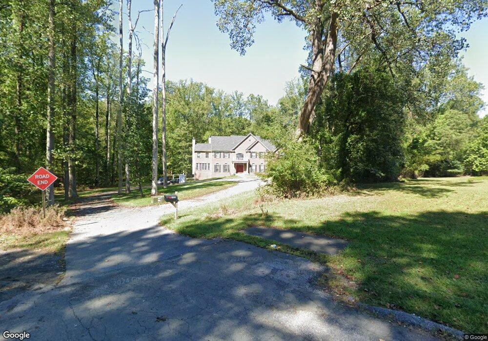
10240 Harvest Fields Dr Woodstock, MD 21163
Woodstock NeighborhoodEstimated Value: $1,218,000 - $1,677,011
--
Bed
2
Baths
7,088
Sq Ft
$204/Sq Ft
Est. Value
About This Home
This home is located at 10240 Harvest Fields Dr, Woodstock, MD 21163 and is currently estimated at $1,449,004, approximately $204 per square foot. 10240 Harvest Fields Dr is a home located in Baltimore County with nearby schools including Hernwood Elementary School, Deer Park Middle Magnet School, and New Town High.
Ownership History
Date
Name
Owned For
Owner Type
Purchase Details
Closed on
Jan 11, 2013
Sold by
Frady Dorothy H and Estate Of Hamilton A Hall Jr
Bought by
Lanier James
Current Estimated Value
Home Financials for this Owner
Home Financials are based on the most recent Mortgage that was taken out on this home.
Original Mortgage
$760,000
Outstanding Balance
$541,569
Interest Rate
3.5%
Mortgage Type
New Conventional
Estimated Equity
$907,435
Create a Home Valuation Report for This Property
The Home Valuation Report is an in-depth analysis detailing your home's value as well as a comparison with similar homes in the area
Home Values in the Area
Average Home Value in this Area
Purchase History
| Date | Buyer | Sale Price | Title Company |
|---|---|---|---|
| Lanier James | $260,000 | None Available |
Source: Public Records
Mortgage History
| Date | Status | Borrower | Loan Amount |
|---|---|---|---|
| Open | Lanier James | $760,000 |
Source: Public Records
Tax History Compared to Growth
Tax History
| Year | Tax Paid | Tax Assessment Tax Assessment Total Assessment is a certain percentage of the fair market value that is determined by local assessors to be the total taxable value of land and additions on the property. | Land | Improvement |
|---|---|---|---|---|
| 2025 | $13,854 | $1,189,800 | -- | -- |
| 2024 | $13,854 | $1,143,300 | $212,300 | $931,000 |
| 2023 | $6,891 | $1,132,200 | $0 | $0 |
| 2022 | $13,524 | $1,121,100 | $0 | $0 |
| 2021 | $12,592 | $1,110,000 | $212,300 | $897,700 |
| 2020 | $12,592 | $1,034,000 | $0 | $0 |
| 2019 | $11,671 | $958,000 | $0 | $0 |
| 2018 | $10,750 | $882,000 | $167,600 | $714,400 |
| 2017 | $10,309 | $853,400 | $0 | $0 |
| 2016 | -- | $167,600 | $0 | $0 |
| 2015 | -- | $167,600 | $0 | $0 |
| 2014 | -- | $167,600 | $0 | $0 |
Source: Public Records
Map
Nearby Homes
- 10628 Saint Paul Ave
- 3200 Peddicoat Ct
- 10719 Old Court Rd
- 9605 Mendoza Rd
- 3517 Kings Point Rd
- 10301 Marriottsville Rd
- 3618 Granite Rd
- 10645 Davis Ave
- 3525 Cabot Rd
- 10520 Marriottsville Rd
- 9113 Dogwood Rd
- 3538 Corn Stream Rd
- 3518 Orchard Shade Rd
- 9804 Marriottsville Rd
- 30 Sheraton Rd
- 4129 Holbrook Rd
- 9311 Colorado Ave
- 10313 Cavey Ln
- 3803 Marriottsville Rd
- 4133 Holbrook Rd
- 10238 Harvest Fields Dr
- 10236 Harvest Fields Dr
- 10231 Harvest Fields Dr
- 0 Harvest Fields Dr Unit 1004877350
- 10234 Harvest Fields Dr
- 10229 Harvest Fields Dr
- 10227 Harvest Fields Dr
- 10225 Harvest Fields Dr
- 3144 Granite Rd
- 10223 Harvest Fields Dr
- 10232 Harvest Fields Dr
- 10230 Harvest Fields Dr
- 10221 Harvest Fields Dr
- 10228 Harvest Fields Dr
- 10219 Harvest Fields Dr
- 10226 Harvest Fields Dr
- 10217 Harvest Fields Dr
- 10222 Harvest Fields Dr
- 10220 Harvest Fields Dr
- 10224 Harvest Fields Dr