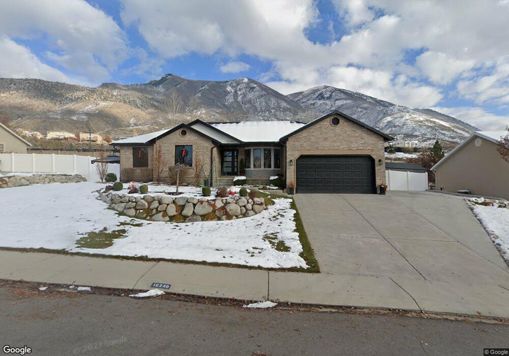
10240 N 3900 W Unit 3 Pleasant Grove, UT 84062
Estimated Value: $666,000 - $701,000
3
Beds
3
Baths
1,618
Sq Ft
$421/Sq Ft
Est. Value
About This Home
This home is located at 10240 N 3900 W Unit 3, Pleasant Grove, UT 84062 and is currently estimated at $681,266, approximately $421 per square foot. 10240 N 3900 W Unit 3 is a home located in Utah County with nearby schools including Cedar Ridge Elementary School, Mountain Ridge Junior High School, and Lone Peak High School.
Ownership History
Date
Name
Owned For
Owner Type
Purchase Details
Closed on
Apr 19, 2023
Sold by
Rowley Rich P
Bought by
Rowley Family Living Trust
Current Estimated Value
Home Financials for this Owner
Home Financials are based on the most recent Mortgage that was taken out on this home.
Original Mortgage
$220,000
Outstanding Balance
$214,030
Interest Rate
6.73%
Mortgage Type
Credit Line Revolving
Estimated Equity
$467,236
Purchase Details
Closed on
Aug 20, 2020
Sold by
Rowley Richard Paul
Bought by
Rowley Rich P and Rowley Mccall C
Purchase Details
Closed on
Apr 18, 2006
Sold by
Rowley Richard P and Rowley Richard Paul
Bought by
Rowley Richard Paul
Home Financials for this Owner
Home Financials are based on the most recent Mortgage that was taken out on this home.
Original Mortgage
$221,600
Interest Rate
8.57%
Mortgage Type
Fannie Mae Freddie Mac
Purchase Details
Closed on
Apr 12, 2006
Sold by
Bawden Chad
Bought by
Rowley Richard P
Home Financials for this Owner
Home Financials are based on the most recent Mortgage that was taken out on this home.
Original Mortgage
$221,600
Interest Rate
8.57%
Mortgage Type
Fannie Mae Freddie Mac
Purchase Details
Closed on
Mar 16, 2005
Sold by
Petersen Brett A
Bought by
Bawden Chad
Home Financials for this Owner
Home Financials are based on the most recent Mortgage that was taken out on this home.
Original Mortgage
$264,100
Interest Rate
6%
Mortgage Type
Purchase Money Mortgage
Purchase Details
Closed on
Nov 7, 2003
Sold by
Petersen Brett A and Petersen Annie M
Bought by
Petersen Brett A
Home Financials for this Owner
Home Financials are based on the most recent Mortgage that was taken out on this home.
Original Mortgage
$100,000
Interest Rate
5.72%
Mortgage Type
Credit Line Revolving
Purchase Details
Closed on
Sep 8, 1999
Sold by
Freeland William A
Bought by
Petersen Brett A and Petersen Annie M
Home Financials for this Owner
Home Financials are based on the most recent Mortgage that was taken out on this home.
Original Mortgage
$140,000
Interest Rate
7.66%
Create a Home Valuation Report for This Property
The Home Valuation Report is an in-depth analysis detailing your home's value as well as a comparison with similar homes in the area
Home Values in the Area
Average Home Value in this Area
Purchase History
| Date | Buyer | Sale Price | Title Company |
|---|---|---|---|
| Rowley Family Living Trust | -- | Meridian Title Company | |
| Rowley Rich P | -- | Meridian Title Company | |
| Rowley Rich P | -- | None Available | |
| Rowley Richard Paul | -- | Backman Orem | |
| Rowley Richard P | -- | Merrill Title Company | |
| Bawden Chad | -- | -- | |
| Petersen Brett A | -- | Equity Title Agency Inc | |
| Petersen Brett A | -- | Signature Title |
Source: Public Records
Mortgage History
| Date | Status | Borrower | Loan Amount |
|---|---|---|---|
| Open | Rowley Rich P | $220,000 | |
| Previous Owner | Rowley Richard Paul | $221,600 | |
| Previous Owner | Rowley Richard P | $55,400 | |
| Previous Owner | Bawden Chad | $264,100 | |
| Previous Owner | Petersen Brett A | $100,000 | |
| Previous Owner | Petersen Brett A | $140,000 |
Source: Public Records
Tax History Compared to Growth
Tax History
| Year | Tax Paid | Tax Assessment Tax Assessment Total Assessment is a certain percentage of the fair market value that is determined by local assessors to be the total taxable value of land and additions on the property. | Land | Improvement |
|---|---|---|---|---|
| 2025 | $2,798 | $356,620 | $306,900 | $341,500 |
| 2024 | $2,798 | $331,375 | $0 | $0 |
| 2023 | $2,627 | $334,235 | $0 | $0 |
| 2022 | $2,576 | $320,100 | $0 | $0 |
| 2021 | $2,307 | $427,100 | $199,600 | $227,500 |
| 2020 | $2,147 | $387,900 | $184,800 | $203,100 |
| 2019 | $1,867 | $350,300 | $173,700 | $176,600 |
| 2018 | $1,852 | $327,300 | $173,700 | $153,600 |
| 2017 | $1,797 | $169,840 | $0 | $0 |
| 2016 | $1,788 | $157,190 | $0 | $0 |
| 2015 | $1,889 | $157,190 | $0 | $0 |
| 2014 | $1,725 | $142,560 | $0 | $0 |
Source: Public Records
Map
Nearby Homes
- 10358 N Tamarack Way
- 10412 N Bayhill Dr
- 3870 Mountaintop Cir
- 10514 N Doral Dr
- 10456 N Morgan Blvd
- 4198 W Sage Rd N
- 10448 Sage Vista Ln
- 10468 N Sage Vista Ln
- 3851 W Mountaintop Cir Unit 5
- 10587 N Avalon St
- 4292 W Joshua Ln
- 4083 W Hayes Cir
- 10207 N Cottonwood Dr
- 9900 N Meadow Dr
- 4084 W Shinnecock
- 10795 N La Costa
- 4124 N 810 W
- 4616 W Carriage Ln
- 9575 Aztec Dr
- 9752 N Dorchester Dr
- 10240 N 3900 W
- 10250 N 3900 W
- 10250 N 3900 W Unit 4
- 10230 N 3900 W
- 10230 N 3900 W Unit 2
- 3905 W 10260 N
- 3905 W 10260 N Unit 22
- 10233 N 3900 W
- 10262 N 3900 W
- 10220 N 3900 W
- 10220 N 3900 W Unit 1
- 10263 N 3900 W
- 3925 W 10260 N
- 3925 W 10260 N Unit 21
- 3940 W 10220 N
- 3940 W 10220 N Unit 24
- 10270 N 3900 W
- 10270 N 3900 W Unit 6
- 3915 W 10220 N
- 10208 N 3900 W