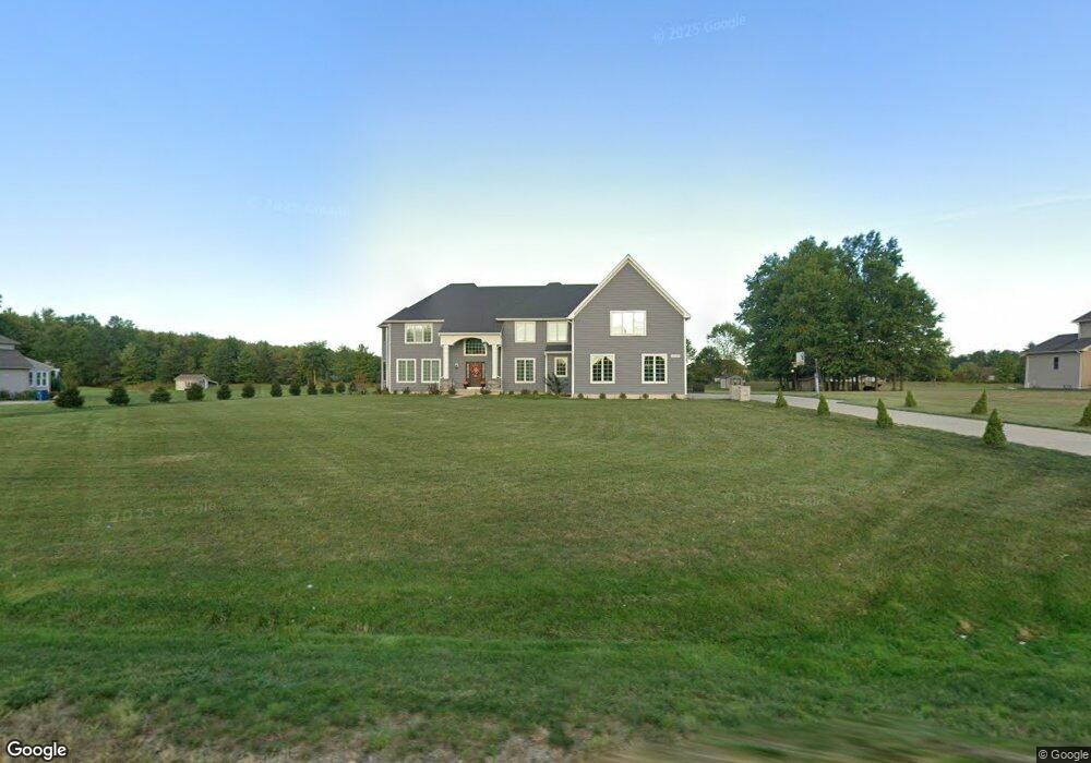
10245 Station Rd Unit 32 Columbia Station, OH 44028
Estimated Value: $764,183 - $1,116,000
5
Beds
5
Baths
5,243
Sq Ft
$177/Sq Ft
Est. Value
About This Home
This home is located at 10245 Station Rd Unit 32, Columbia Station, OH 44028 and is currently estimated at $928,061, approximately $177 per square foot. 10245 Station Rd Unit 32 is a home located in Lorain County with nearby schools including Falls-Lenox Primary Elementary School, Olmsted Falls Intermediate Building, and Olmsted Falls Middle School.
Ownership History
Date
Name
Owned For
Owner Type
Purchase Details
Closed on
Aug 2, 2018
Sold by
Garland Griffin Homes Inc
Bought by
Smits Anthony M and Smits Eileen M
Current Estimated Value
Home Financials for this Owner
Home Financials are based on the most recent Mortgage that was taken out on this home.
Original Mortgage
$637,500
Outstanding Balance
$542,739
Interest Rate
3.64%
Mortgage Type
New Conventional
Estimated Equity
$385,322
Purchase Details
Closed on
Aug 13, 2017
Sold by
Current Land Development Llc
Bought by
Garland Griffin Homes Inc
Purchase Details
Closed on
Jun 23, 2003
Sold by
Current Land Development Llc
Bought by
Current Land Development Llc
Create a Home Valuation Report for This Property
The Home Valuation Report is an in-depth analysis detailing your home's value as well as a comparison with similar homes in the area
Home Values in the Area
Average Home Value in this Area
Purchase History
| Date | Buyer | Sale Price | Title Company |
|---|---|---|---|
| Smits Anthony M | $92,500 | Chicago Title | |
| Garland Griffin Homes Inc | $79,000 | -- | |
| Current Land Development Llc | -- | -- |
Source: Public Records
Mortgage History
| Date | Status | Borrower | Loan Amount |
|---|---|---|---|
| Open | Smits Anthony M | $637,500 |
Source: Public Records
Tax History Compared to Growth
Tax History
| Year | Tax Paid | Tax Assessment Tax Assessment Total Assessment is a certain percentage of the fair market value that is determined by local assessors to be the total taxable value of land and additions on the property. | Land | Improvement |
|---|---|---|---|---|
| 2024 | $11,832 | $210,700 | $28,875 | $181,825 |
| 2023 | $14,651 | $217,574 | $36,344 | $181,230 |
| 2022 | $14,143 | $217,574 | $36,344 | $181,230 |
| 2021 | $14,456 | $217,574 | $36,344 | $181,230 |
| 2020 | $14,824 | $199,060 | $33,250 | $165,810 |
| 2019 | $2,020 | $29,930 | $29,930 | $0 |
| 2018 | $1,951 | $29,930 | $29,930 | $0 |
| 2017 | $1,870 | $25,520 | $25,520 | $0 |
| 2016 | $1,886 | $25,520 | $25,520 | $0 |
| 2015 | $1,901 | $25,520 | $25,520 | $0 |
| 2014 | $1,566 | $25,520 | $25,520 | $0 |
| 2013 | $1,566 | $25,520 | $25,520 | $0 |
Source: Public Records
Map
Nearby Homes
- 9783 Burts Way
- 9966 Ethan Dr
- 9954 Ethan Dr
- 9425 Ravinia Dr
- 9111 Devonshire Dr
- 0 Sprague Rd
- 8972 Sharp Rd
- 8767 Stearns Rd
- 9100 Ashwood Ct
- 9050 Ashwood Ct
- 26724 Lake of the Falls Blvd
- 26739 Lake of the Falls Blvd
- 9394 Basswood Dr
- 8665 Westfield Park Dr
- 8860 Sharp Rd
- 8706 Stearns Rd
- 26633 Lake of the Falls Blvd
- 9422 Driftwood Dr
- 25914 Nichols Rd
- 26680 Village Ln
- 10228 Station Rd
- 10301 Station Rd
- S/L 26 Glencove Trail
- 10187 Station Rd
- 10170 Station Rd
- S/L #21 Glencove Trail
- S/L 3 Glencove Trail
- S/L #25 Glencove Trail
- 10284 Station Rd
- 26410 Cobblestone Trail
- 10129 Station Rd
- 26433 Glencove Trail
- 10340 Station Rd
- 26415 Cobblestone Trail
- 26415 Cobblestone Trail Unit 29
- 10374 Sandstone Trail
- 10450 Station Rd
- 26500 Glencove Trail
- 10052 Station Rd
- 10043 Station Rd