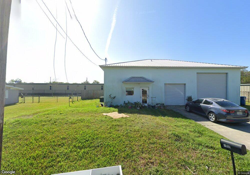
1025 10th St Daytona Beach, FL 32117
Estimated Value: $227,000 - $261,000
--
Bed
1
Bath
--
Sq Ft
7.14
Acres
About This Home
This home is located at 1025 10th St, Daytona Beach, FL 32117 and is currently estimated at $244,000. 1025 10th St is a home located in Volusia County with nearby schools including Westside Elementary School, Campbell Middle School, and Mainland High School.
Ownership History
Date
Name
Owned For
Owner Type
Purchase Details
Closed on
Dec 12, 2022
Sold by
Rodrigue Diane
Bought by
Rodrigue Diane
Current Estimated Value
Purchase Details
Closed on
Jul 31, 2014
Sold by
Wivigeco Llc
Bought by
Rodrigue Diane
Purchase Details
Closed on
Jan 24, 2014
Sold by
Jones William H and Jones Jan L
Bought by
Wivigeco Llc
Purchase Details
Closed on
Feb 15, 1993
Bought by
Rodrigue Diane
Purchase Details
Closed on
Jan 15, 1993
Bought by
Rodrigue Diane
Purchase Details
Closed on
Aug 15, 1991
Bought by
Rodrigue Diane
Purchase Details
Closed on
May 15, 1990
Bought by
Rodrigue Diane
Purchase Details
Closed on
Feb 15, 1979
Bought by
Rodrigue Diane
Create a Home Valuation Report for This Property
The Home Valuation Report is an in-depth analysis detailing your home's value as well as a comparison with similar homes in the area
Home Values in the Area
Average Home Value in this Area
Purchase History
| Date | Buyer | Sale Price | Title Company |
|---|---|---|---|
| Rodrigue Diane | $100 | -- | |
| Rodrigue Diane | $100 | None Listed On Document | |
| Rodrigue Diane | $5,000 | Waterside Title Co | |
| Wivigeco Llc | -- | Attorney | |
| Rodrigue Diane | $100 | -- | |
| Rodrigue Diane | $67,500 | -- | |
| Rodrigue Diane | $100 | -- | |
| Rodrigue Diane | $100 | -- | |
| Rodrigue Diane | $28,000 | -- |
Source: Public Records
Tax History Compared to Growth
Tax History
| Year | Tax Paid | Tax Assessment Tax Assessment Total Assessment is a certain percentage of the fair market value that is determined by local assessors to be the total taxable value of land and additions on the property. | Land | Improvement |
|---|---|---|---|---|
| 2025 | $53 | $4,875 | $4,875 | -- |
| 2024 | $53 | $4,875 | $4,875 | -- |
| 2023 | $53 | $3,475 | $3,475 | $0 |
| 2022 | $46 | $2,500 | $2,500 | $0 |
| 2021 | $48 | $2,450 | $2,450 | $0 |
| 2020 | $48 | $2,450 | $2,450 | $0 |
| 2019 | $47 | $2,450 | $2,450 | $0 |
| 2018 | $44 | $2,450 | $2,450 | $0 |
| 2017 | $40 | $1,900 | $1,900 | $0 |
| 2016 | $41 | $1,900 | $0 | $0 |
| 2015 | $42 | $1,900 | $0 | $0 |
| 2014 | $50 | $2,250 | $0 | $0 |
Source: Public Records
Map
Nearby Homes
- 842 E Colonial Cir
- 843 E Colonial Cir
- 887 E Colonial Cir
- 841 W Colonial Cir
- 1480 Vine St
- 896 W Colonial Cir
- 1195 10th St
- 102 Astor St
- 1018 Grand Hickory Cir
- 813 W Colonial Cir
- 1111 Lpga Blvd
- 1201 10th St
- 403 10th St
- 1016 Great Oaks Dr
- 815 8th St
- 1212 Leon Ln
- 1017 Chippewa Trail
- 1082 Yaupon St
- 1219 David Dr
- 1367 Vine
- 1007 10th St
- 1006 10th St
- 1008 10th St
- 1011 10th St
- 1004 10th St
- 1012 10th St
- 1002 10th St Unit A
- 1014 10th St
- 1010 10th St
- 1017 10th St
- 969 Rosalie Dr
- 1450 N Nova Rd
- 939 Rosalie Dr
- 902 N Colonial Cir
- 960 N Colonial Cir
- 1440 N Nova Rd Unit 201
- 1440 N Nova Rd Unit 306
- 1440 N Nova Rd Unit 310
- 1440 N Nova Rd Unit 301
- 1440 N Nova Rd Unit 16