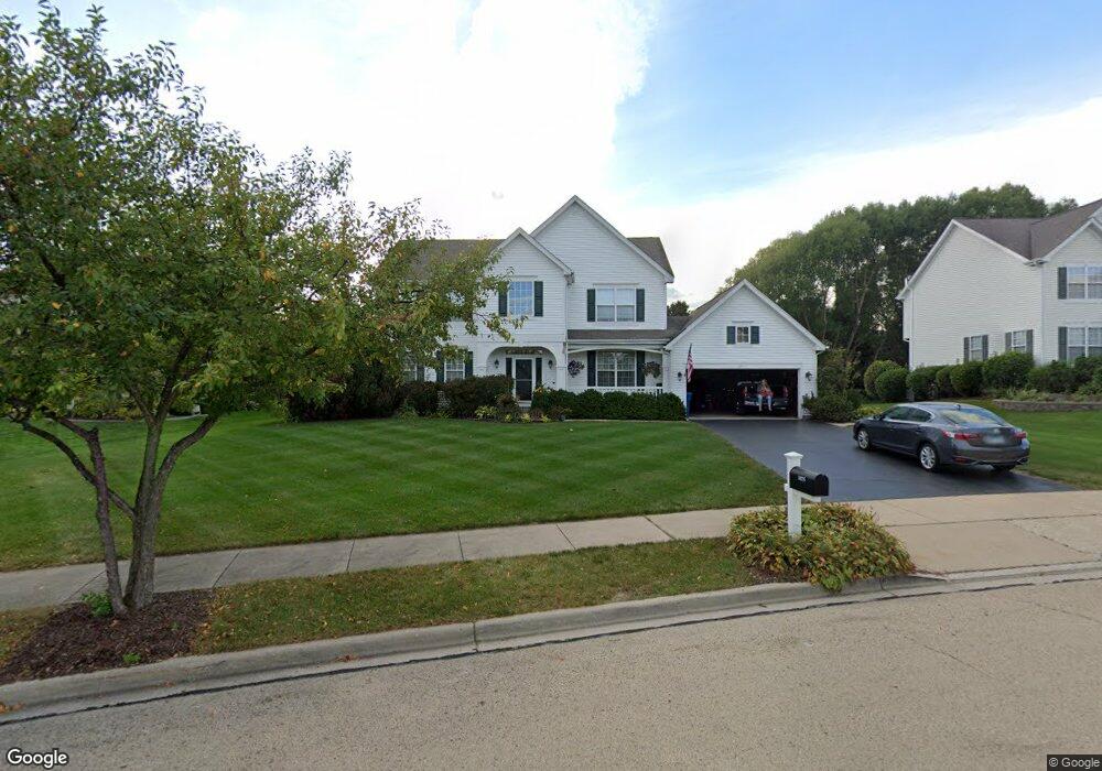
1025 Angle Tarn West Dundee, IL 60118
Estimated Value: $444,245 - $505,000
4
Beds
--
Bath
2,598
Sq Ft
$185/Sq Ft
Est. Value
About This Home
This home is located at 1025 Angle Tarn, West Dundee, IL 60118 and is currently estimated at $480,811, approximately $185 per square foot. 1025 Angle Tarn is a home located in Kane County with nearby schools including Sleepy Hollow Elementary School, Dundee Middle School, and Dundee-Crown High School.
Ownership History
Date
Name
Owned For
Owner Type
Purchase Details
Closed on
Nov 27, 1996
Sold by
The Ryland Group Inc
Bought by
Magsamen Richard C and Magsamen Traci A
Current Estimated Value
Home Financials for this Owner
Home Financials are based on the most recent Mortgage that was taken out on this home.
Original Mortgage
$192,100
Outstanding Balance
$19,386
Interest Rate
7.62%
Estimated Equity
$461,425
Create a Home Valuation Report for This Property
The Home Valuation Report is an in-depth analysis detailing your home's value as well as a comparison with similar homes in the area
Home Values in the Area
Average Home Value in this Area
Purchase History
| Date | Buyer | Sale Price | Title Company |
|---|---|---|---|
| Magsamen Richard C | $256,500 | Ticor Title Insurance |
Source: Public Records
Mortgage History
| Date | Status | Borrower | Loan Amount |
|---|---|---|---|
| Open | Magsamen Richard C | $192,100 |
Source: Public Records
Tax History
| Year | Tax Paid | Tax Assessment Tax Assessment Total Assessment is a certain percentage of the fair market value that is determined by local assessors to be the total taxable value of land and additions on the property. | Land | Improvement |
|---|---|---|---|---|
| 2024 | $10,697 | $139,228 | $27,254 | $111,974 |
| 2023 | $10,035 | $125,272 | $24,522 | $100,750 |
| 2022 | $10,167 | $121,401 | $24,522 | $96,879 |
| 2021 | $9,816 | $114,627 | $23,154 | $91,473 |
| 2020 | $9,636 | $112,049 | $22,633 | $89,416 |
| 2019 | $9,330 | $106,369 | $21,486 | $84,883 |
| 2018 | $8,956 | $99,910 | $21,061 | $78,849 |
| 2017 | $9,399 | $102,348 | $24,816 | $77,532 |
| 2016 | $9,584 | $99,098 | $24,028 | $75,070 |
| 2015 | -- | $92,858 | $22,515 | $70,343 |
| 2014 | -- | $90,293 | $21,893 | $68,400 |
| 2013 | -- | $93,057 | $22,563 | $70,494 |
Source: Public Records
Map
Nearby Homes
- 1042 Chateau Bluff Ln
- 36 River Ridge Dr
- 915 Willow Ln
- 601 Edwards Ave
- 10 Chateau Dr
- 601 S 2nd St
- 936 Glen Oak Dr
- 305 Oregon Ave
- Lot 1 View St
- 820 Lindsay Ln
- 804 Lindsay Ln
- 808 Lindsay Ln
- 810 Lindsay Ln
- 1811 W Main St
- 306 Johnson St
- 206 Water St
- 1040 Beau Brummel Ct
- 822 Lindsay Ln
- 816 Lindsay Ln
- 818 Lindsay Ln
- 971 Angle Tarn
- 1041 Angle Tarn
- 1204 Summerwood
- 1022 Angle Tarn
- 1067 Angle Tarn
- 963 Angle Tarn
- 968 Angle Tarn
- 1207 Summerwood
- 1044 Angle Tarn
- 1129 Angle Tarn
- 955 Angle Tarn
- 1068 Angle Tarn
- 1147 Angle Tarn
- 937 Angle Tarn
- 936 Angle Tarn
- 1225 Summerwood
- 1236 Summerwood
- 1116 Fox Path
- 1165 Angle Tarn
- 1108 Fox Path
Your Personal Tour Guide
Ask me questions while you tour the home.