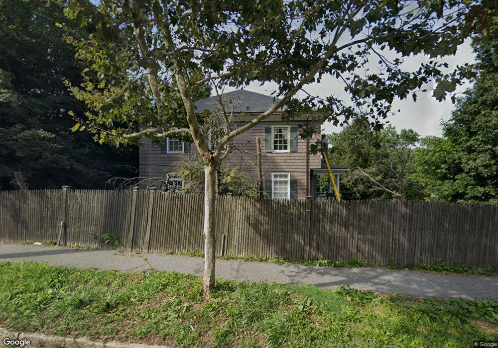
1025 Boylston St Chestnut Hill, MA 02467
Chestnut Hill NeighborhoodEstimated Value: $2,071,000 - $3,140,000
4
Beds
3
Baths
3,064
Sq Ft
$886/Sq Ft
Est. Value
About This Home
This home is located at 1025 Boylston St, Chestnut Hill, MA 02467 and is currently estimated at $2,713,571, approximately $885 per square foot. 1025 Boylston St is a home located in Norfolk County with nearby schools including Heath Elementary School, Brimmer & May School, and Maimonides School.
Ownership History
Date
Name
Owned For
Owner Type
Purchase Details
Closed on
Jul 2, 2008
Sold by
Lim Kahi E and Lukminto Vonny
Bought by
Dutta Biswadeb
Current Estimated Value
Purchase Details
Closed on
Oct 29, 1998
Sold by
Martell Tr Stephen R
Bought by
Lim Khai E
Purchase Details
Closed on
Jul 8, 1997
Sold by
Rosenberg Michael and Rosenberg Sherryl
Bought by
Martell Tr Stephen R
Create a Home Valuation Report for This Property
The Home Valuation Report is an in-depth analysis detailing your home's value as well as a comparison with similar homes in the area
Home Values in the Area
Average Home Value in this Area
Purchase History
| Date | Buyer | Sale Price | Title Company |
|---|---|---|---|
| Dutta Biswadeb | $905,000 | -- | |
| Lim Khai E | $560,000 | -- | |
| Martell Tr Stephen R | $147,500 | -- |
Source: Public Records
Mortgage History
| Date | Status | Borrower | Loan Amount |
|---|---|---|---|
| Open | Martell Tr Stephen R | $523,750 | |
| Closed | Martell Tr Stephen R | $100,000 | |
| Closed | Martell Tr Stephen R | $417,000 |
Source: Public Records
Tax History Compared to Growth
Tax History
| Year | Tax Paid | Tax Assessment Tax Assessment Total Assessment is a certain percentage of the fair market value that is determined by local assessors to be the total taxable value of land and additions on the property. | Land | Improvement |
|---|---|---|---|---|
| 2025 | $24,141 | $2,445,900 | $1,315,300 | $1,130,600 |
| 2024 | $22,962 | $2,350,300 | $1,264,600 | $1,085,700 |
| 2023 | $19,370 | $1,942,800 | $903,500 | $1,039,300 |
| 2022 | $18,855 | $1,850,300 | $860,500 | $989,800 |
| 2021 | $17,436 | $1,779,200 | $827,400 | $951,800 |
| 2020 | $15,965 | $1,689,400 | $752,100 | $937,300 |
| 2019 | $15,076 | $1,609,000 | $716,300 | $892,700 |
| 2018 | $14,668 | $1,550,500 | $707,000 | $843,500 |
| 2017 | $16,167 | $1,636,300 | $666,900 | $969,400 |
| 2016 | $15,491 | $1,486,700 | $580,700 | $906,000 |
| 2015 | $14,839 | $1,389,400 | $542,700 | $846,700 |
| 2014 | $15,620 | $1,371,400 | $499,100 | $872,300 |
Source: Public Records
Map
Nearby Homes
- 1014 Boylston St
- 76 Norfolk Rd
- 335 Heath St
- 174 Middlesex Rd
- 142 Crafts Rd
- 130 Cabot St
- 88 Cutler Ln
- 59 Ackers Ave Unit 1
- 0 Glenoe Rd
- 3 Glenoe Rd
- 55 Reservoir Rd Unit 2
- 30 Ackers Ave
- 85 Gate House Rd
- 138 Woodland Rd
- 675 Chestnut Hill Ave
- 2400 Beacon St Unit 112
- 540 Chestnut Hill Ave
- 15 Glenland Rd
- 9 Willard Rd
- 39 Clyde St
- 180 Fairway Rd
- 1033 Boylston St
- 176 Fairway Rd
- 1039 Boylston St
- 192 Fairway Rd
- 170 Fairway Rd
- 76 Denny Rd
- 1039B Boylston St (Off) L:
- 21 Crafts Rd
- 1020 Boylston St
- 1041 Boylston St
- 69 Denny Rd
- 191 Fairway Rd Unit 191
- 191 Fairway Rd
- 191 Fairway Rd Unit n/a
- 14 Jefferson Rd
- 41 Crafts Rd
- 47 Crafts Rd
- 35 Crafts Rd
- 160 Fairway Rd