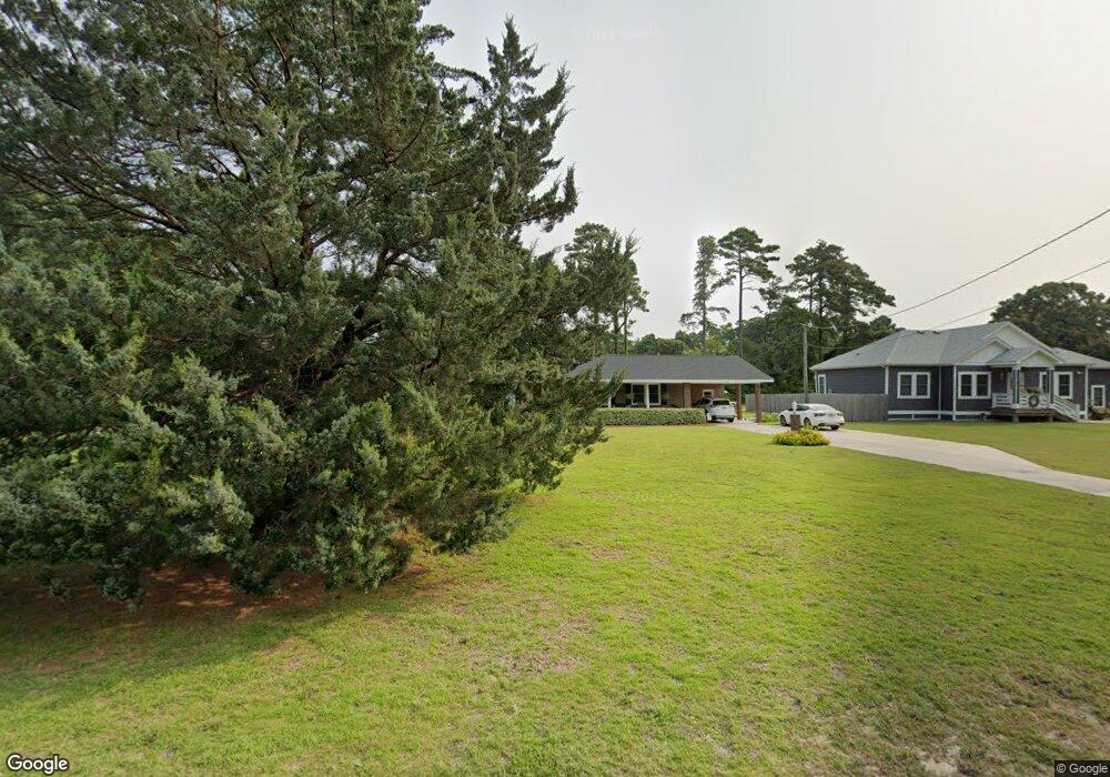
1025 Burnside Rd Manteo, NC 27954
Estimated Value: $417,008 - $500,000
4
Beds
2
Baths
2,094
Sq Ft
$228/Sq Ft
Est. Value
About This Home
This home is located at 1025 Burnside Rd, Manteo, NC 27954 and is currently estimated at $476,502, approximately $227 per square foot. 1025 Burnside Rd is a home located in Dare County with nearby schools including Manteo Elementary School, Manteo Middle School, and Manteo High School.
Ownership History
Date
Name
Owned For
Owner Type
Purchase Details
Closed on
Aug 4, 2025
Sold by
Songer Dorothy M
Bought by
Songer Dorothy M and Songer Neil C
Current Estimated Value
Purchase Details
Closed on
Jun 18, 2019
Sold by
J D Johnson Reality & Const
Bought by
Songer Dorothy M
Purchase Details
Closed on
Oct 3, 2018
Sold by
Songer William L and Songer Dorothy M
Bought by
Songer Sotothy M
Home Financials for this Owner
Home Financials are based on the most recent Mortgage that was taken out on this home.
Original Mortgage
$208,000
Interest Rate
4.72%
Purchase Details
Closed on
Sep 27, 2018
Sold by
Manteo Faith Baptist Church Inc
Bought by
Songer Dorothy and Songer William
Home Financials for this Owner
Home Financials are based on the most recent Mortgage that was taken out on this home.
Original Mortgage
$208,000
Interest Rate
4.72%
Purchase Details
Closed on
Nov 30, 2016
Sold by
Ambrose Wanda P and Ambrose Edward H
Bought by
Manteo Faith Baptist Churc Inc
Create a Home Valuation Report for This Property
The Home Valuation Report is an in-depth analysis detailing your home's value as well as a comparison with similar homes in the area
Home Values in the Area
Average Home Value in this Area
Purchase History
| Date | Buyer | Sale Price | Title Company |
|---|---|---|---|
| Songer Dorothy M | -- | None Listed On Document | |
| Songer Dorothy M | -- | None Listed On Document | |
| Songer Dorothy M | $21,500 | -- | |
| Songer Sotothy M | -- | -- | |
| Songer Dorothy | -- | -- | |
| Manteo Faith Baptist Churc Inc | -- | None Available |
Source: Public Records
Mortgage History
| Date | Status | Borrower | Loan Amount |
|---|---|---|---|
| Previous Owner | Songer Dorothy | $208,000 | |
| Previous Owner | Songer Dorothy | -- |
Source: Public Records
Tax History Compared to Growth
Tax History
| Year | Tax Paid | Tax Assessment Tax Assessment Total Assessment is a certain percentage of the fair market value that is determined by local assessors to be the total taxable value of land and additions on the property. | Land | Improvement |
|---|---|---|---|---|
| 2024 | $1,432 | $259,200 | $79,200 | $180,000 |
| 2023 | $1,418 | $259,200 | $79,200 | $180,000 |
| 2022 | $1,392 | $259,200 | $79,200 | $180,000 |
| 2021 | $1,366 | $259,200 | $79,200 | $180,000 |
| 2020 | $1,363 | $259,200 | $79,200 | $180,000 |
| 2019 | $1,097 | $178,000 | $52,900 | $125,100 |
| 2018 | $0 | $178,000 | $52,900 | $125,100 |
| 2017 | $0 | $178,000 | $52,900 | $125,100 |
| 2016 | $1,026 | $178,000 | $52,900 | $125,100 |
| 2014 | $1,026 | $178,000 | $52,900 | $125,100 |
Source: Public Records
Map
Nearby Homes
- 1006 Burnside Rd
- 137 Sherwood Dr Unit Lot 58
- 137 Sherwood Dr
- 1095 Burnside Rd Unit Lot B3
- 938 Burnside Rd Unit Lot NA
- 942 Burnside Rd Unit Lot NA
- 0 Shady Pines Ln Unit Lot 13 128538
- 0 Shady Pines Ln Unit Lot 27 128148
- 1434 /202D Dartmoor Ave Unit 202D
- 116 Cutter Ct Unit Lot 6
- 501 Dora Dr Unit Lot 26
- 1285 Burnside Rd Unit Lot 1
- 1285 Burnside Rd Unit Lot 2
- 1285 Burnside Rd Unit Lot 3
- 517 Unit 2 Ananias Dare St Unit 2
- 517 Unit 1 Ananias Dare St Unit 1
- 517 Ananias Dare St Unit 4
- 517 Ananias Dare St Unit 3
- 104 Coleman Rd
- 707 Harriot St Unit lot 7
- 1021 Burnside Rd
- 111 Rimpaul Rd
- 1033 Burnside Rd
- 122 Timberlin Way
- 124 Timberlin Way
- 116 Timberlin Way
- 1028 Burnside Rd
- 110 Rimpaul Rd
- 126 Timberlin Way Unit 7
- 126 Timberlin Way
- 1014 Burnside Rd
- 106 Payne Rd
- 1036 Burnside Rd
- 114 Timberlin Way
- 101 The Oaks
- 105 The Oaks
- 108 Payne Rd
- 108 Payne Rd Unit Lot 4
- 117 Timberlin Way
- 113 Timberlin Way