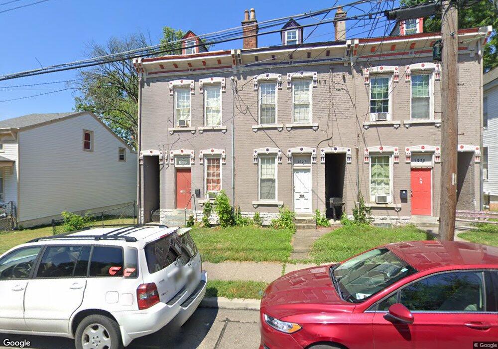
1025 Considine Ave Cincinnati, OH 45205
East Price Hill NeighborhoodEstimated Value: $109,554 - $184,000
3
Beds
1
Bath
1,710
Sq Ft
$85/Sq Ft
Est. Value
About This Home
This home is located at 1025 Considine Ave, Cincinnati, OH 45205 and is currently estimated at $145,639, approximately $85 per square foot. 1025 Considine Ave is a home located in Hamilton County with nearby schools including Robert A. Taft Information Technology High School, Gilbert A. Dater High School, and Western Hills High School.
Ownership History
Date
Name
Owned For
Owner Type
Purchase Details
Closed on
Dec 15, 2010
Sold by
States Resources Corp
Bought by
Smith Ray Sean
Current Estimated Value
Purchase Details
Closed on
Sep 15, 2009
Sold by
Southern Ohio Property Investments Ltd
Bought by
States Resources Corporation
Purchase Details
Closed on
Nov 22, 1994
Sold by
P B Realty Inc
Bought by
Southern Ohio Property Investments Ltd
Home Financials for this Owner
Home Financials are based on the most recent Mortgage that was taken out on this home.
Original Mortgage
$14,200
Interest Rate
8.91%
Purchase Details
Closed on
Jul 14, 1994
Sold by
Brown Ruth and Leis Simon L
Bought by
The Provident Bank Dept 219
Create a Home Valuation Report for This Property
The Home Valuation Report is an in-depth analysis detailing your home's value as well as a comparison with similar homes in the area
Home Values in the Area
Average Home Value in this Area
Purchase History
| Date | Buyer | Sale Price | Title Company |
|---|---|---|---|
| Smith Ray Sean | $9,000 | Chicago Title Insurance Co | |
| States Resources Corporation | $18,000 | Attorney | |
| Southern Ohio Property Investments Ltd | -- | -- | |
| The Provident Bank Dept 219 | $10,000 | -- |
Source: Public Records
Mortgage History
| Date | Status | Borrower | Loan Amount |
|---|---|---|---|
| Previous Owner | Southern Ohio Property Investments Ltd | $14,200 |
Source: Public Records
Tax History
| Year | Tax Paid | Tax Assessment Tax Assessment Total Assessment is a certain percentage of the fair market value that is determined by local assessors to be the total taxable value of land and additions on the property. | Land | Improvement |
|---|---|---|---|---|
| 2025 | $1,485 | $23,384 | $1,257 | $22,127 |
| 2023 | $1,486 | $23,384 | $1,257 | $22,127 |
| 2022 | $563 | $7,924 | $1,113 | $6,811 |
| 2021 | $552 | $7,924 | $1,113 | $6,811 |
| 2020 | $553 | $7,924 | $1,113 | $6,811 |
| 2019 | $553 | $7,204 | $1,012 | $6,192 |
| 2018 | $553 | $7,204 | $1,012 | $6,192 |
| 2017 | $532 | $7,204 | $1,012 | $6,192 |
| 2016 | $79 | $1,008 | $560 | $448 |
| 2015 | $123 | $1,008 | $560 | $448 |
| 2014 | $72 | $1,008 | $560 | $448 |
| 2013 | $75 | $1,040 | $578 | $462 |
Source: Public Records
Map
Nearby Homes
- 1030 Considine Ave
- 1015 Purcell Ave
- 1124 Elberon Ave
- 3321 Glenway Ave
- 3424 Kensington Place
- 3320 Glenway Ave
- 817 Hawthorne Ave
- 2829 Glenway Ave
- 922 Summit Ave
- 2540 Ring Place
- 1114 Wing St
- 2519 Warsaw Ave
- 812 Fairbanks Ave
- 924 Mcpherson Ave
- 735 Elberon Ave
- 2500 Warsaw Ave
- 2832 Claypole Ave
- 3320 Freddie Dr
- 2485 Warsaw Ave
- 903 Mcpherson Ave
- 1027 Considine Ave
- 1029 Considine Ave
- 1023 Considine Ave
- 1021 Considine Ave
- 1019 Considine Ave
- 1033 Considine Ave
- 1017 Considine Ave
- 1037 Considine Ave
- 1039 Considine Ave
- 1020 Purcell Ave
- 1026 Purcell Ave
- 1041 Considine Ave
- 1028 Purcell Ave
- 1016 Purcell Ave
- 1024 Purcell Ave
- 1032 Purcell Ave
- 1018 Purcell Ave
- 1022 Considine Ave
- 1028 Considine Ave
- 1012 Purcell Ave
Your Personal Tour Guide
Ask me questions while you tour the home.