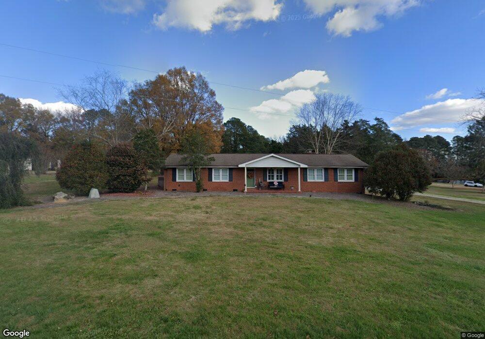
1025 Eagle Rock Rd Wendell, NC 27591
Estimated Value: $340,017 - $455,000
--
Bed
2
Baths
1,593
Sq Ft
$241/Sq Ft
Est. Value
About This Home
This home is located at 1025 Eagle Rock Rd, Wendell, NC 27591 and is currently estimated at $384,504, approximately $241 per square foot. 1025 Eagle Rock Rd is a home located in Wake County with nearby schools including Carver Elementary, Wendell Middle School, and East Wake High School.
Ownership History
Date
Name
Owned For
Owner Type
Purchase Details
Closed on
Apr 1, 2011
Sold by
Smith Vic Elaine
Bought by
Pearce Lisa Clark
Current Estimated Value
Purchase Details
Closed on
Feb 2, 2006
Sold by
Holifield David Faison
Bought by
Holifield Vic Elaine Smith
Purchase Details
Closed on
Oct 24, 2000
Sold by
Holifield Vic Elaine Smith
Bought by
Holifield David Faison and Holifield Vic Elaine Smith
Create a Home Valuation Report for This Property
The Home Valuation Report is an in-depth analysis detailing your home's value as well as a comparison with similar homes in the area
Home Values in the Area
Average Home Value in this Area
Purchase History
| Date | Buyer | Sale Price | Title Company |
|---|---|---|---|
| Pearce Lisa Clark | $220,000 | None Available | |
| Holifield Vic Elaine Smith | -- | None Available | |
| Holifield David Faison | -- | -- |
Source: Public Records
Tax History Compared to Growth
Tax History
| Year | Tax Paid | Tax Assessment Tax Assessment Total Assessment is a certain percentage of the fair market value that is determined by local assessors to be the total taxable value of land and additions on the property. | Land | Improvement |
|---|---|---|---|---|
| 2025 | -- | $364,619 | $111,350 | $253,269 |
| 2024 | $2,284 | $364,619 | $111,350 | $253,269 |
| 2023 | $1,835 | $232,798 | $44,480 | $188,318 |
| 2022 | $1,701 | $232,798 | $44,480 | $188,318 |
| 2021 | $1,656 | $232,798 | $44,480 | $188,318 |
| 2020 | $1,629 | $232,798 | $44,480 | $188,318 |
| 2019 | $1,623 | $196,303 | $44,480 | $151,823 |
| 2018 | $1,493 | $196,303 | $44,480 | $151,823 |
| 2017 | $1,416 | $196,303 | $44,480 | $151,823 |
| 2016 | $1,387 | $196,303 | $44,480 | $151,823 |
| 2015 | $1,483 | $210,631 | $70,600 | $140,031 |
| 2014 | $1,406 | $210,631 | $70,600 | $140,031 |
Source: Public Records
Map
Nearby Homes
- 1317 Pavo Path
- 305 Wash Hollow Dr
- 237 Wash Hollow Dr
- Blake Plan at Anderson Farm - The Townes
- Collin Plan at Anderson Farm - The Townes
- BOOTH Plan at Anderson Farm
- WILMINGTON Plan at Anderson Farm
- HAYDEN Plan at Anderson Farm
- PENWELL Plan at Anderson Farm
- 1324 Pavo Path
- 1325 Pavo Path
- 1316 Pavo Path
- 1321 Pavo Path
- 1320 Pavo Path
- 870 Old Tarboro Rd
- 818 Old Tarboro Rd
- 816 Old Tarboro Rd
- 814 Old Tarboro Rd
- 810 Old Tarboro Rd
- 812 Old Tarboro Rd
- 1029 Eagle Rock Rd
- 1012 Eagle Rock Rd
- 1004 Eagle Rock Rd
- 1009 Martin Pond Rd
- 1002 Eagle Rock Rd
- 1005 Martin Pond Rd
- 1016 Martin Pond Rd
- 6445 Falconwood Dr
- 1113 Eagle Rock Rd
- 6900 Knightdale Eagle Rock Rd
- 6444 Falconwood Dr
- 1141 Clear Cir
- 6905 Knightdale Eagle Rock Rd
- 6441 Falconwood Dr
- 908 Eagle Rock Rd
- 6901 Knightdale Eagle Rock Rd
- 6816 Knightdale Eagle Rock Rd
- 1101 Martin Pond Rd
- 6811 Knightdale Eagle Rock Rd
- 6909 Knightdale Eagle Rock Rd