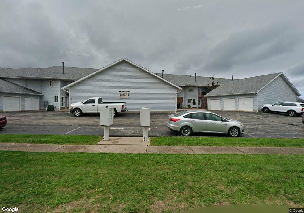
1025 Harbor St Unit 29 Conneaut, OH 44030
Estimated Value: $207,000 - $222,000
2
Beds
2
Baths
1,164
Sq Ft
$184/Sq Ft
Est. Value
About This Home
This home is located at 1025 Harbor St Unit 29, Conneaut, OH 44030 and is currently estimated at $214,093, approximately $183 per square foot. 1025 Harbor St Unit 29 is a home located in Ashtabula County with nearby schools including Lakeshore Primary Elementary School, Gateway Elementary School, and Conneaut Middle School.
Ownership History
Date
Name
Owned For
Owner Type
Purchase Details
Closed on
Mar 6, 2020
Sold by
Warner Mark A and Simon Seymour Christine
Bought by
Warner Mark A and Simon Seymour Christine
Current Estimated Value
Purchase Details
Closed on
Oct 13, 2016
Sold by
Crick Gary Living Trst
Bought by
Mark A Warner
Home Financials for this Owner
Home Financials are based on the most recent Mortgage that was taken out on this home.
Interest Rate
3.47%
Purchase Details
Closed on
Nov 21, 1997
Sold by
Spence Ilona
Bought by
Crick Gary
Create a Home Valuation Report for This Property
The Home Valuation Report is an in-depth analysis detailing your home's value as well as a comparison with similar homes in the area
Home Values in the Area
Average Home Value in this Area
Purchase History
| Date | Buyer | Sale Price | Title Company |
|---|---|---|---|
| Warner Mark A | -- | None Available | |
| Mark A Warner | $117,500 | -- | |
| Crick Gary | $91,800 | -- |
Source: Public Records
Mortgage History
| Date | Status | Borrower | Loan Amount |
|---|---|---|---|
| Previous Owner | Mark A Warner | -- |
Source: Public Records
Tax History Compared to Growth
Tax History
| Year | Tax Paid | Tax Assessment Tax Assessment Total Assessment is a certain percentage of the fair market value that is determined by local assessors to be the total taxable value of land and additions on the property. | Land | Improvement |
|---|---|---|---|---|
| 2024 | $3,672 | $50,200 | $10,470 | $39,730 |
| 2023 | $1,907 | $50,200 | $10,470 | $39,730 |
| 2022 | $1,554 | $38,150 | $8,050 | $30,100 |
| 2021 | $1,581 | $38,150 | $8,050 | $30,100 |
| 2020 | $1,580 | $38,150 | $8,050 | $30,100 |
| 2019 | $1,928 | $35,320 | $5,500 | $29,820 |
| 2018 | $1,838 | $35,320 | $5,500 | $29,820 |
| 2017 | $917 | $35,320 | $5,500 | $29,820 |
| 2016 | $1,502 | $31,470 | $4,900 | $26,570 |
| 2015 | $1,517 | $31,470 | $4,900 | $26,570 |
| 2014 | $1,336 | $31,470 | $4,900 | $26,570 |
| 2013 | $1,306 | $31,640 | $4,620 | $27,020 |
Source: Public Records
Map
Nearby Homes
- 1025 Harbor St Unit 35
- 0 Harbor St Unit 5122727
- 982 Day St
- 290 Park Ave
- 973 Buffalo St
- 794 Buffalo St
- 770 Buffalo St
- 169 River St
- 703 Sandusky St
- 688 Grove St
- 716 Chestnut St
- 644 Mill St
- 630 Mill St
- 554 Sandusky St
- 536 Mill St
- 533 Mill St
- 0 Chestnut St Unit 5120761
- 179 Hayward Ave
- 381 Bliss Ave
- 281 Depot St
- 1025 Harbor St Unit 37
- 1025 Harbor St Unit 36
- 1025 Harbor St Unit 34
- 1025 Harbor St Unit 33
- 1025 Harbor St Unit 32
- 1025 Harbor St Unit 31
- 1025 Harbor St Unit 30
- 1025 Harbor St Unit 28
- 1025 Harbor St Unit 27
- 1025 Harbor St Unit 26
- 1025 Harbor St Unit 24
- 1025 Harbor St Unit 22
- 1025 Harbor St Unit 21
- 208 Park Ave Unit 19
- 208 Park Ave Unit 18
- 208 Park Ave Unit 17
- 208 Park Ave Unit 16
- 208 Park Ave Unit 15
- 208 Park Ave Unit 14
- 208 Park Ave Unit 13