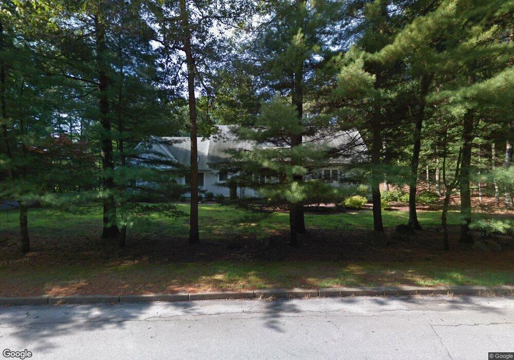
1025 High Hawk Rd East Greenwich, RI 02818
Tillinghast NeighborhoodEstimated Value: $1,069,350 - $1,126,000
4
Beds
4
Baths
2,858
Sq Ft
$382/Sq Ft
Est. Value
About This Home
This home is located at 1025 High Hawk Rd, East Greenwich, RI 02818 and is currently estimated at $1,090,588, approximately $381 per square foot. 1025 High Hawk Rd is a home located in Kent County with nearby schools including Frenchtown Elementary School, James H. Eldredge Elementary School, and East Greenwich High School.
Ownership History
Date
Name
Owned For
Owner Type
Purchase Details
Closed on
May 25, 2004
Sold by
Petit Robert F and Petit Cynthia E
Bought by
Lavalla Kevin M
Current Estimated Value
Purchase Details
Closed on
Jul 11, 2000
Sold by
Rhee Sangghon and Chang Rosita P
Bought by
Petit Robert F and Petit Cynthia E
Purchase Details
Closed on
Jan 9, 1989
Sold by
East Greenwich Dev
Bought by
Rhee Sangghan
Home Financials for this Owner
Home Financials are based on the most recent Mortgage that was taken out on this home.
Original Mortgage
$200,000
Interest Rate
10.32%
Create a Home Valuation Report for This Property
The Home Valuation Report is an in-depth analysis detailing your home's value as well as a comparison with similar homes in the area
Home Values in the Area
Average Home Value in this Area
Purchase History
| Date | Buyer | Sale Price | Title Company |
|---|---|---|---|
| Lavalla Kevin M | $650,000 | -- | |
| Petit Robert F | $410,000 | -- | |
| Rhee Sangghan | $400,000 | -- |
Source: Public Records
Mortgage History
| Date | Status | Borrower | Loan Amount |
|---|---|---|---|
| Previous Owner | Rhee Sangghan | $200,000 |
Source: Public Records
Tax History Compared to Growth
Tax History
| Year | Tax Paid | Tax Assessment Tax Assessment Total Assessment is a certain percentage of the fair market value that is determined by local assessors to be the total taxable value of land and additions on the property. | Land | Improvement |
|---|---|---|---|---|
| 2024 | $12,092 | $820,900 | $248,300 | $572,600 |
| 2023 | $12,125 | $554,900 | $216,000 | $338,900 |
| 2022 | $11,886 | $554,900 | $216,000 | $338,900 |
| 2021 | $11,658 | $554,900 | $216,000 | $338,900 |
| 2020 | $12,296 | $524,800 | $200,400 | $324,400 |
| 2019 | $12,181 | $524,800 | $200,400 | $324,400 |
| 2018 | $12,070 | $524,800 | $200,400 | $324,400 |
| 2017 | $12,637 | $534,100 | $208,600 | $325,500 |
| 2016 | $12,866 | $534,100 | $208,600 | $325,500 |
| 2015 | $12,423 | $534,100 | $208,600 | $325,500 |
| 2014 | $12,114 | $520,800 | $187,700 | $333,100 |
Source: Public Records
Map
Nearby Homes
- 50 Pheasant Dr
- 85 Sheep Farm Dr
- 60 Pheasant Dr
- 20 Mcpartland Way
- 15 Forest Ln
- 81 Shippee Rd
- 2 Corr Way
- 69 Bates Trail
- 65 Huguenot Dr
- 1300 Middle Rd
- 0 Tipping Rock Dr Unit 1377285
- 120 Adirondack Dr
- 25 Westfield Dr
- 20 Bailey Blvd
- 15 Ezechiel Carre Rd
- 25 Rock Way
- 2500 Division Rd
- 1121 Tillinghast Rd
- 35 Beech Crest Rd
- 130 Tipping Rock Dr
- 15 Sheep Farm Dr
- 160 Woodbridge Dr
- 985 High Hawk Rd
- 1000 High Hawk Rd
- 10 Sheep Farm Dr
- 25 Sheep Farm Dr
- 20 Sheep Farm Dr
- 1040 High Hawk Rd
- 165 Woodbridge Dr
- 960 High Hawk Rd
- 945 High Hawk Rd
- 20 Pheasant Dr
- 150 Woodbridge Dr
- 30 Sheep Farm Dr
- 940 High Hawk Rd
- 30 Pheasant Dr
- 5 Osprey Dr
- 25 Osprey Dr
- 45 Sheep Farm Dr
- 155 Woodbridge Dr