Estimated Value: $77,000 - $180,000
3
Beds
1
Bath
1,200
Sq Ft
$112/Sq Ft
Est. Value
About This Home
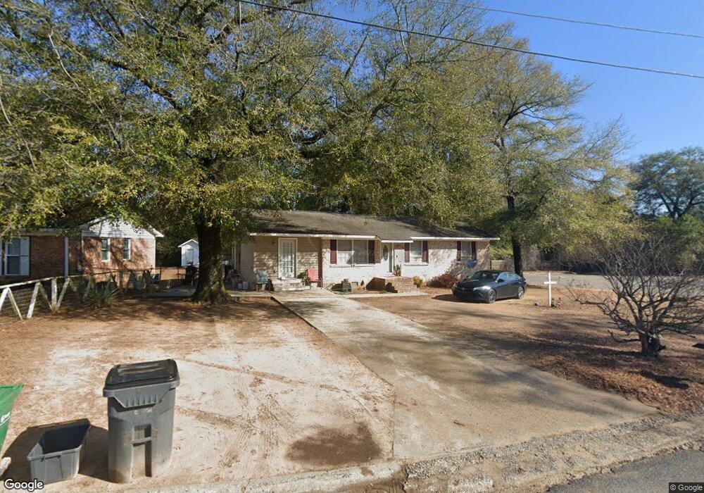
This home is located at 1025 King Blvd, Perry, GA 31069 and is currently estimated at $134,339, approximately $111 per square foot. 1025 King Blvd is a home located in Houston County with nearby schools including Morningside Elementary School, Perry Middle School, and Perry High School.
Ownership History
Date
Name
Owned For
Owner Type
Purchase Details
Closed on
Oct 21, 1976
Sold by
Ramshire Inc
Bought by
Barrett Sam and Doris Mae
Current Estimated Value
Purchase Details
Closed on
Mar 1, 1976
Bought by
Ramshire Inc
Purchase Details
Closed on
Jan 6, 1976
Sold by
Rivers Construction Co Inc
Purchase Details
Closed on
Oct 31, 1974
Sold by
Rivers & Horton Inc
Bought by
Rivers Construction Co Inc
Purchase Details
Closed on
Aug 8, 1972
Sold by
Systems Structures Ltd
Bought by
Rivers & Horton Inc
Create a Home Valuation Report for This Property
The Home Valuation Report is an in-depth analysis detailing your home's value as well as a comparison with similar homes in the area
Home Values in the Area
Average Home Value in this Area
Purchase History
| Date | Buyer | Sale Price | Title Company |
|---|---|---|---|
| Barrett Sam | -- | -- | |
| Ramshire Inc | -- | -- | |
| -- | -- | -- | |
| Rivers Construction Co Inc | -- | -- | |
| Rivers & Horton Inc | -- | -- |
Source: Public Records
Tax History Compared to Growth
Tax History
| Year | Tax Paid | Tax Assessment Tax Assessment Total Assessment is a certain percentage of the fair market value that is determined by local assessors to be the total taxable value of land and additions on the property. | Land | Improvement |
|---|---|---|---|---|
| 2024 | $1,057 | $30,000 | $2,880 | $27,120 |
| 2023 | $883 | $25,120 | $2,880 | $22,240 |
| 2022 | $486 | $23,120 | $2,880 | $20,240 |
| 2021 | $416 | $20,000 | $2,880 | $17,120 |
| 2020 | $423 | $20,200 | $2,880 | $17,320 |
| 2019 | $423 | $20,200 | $2,880 | $17,320 |
| 2018 | $423 | $20,200 | $2,880 | $17,320 |
| 2017 | $423 | $20,200 | $2,880 | $17,320 |
| 2016 | $424 | $20,200 | $2,880 | $17,320 |
| 2015 | $425 | $20,200 | $2,880 | $17,320 |
| 2014 | -- | $20,200 | $2,880 | $17,320 |
| 2013 | -- | $20,200 | $2,880 | $17,320 |
Source: Public Records
Map
Nearby Homes
- 1110 Creekwood Dr
- 1100 Creekwood Dr
- 132 Bramblewood Ln
- 118 Bramblewood Ln
- 202 Obsidian Dr
- 1343 Wf Ragin Dr
- 126 Bramblewood Ln
- 104 Pridgen Pass
- 1335 Ball St
- 113 Pridgen Pass
- 1211 Jewell Dr
- 1312 Sam Nunn Blvd
- 713 Walcott St
- The Pearson Plan at Avalon
- The Crawford Plan at Avalon
- The Piedmont Plan at Avalon
- The Lawson Plan at Avalon
- The Coleman Plan at Avalon
- The McGinnis Plan at Avalon
- The Harrington Plan at Avalon
- 1023 King Blvd
- 220 Hill Ln
- 1021 King Blvd
- 1022 King Blvd
- 216 Hill Ln
- 1018 King Blvd
- 1020 King Blvd
- 1024 King Blvd
- 1016 King Blvd
- 1019 King Blvd
- 214 Hill Ln
- 222 Hill Ln
- 1014 King Blvd
- 212 Hill Ln
- 1017 King Blvd
- 1108 Creekwood Dr
- 1034 Winchester Cir
- 1106 Creekwood Dr
- 1036 Winchester Cir
- 1040 Winchester Cir