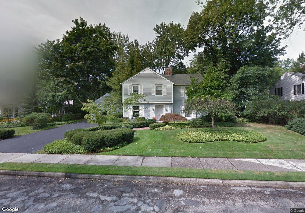
1025 N Glenhurst Dr Unit Bldg-Unit Birmingham, MI 48009
Estimated Value: $2,695,716 - $3,709,000
5
Beds
7
Baths
5,635
Sq Ft
$598/Sq Ft
Est. Value
About This Home
This home is located at 1025 N Glenhurst Dr Unit Bldg-Unit, Birmingham, MI 48009 and is currently estimated at $3,370,905, approximately $598 per square foot. 1025 N Glenhurst Dr Unit Bldg-Unit is a home located in Oakland County with nearby schools including Quarton Elementary, Derby Middle School, and Ernest W. Seaholm High School.
Ownership History
Date
Name
Owned For
Owner Type
Purchase Details
Closed on
Dec 9, 2019
Sold by
Mccarthy Cassandra and Mccarthy Victoria L
Bought by
Mccarthy Cassandra and Mccarthy Victoria L
Current Estimated Value
Purchase Details
Closed on
Mar 8, 2017
Sold by
Lmb Properties Llc and Wiand Richard K
Bought by
Mccarthy Cassandra and Mccarthy Victoria L
Home Financials for this Owner
Home Financials are based on the most recent Mortgage that was taken out on this home.
Original Mortgage
$300,000
Outstanding Balance
$247,785
Interest Rate
3.62%
Mortgage Type
Construction
Estimated Equity
$3,123,120
Purchase Details
Closed on
Jan 15, 2015
Sold by
The Mary Lou Craig Trust and Craig Mary Lou
Bought by
Lmb Properties Llc
Create a Home Valuation Report for This Property
The Home Valuation Report is an in-depth analysis detailing your home's value as well as a comparison with similar homes in the area
Home Values in the Area
Average Home Value in this Area
Purchase History
| Date | Buyer | Sale Price | Title Company |
|---|---|---|---|
| Mccarthy Cassandra | -- | None Available | |
| Mccarthy Cassandra | $650,000 | Cislo Title Co | |
| Lmb Properties Llc | $560,000 | None Available |
Source: Public Records
Mortgage History
| Date | Status | Borrower | Loan Amount |
|---|---|---|---|
| Open | Mccarthy Cassandra | $300,000 |
Source: Public Records
Tax History Compared to Growth
Tax History
| Year | Tax Paid | Tax Assessment Tax Assessment Total Assessment is a certain percentage of the fair market value that is determined by local assessors to be the total taxable value of land and additions on the property. | Land | Improvement |
|---|---|---|---|---|
| 2024 | $44,390 | $1,495,200 | $0 | $0 |
| 2023 | $43,438 | $1,387,340 | $0 | $0 |
| 2022 | $45,436 | $1,238,340 | $0 | $0 |
| 2021 | $45,837 | $1,172,630 | $0 | $0 |
| 2020 | $40,839 | $1,164,920 | $0 | $0 |
| 2019 | $46,215 | $1,149,090 | $0 | $0 |
| 2018 | $45,870 | $1,077,500 | $0 | $0 |
| 2017 | $32,485 | $684,870 | $0 | $0 |
| 2016 | $20,861 | $390,980 | $0 | $0 |
| 2015 | -- | $346,490 | $0 | $0 |
| 2014 | -- | $287,990 | $0 | $0 |
| 2011 | -- | $247,690 | $0 | $0 |
Source: Public Records
Map
Nearby Homes
- 956 Westwood Dr
- 1120 Lyonhurst St
- 1882 Melbourne St
- 1260 Lyonhurst St
- 1019 N Cranbrook Rd
- 345 Kimberly St
- 586 Fairfax St
- 1834 Fairview St
- 1056 Pilgrim Ave
- 2579 Amberly Rd
- 120 Westchester Way
- 1537 Ashford Ln
- 222 Arlington St
- 592 Lakeside Dr
- 1295 Lakeside Dr
- 1030 Lakeside Dr
- 394 S Glenhurst Dr
- 375 Dunston Rd
- 1551 Lakeside Dr
- 397 S Cranbrook Rd
- 1025 N Glenhurst Dr
- 1011 N Glenhurst Dr
- 1043 N Glenhurst Dr
- 1000 Westwood Dr
- 1030 N Glenhurst Dr
- 1065 N Glenhurst Dr
- 1010 N Glenhurst Dr
- 1010 N Glenhurst Dr
- 1044 N Glenhurst Dr
- 938 Westwood Dr
- 967 N Glenhurst Dr
- 1036 Westwood Dr
- 1060 N Glenhurst Dr
- 1087 N Glenhurst Dr
- 1906 Kenwood Ct
- 986 N Glenhurst Dr
- 900 Brookwood St
- 979 Westwood Dr
- 945 N Glenhurst Dr
- 912 Westwood Dr