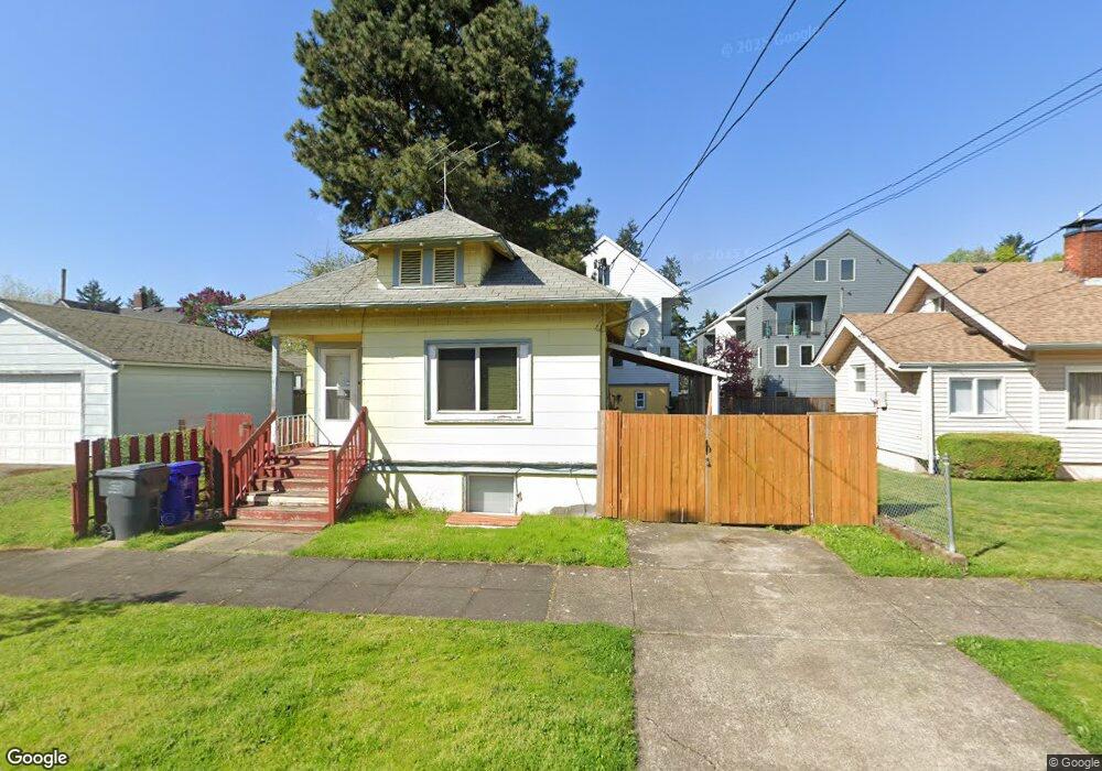
1025 N Simpson St Portland, OR 97217
Humboldt NeighborhoodEstimated Value: $463,442 - $558,000
3
Beds
2
Baths
736
Sq Ft
$669/Sq Ft
Est. Value
About This Home
This home is located at 1025 N Simpson St, Portland, OR 97217 and is currently estimated at $492,111, approximately $668 per square foot. 1025 N Simpson St is a home located in Multnomah County with nearby schools including Chief Joseph Elementary School, Ockley Green, and Jefferson High School.
Ownership History
Date
Name
Owned For
Owner Type
Purchase Details
Closed on
May 19, 2021
Sold by
Andrews Elena V and Martin Elena
Bought by
Andrews Elena V
Current Estimated Value
Home Financials for this Owner
Home Financials are based on the most recent Mortgage that was taken out on this home.
Original Mortgage
$118,200
Interest Rate
2.9%
Mortgage Type
New Conventional
Purchase Details
Closed on
Aug 20, 2007
Sold by
Martin Elena Virginia B
Bought by
Martin Elena
Home Financials for this Owner
Home Financials are based on the most recent Mortgage that was taken out on this home.
Original Mortgage
$141,200
Interest Rate
6.62%
Mortgage Type
Stand Alone Refi Refinance Of Original Loan
Create a Home Valuation Report for This Property
The Home Valuation Report is an in-depth analysis detailing your home's value as well as a comparison with similar homes in the area
Home Values in the Area
Average Home Value in this Area
Purchase History
| Date | Buyer | Sale Price | Title Company |
|---|---|---|---|
| Andrews Elena V | -- | Old Republic Title | |
| Martin Elena | -- | Transnation Title Agency Or |
Source: Public Records
Mortgage History
| Date | Status | Borrower | Loan Amount |
|---|---|---|---|
| Closed | Andrews Elena V | $118,200 | |
| Closed | Martin Elena | $141,200 |
Source: Public Records
Tax History Compared to Growth
Tax History
| Year | Tax Paid | Tax Assessment Tax Assessment Total Assessment is a certain percentage of the fair market value that is determined by local assessors to be the total taxable value of land and additions on the property. | Land | Improvement |
|---|---|---|---|---|
| 2025 | $2,712 | $100,660 | -- | -- |
| 2024 | $2,615 | $97,730 | -- | -- |
| 2023 | $2,514 | $94,890 | $0 | $0 |
| 2022 | $2,460 | $92,130 | $0 | $0 |
| 2021 | $2,419 | $89,450 | $0 | $0 |
| 2020 | $2,219 | $86,850 | $0 | $0 |
| 2019 | $2,137 | $84,330 | $0 | $0 |
| 2018 | $2,075 | $81,880 | $0 | $0 |
| 2017 | $1,989 | $79,500 | $0 | $0 |
| 2016 | $1,820 | $77,190 | $0 | $0 |
| 2015 | $1,772 | $74,950 | $0 | $0 |
| 2014 | $1,746 | $72,770 | $0 | $0 |
Source: Public Records
Map
Nearby Homes
- 5860 N Missouri Ave
- 5814 N Mississippi Ave
- 6120 N Montana Ave
- 1366 N Simpson St Unit 4
- 6219 N Minnesota Ave
- 5606 N Maryland Ave
- 1480 N Jarrett St Unit 103
- 5505 N Minnesota Ave
- 6315 N Montana Ave
- 5406 N Missouri Ave
- 1455 N Killingsworth St Unit 316
- 1455 N Killingsworth St Unit 404
- 1455 N Killingsworth St Unit 201
- 1455 N Killingsworth St Unit 313
- 1455 N Killingsworth St Unit 415
- 708 N Killingsworth St Unit 7
- 708 N Killingsworth St Unit 3
- 708 N Killingsworth St Unit 11
- 708 N Killingsworth St Unit 8
- 708 N Killingsworth St Unit 12
- 1017 N Simpson St
- 5916 N Missouri Ave
- 5906 N Missouri Ave
- 1024 N Ainsworth St
- 1020 N Ainsworth St
- 5926 N Missouri Ave
- 5911 N Michigan Ave
- 5903 N Michigan Ave
- 1018 N Ainsworth St
- 1018 N Ainsworth St Unit 1
- 1018 N Ainsworth St Unit 2
- 5917 N Michigan Ave
- 1016 N Ainsworth St
- 5971 N Michigan Ave
- 5934 N Missouri Ave
- 1016 N Simpson St
- 5975 N Michigan Ave
- 1014-1026 N Ainsworth St
- 1014-1026 N Ainsworth St Unit 1026
- 1014 N Ainsworth St Unit 3-9