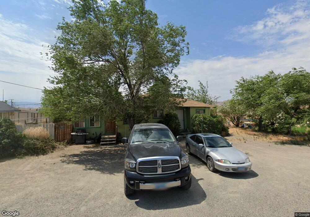
1025 Pyramid Ave Silver Springs, NV 89429
Estimated Value: $237,000 - $409,000
2
Beds
1
Bath
1,492
Sq Ft
$222/Sq Ft
Est. Value
About This Home
This home is located at 1025 Pyramid Ave, Silver Springs, NV 89429 and is currently estimated at $331,054, approximately $221 per square foot. 1025 Pyramid Ave is a home located in Lyon County with nearby schools including Silver Springs Elementary School and Silver Stage High School.
Ownership History
Date
Name
Owned For
Owner Type
Purchase Details
Closed on
May 21, 2021
Sold by
Walker Mark and Walker Shannon
Bought by
Meisner Robert
Current Estimated Value
Home Financials for this Owner
Home Financials are based on the most recent Mortgage that was taken out on this home.
Original Mortgage
$240,000
Outstanding Balance
$216,816
Interest Rate
2.9%
Mortgage Type
VA
Estimated Equity
$114,238
Purchase Details
Closed on
Aug 5, 2016
Sold by
Morrison Gloria
Bought by
Champion Mortgage Company
Home Financials for this Owner
Home Financials are based on the most recent Mortgage that was taken out on this home.
Interest Rate
3.43%
Purchase Details
Closed on
Oct 2, 2006
Sold by
Langford Ralph and Dickson Kurt Eugene
Bought by
Walker Mark and Walker Shannon
Create a Home Valuation Report for This Property
The Home Valuation Report is an in-depth analysis detailing your home's value as well as a comparison with similar homes in the area
Home Values in the Area
Average Home Value in this Area
Purchase History
| Date | Buyer | Sale Price | Title Company |
|---|---|---|---|
| Meisner Robert | $240,000 | Ticor Title Fernley | |
| Champion Mortgage Company | $71,000 | -- | |
| Walker Mark | $249,000 | Northern Nevada Title Co |
Source: Public Records
Mortgage History
| Date | Status | Borrower | Loan Amount |
|---|---|---|---|
| Open | Meisner Robert | $240,000 | |
| Previous Owner | Champion Mortgage Company | -- |
Source: Public Records
Tax History Compared to Growth
Tax History
| Year | Tax Paid | Tax Assessment Tax Assessment Total Assessment is a certain percentage of the fair market value that is determined by local assessors to be the total taxable value of land and additions on the property. | Land | Improvement |
|---|---|---|---|---|
| 2025 | $1,204 | $32,552 | $14,000 | $18,552 |
| 2024 | $1,151 | $32,237 | $14,000 | $18,237 |
| 2023 | $877 | $26,703 | $9,975 | $16,728 |
| 2022 | $595 | $25,369 | $9,975 | $15,394 |
| 2021 | $565 | $24,677 | $9,975 | $14,702 |
| 2020 | $537 | $23,329 | $9,770 | $13,559 |
| 2019 | $515 | $22,588 | $9,770 | $12,818 |
| 2018 | $798 | $16,621 | $4,340 | $12,281 |
| 2017 | $785 | $16,389 | $4,340 | $12,049 |
| 2016 | $778 | $11,989 | $3,470 | $8,519 |
| 2015 | $777 | $11,128 | $3,080 | $8,048 |
| 2014 | $782 | $8,624 | $3,080 | $5,544 |
Source: Public Records
Map
Nearby Homes
- 2570 Fort Churchill St
- 2745 Fort Churchill St
- 2985 Truckee St
- 2820 Truckee St
- 2810 Winnemucca St
- 2550 Pueblo St
- 3325 Rawhide St
- 2735 Toiyabe St
- 3170 Spring Cir
- 1415 Lahontan St
- 2845 Talapoosa St
- 3215 Spring Cir
- 3160 Snowberry St
- 2880 Talapoosa St
- 3135 Snowberry St
- 3570 S Hwy 95a
- 2810 Talapoosa St
- 3590 S Hwy 95a
- 3395 Highway 50
- 3355 Highway 50 Unit Lot 3
- 1925 Pyramid St
- 2986 & 2990 N Us Highway 95a
- 2986 & 2990 N Us Highway 95a Unit 6 & 7
- 3005 Fort Churchill Rd
- 2994 Us Highway 95a N
- 2984 Fort Churchill Rd
- 2950 Fort Churchill Rd
- 2920 Us Highway 95a N
- 1095 Fort Churchill St
- 3410 Fort Churchill St
- 3380 Fort Churchill St
- 2685&2665 Fort Churchill St
- 0000 Fort Churchill St
- 2765 Fort Churchill St
- 2890 Fort Churchill St
- 3780 Fort Churchill St
- 2695 Fort Churchill St
- 2785 Fort Churchill St
- 1730 Fort Churchill St
- 1180 Fort Churchill St