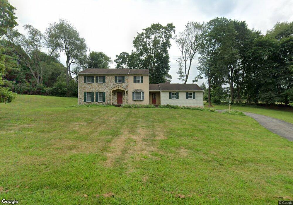
1025 Robin Dr West Chester, PA 19382
Estimated Value: $712,877 - $828,000
4
Beds
3
Baths
2,269
Sq Ft
$334/Sq Ft
Est. Value
About This Home
This home is located at 1025 Robin Dr, West Chester, PA 19382 and is currently estimated at $757,469, approximately $333 per square foot. 1025 Robin Dr is a home located in Chester County with nearby schools including Penn Wood Elementary School, Stetson Middle School, and Bayard Rustin High School.
Ownership History
Date
Name
Owned For
Owner Type
Purchase Details
Closed on
Mar 22, 2006
Sold by
Sabatino Christian N and Sabatino Joanne
Bought by
Sabatino Christian N
Current Estimated Value
Purchase Details
Closed on
Aug 27, 2004
Sold by
Silva Rosemary M
Bought by
Sabatino Christian N and Sabatino Joanne
Home Financials for this Owner
Home Financials are based on the most recent Mortgage that was taken out on this home.
Original Mortgage
$70,000
Outstanding Balance
$34,980
Interest Rate
6.01%
Mortgage Type
Purchase Money Mortgage
Estimated Equity
$722,489
Purchase Details
Closed on
Aug 20, 2001
Sold by
Silva Richard P and Silva Rosemary M
Bought by
Silva Rosemary M
Create a Home Valuation Report for This Property
The Home Valuation Report is an in-depth analysis detailing your home's value as well as a comparison with similar homes in the area
Home Values in the Area
Average Home Value in this Area
Purchase History
| Date | Buyer | Sale Price | Title Company |
|---|---|---|---|
| Sabatino Christian N | -- | None Available | |
| Sabatino Christian N | $370,500 | Stewart Title Guaranty Co | |
| Silva Rosemary M | -- | -- |
Source: Public Records
Mortgage History
| Date | Status | Borrower | Loan Amount |
|---|---|---|---|
| Open | Sabatino Christian N | $70,000 |
Source: Public Records
Tax History Compared to Growth
Tax History
| Year | Tax Paid | Tax Assessment Tax Assessment Total Assessment is a certain percentage of the fair market value that is determined by local assessors to be the total taxable value of land and additions on the property. | Land | Improvement |
|---|---|---|---|---|
| 2025 | $5,479 | $177,280 | $71,640 | $105,640 |
| 2024 | $5,479 | $177,280 | $71,640 | $105,640 |
| 2023 | $5,442 | $177,280 | $71,640 | $105,640 |
| 2022 | $5,338 | $177,280 | $71,640 | $105,640 |
| 2021 | $5,268 | $177,280 | $71,640 | $105,640 |
| 2020 | $5,235 | $177,280 | $71,640 | $105,640 |
| 2019 | $5,166 | $177,280 | $71,640 | $105,640 |
| 2018 | $5,062 | $177,280 | $71,640 | $105,640 |
| 2017 | $4,958 | $177,280 | $71,640 | $105,640 |
| 2016 | $3,819 | $177,280 | $71,640 | $105,640 |
| 2015 | $3,819 | $177,280 | $71,640 | $105,640 |
| 2014 | $3,819 | $177,280 | $71,640 | $105,640 |
Source: Public Records
Map
Nearby Homes
- 120 Freedom Rider Trail
- 5 Dorset Rd
- 1312 College Hill Dr
- 1376 College Hill Dr
- 1343 Creek Rd
- 1523 Johnnys Way
- 1018 Ashley Rd
- 1512 Pennsbury Dr
- 32 Lenfant Ct
- 1547 Johnnys Way
- 16 Diamond Dr
- 35 Skyline Dr
- 407 Leslie Ln
- 22 Bennetts Ln
- 301 Westtown Way
- 207 Walnut Hill Rd Unit C5
- 1545 Pheasant Ln. & 193a Middletown Rd
- 222 Westtown Way
- 1545 Pheasant Ln
- 1518 Manley Rd Unit B20
- 1107 Shady Grove Way
- 1024 Robin Dr
- 1023 Robin Dr
- 1111 Shady Grove Way
- 1022 Robin Dr
- 1021 Robin Dr
- 1005 Shady Grove Way
- 1408 Favonius Way
- 1020 Robin Dr
- 1115 Shady Grove Way
- 1019 Robin Dr
- 1409 Favonius Way
- 1018 Robin Dr
- 1001 Shady Grove Way
- 1102 Cardinal Dr
- 1106 Cardinal Dr
- 1108 Cardinal Dr
- 1402 Thrush Ln
- 1110 Cardinal Dr
- 1410 Favonius Way