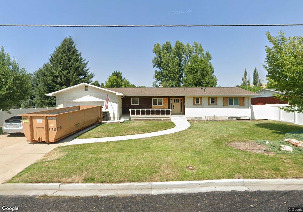
1025 Sumac Dr Logan, UT 84321
Wilson NeighborhoodEstimated Value: $490,000 - $583,000
3
Beds
3
Baths
2,887
Sq Ft
$183/Sq Ft
Est. Value
About This Home
This home is located at 1025 Sumac Dr, Logan, UT 84321 and is currently estimated at $527,037, approximately $182 per square foot. 1025 Sumac Dr is a home located in Cache County with nearby schools including Wilson School, Mount Logan Middle School, and Logan High School.
Ownership History
Date
Name
Owned For
Owner Type
Purchase Details
Closed on
May 13, 2022
Sold by
Hugh W Johnson Revocable Trust
Bought by
Pamela Sue Johnson Trust
Current Estimated Value
Purchase Details
Closed on
May 4, 2021
Sold by
T & M Johnson Properties Llc
Bought by
Johnson Hugh W and Hugh W Johnson Revocable Trust
Purchase Details
Closed on
Oct 29, 2020
Sold by
Sears Robert K and Sears Robert K
Bought by
T & M Johnson Properties Lc
Purchase Details
Closed on
Feb 7, 2011
Sold by
Sears Robert K and Sears Ruth W
Bought by
Sears Robert K
Create a Home Valuation Report for This Property
The Home Valuation Report is an in-depth analysis detailing your home's value as well as a comparison with similar homes in the area
Home Values in the Area
Average Home Value in this Area
Purchase History
| Date | Buyer | Sale Price | Title Company |
|---|---|---|---|
| Pamela Sue Johnson Trust | -- | Hickman Land Title | |
| Johnson Hugh W | -- | Hickman Land Title Co | |
| T & M Johnson Properties Lc | -- | Hickman Land Title Logan | |
| Sears Robert K | -- | None Available |
Source: Public Records
Tax History
| Year | Tax Paid | Tax Assessment Tax Assessment Total Assessment is a certain percentage of the fair market value that is determined by local assessors to be the total taxable value of land and additions on the property. | Land | Improvement |
|---|---|---|---|---|
| 2025 | $232 | $300,155 | $0 | $0 |
| 2023 | $2,494 | $297,735 | $0 | $0 |
| 2022 | $2,152 | $239,985 | $0 | $0 |
| 2021 | $2,049 | $353,030 | $115,000 | $238,030 |
| 2020 | $1,923 | $298,100 | $115,000 | $183,100 |
| 2019 | $2,010 | $298,100 | $115,000 | $183,100 |
| 2018 | $1,930 | $261,384 | $115,000 | $146,384 |
| 2017 | $1,484 | $106,260 | $0 | $0 |
| 2016 | $1,539 | $106,260 | $0 | $0 |
| 2015 | $1,540 | $106,260 | $0 | $0 |
| 2014 | $1,392 | $106,260 | $0 | $0 |
| 2013 | -- | $96,385 | $0 | $0 |
Source: Public Records
Map
Nearby Homes
- 1045 Fox Farm Rd
- 1034 Thrushwood Dr
- 74 Canterbury Cir
- 28 River Pointe Dr
- 70 River Pointe Dr
- 2758 N Canyon Cove Dr
- 2738 N Canyon Cove Dr
- 1164 E Mountain Rd
- 1147 Eastridge Dr
- 1374 E 260 N
- 128 S 1170 E
- 1387 E 260 N
- 684 Apple Dr
- 622 Canyon Rd
- 664 E Center St
- 45 River Circle Dr
- 545 E Boulevard St
- 1535 Sumac Dr
- 640 E 600 N
- 620 E 600 N
- 1035 Sumac Dr
- 1040 Sumac Dr
- 238 Lauralin Dr
- 1007 Sumac Dr
- 1016 Sumac Dr
- 1041 Sumac Dr
- 248 Lauralin Dr
- 1048 Sumac Dr
- 1049 Sumac Dr
- 999 Sumac Dr
- 264 Lauralin Dr
- 194 N Thrushwood Dr
- 1050 Sumac Dr
- 1053 Sumac Dr
- 991 Sumac Dr
- 197 N Thrushwood Dr
- 247 Lauralin Dr
- 182 N Thrushwood Dr
- 1054 Sumac Dr
- 1067 Sumac Dr
Your Personal Tour Guide
Ask me questions while you tour the home.