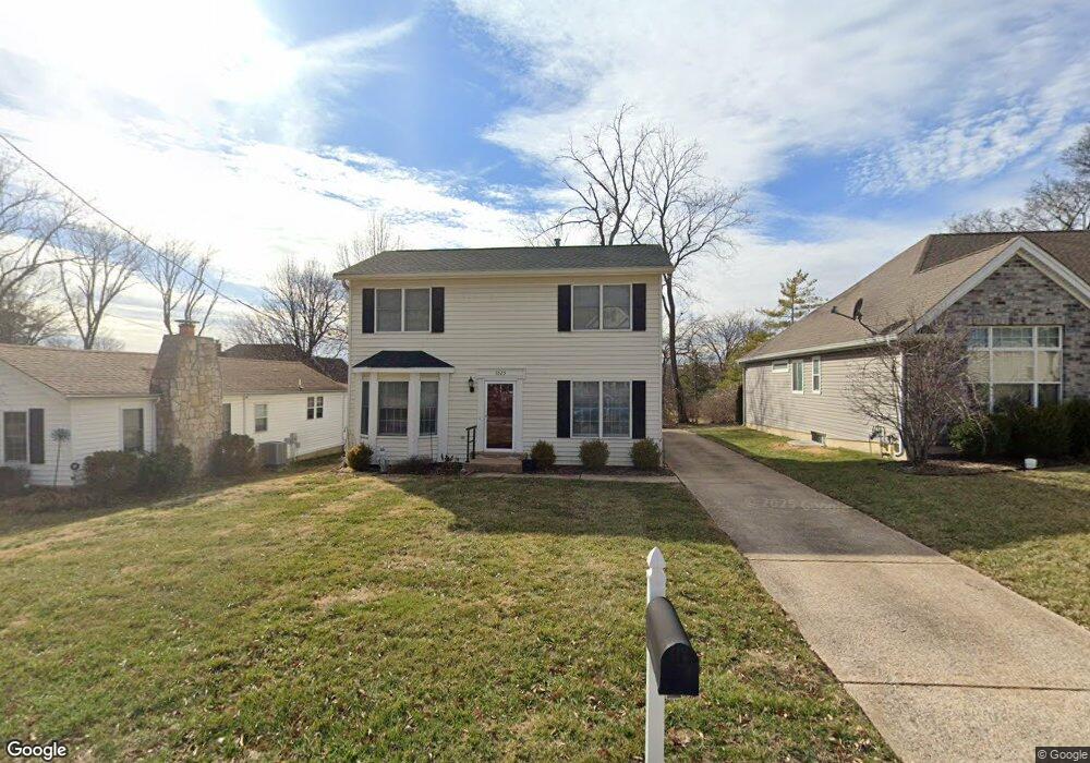
1025 Twin Pine Dr Saint Louis, MO 63131
Estimated Value: $354,000 - $610,000
3
Beds
2
Baths
1,778
Sq Ft
$267/Sq Ft
Est. Value
About This Home
This home is located at 1025 Twin Pine Dr, Saint Louis, MO 63131 and is currently estimated at $474,382, approximately $266 per square foot. 1025 Twin Pine Dr is a home located in St. Louis County with nearby schools including Westchester Elementary School, North Kirkwood Middle School, and Kirkwood Senior High School.
Ownership History
Date
Name
Owned For
Owner Type
Purchase Details
Closed on
Mar 28, 1997
Sold by
Mckean Laura J
Bought by
Vonvonritter Barbara Von
Current Estimated Value
Home Financials for this Owner
Home Financials are based on the most recent Mortgage that was taken out on this home.
Original Mortgage
$90,000
Outstanding Balance
$10,730
Interest Rate
7.55%
Estimated Equity
$463,652
Create a Home Valuation Report for This Property
The Home Valuation Report is an in-depth analysis detailing your home's value as well as a comparison with similar homes in the area
Home Values in the Area
Average Home Value in this Area
Purchase History
| Date | Buyer | Sale Price | Title Company |
|---|---|---|---|
| Vonvonritter Barbara Von | -- | -- |
Source: Public Records
Mortgage History
| Date | Status | Borrower | Loan Amount |
|---|---|---|---|
| Open | Vonvonritter Barbara Von | $90,000 |
Source: Public Records
Tax History
| Year | Tax Paid | Tax Assessment Tax Assessment Total Assessment is a certain percentage of the fair market value that is determined by local assessors to be the total taxable value of land and additions on the property. | Land | Improvement |
|---|---|---|---|---|
| 2025 | $3,666 | $66,200 | $43,340 | $22,860 |
| 2024 | $3,666 | $63,400 | $32,510 | $30,890 |
| 2023 | $3,609 | $63,400 | $32,510 | $30,890 |
| 2022 | $3,502 | $57,320 | $32,510 | $24,810 |
| 2021 | $3,464 | $57,320 | $32,510 | $24,810 |
| 2020 | $2,806 | $44,560 | $32,510 | $12,050 |
| 2019 | $2,820 | $44,560 | $32,510 | $12,050 |
| 2018 | $3,139 | $44,560 | $20,240 | $24,320 |
| 2017 | $3,147 | $44,560 | $20,240 | $24,320 |
| 2016 | $2,939 | $42,120 | $14,440 | $27,680 |
Source: Public Records
Map
Nearby Homes
- 989 Des Peres Dr
- 12224 TBB Roger Ln
- 11909 Lillian Ave
- 1126 Bopp Rd
- 1319 Kendon Dr
- 12467 Ballas Meadows Dr
- 2037 Trailcrest Ln Unit 7
- 1902 Meadowtree Ln Unit 1
- 2005 Woodland Knoll
- 2025 Woodland Knoll
- 2033 Woodland Knoll
- 1209 Missouri Ave
- 1056 Cedargate Dr
- 954 Rochdale Dr
- 1144 Missouri Ave
- 12439 Springdale Ln Unit TBB
- 1312 W Essex Ave
- 1534 Woodgate Dr
- 1612 Dougherty Ferry Rd
- 525 Ballas Park Dr
- 1015 Twin Pine Dr
- 1033 Twin Pine Dr
- 1013 Twin Pine Dr
- 1039 Twin Pine Dr
- 1011 Twin Pine Dr
- 1014 Blase Ave
- 1034 Twin Pine Dr
- 1012 Twin Pine Dr
- 1006 Blase Ave
- 1009 Twin Pine Dr
- 1000 Blase Ave
- 1008 Twin Pine Dr
- 1004 Twin Pine Dr
- 957 Twin Pine Dr
- 963 Twin Pine Dr
- 1033 Kinstern Dr
- 1031 Kinstern Dr
- 1011 Blase Ave
- 1000 Twin Pine Dr
- 958 Blase Ave
Your Personal Tour Guide
Ask me questions while you tour the home.